
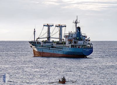
CARAKA JAYA N III-11
Cargo
Current Trip
ORELA SHIPYARD
| Time Travelled | 28 days |
|---|---|
| Remaining Time | --- |
| Distance Travelled | 647.48 nm |
| Remaining Distance | --- |
| AVG Speed | 6.4 Knop |
| MAX Speed | 7.6 Knop |
| AVG Wind | 3.6 knots |
| MAX Wind | 7.8 knots |
| MIN Temp | 20.3°C / 68.54°F |
| MAX Temp | 29.8°C / 85.64°F |
| Djupgående | 3.8 m |
| Position mottagen | 2023-12-26 15:26 |
Current Position
| Longitud | 112.42238° |
|---|---|
| Latitude | -6.81576° |
| Status | Not under command |
| Fart | 4.6 Knop |
| Kurs | 17.1° |
| Område | Java Sea |
| Station | T-AIS |
| Position mottagen | 2023-12-26 15:26 |
Info
Information
The current position of CARAKA JAYA N III-11 is in Java Sea with coordinates -6.81576° / 112.42238° as reported on 2023-12-26 15:26 by AIS to our vessel tracker app. The vessel's current speed is 4.6 Knop
The vessel CARAKA JAYA N III-11 (IMO: 901835900, MMSI: 525012101) is a Cargo It's sailing under the flag of [ID] Indonesia.
In this page you can find informations about the vessels current position, last detected port calls, and current voyage information. If the vessels is not in coverage by AIS you will find the latest position.
The current position of CARAKA JAYA N III-11 is detected by our AIS receivers and we are not responsible for the reliability of the data. The last position was recorded while the vessel was in Coverage by the Ais receivers of our vessel tracking app.
The current draught of CARAKA JAYA N III-11 as reported by AIS is 3.8 meters
Weather
| Temperature | 27.4°C / 81.32°F |
|---|---|
| Wind Speed | 3 knots |
| Direction | 79° E |
| Pressure | 1009 hPa |
| Humidity | 79.6 % |
| Cloud Coverage | 100 % |
Featured Company
Last Port Calls
| Port | Arrival | Departure | Time In Port |
|---|---|---|---|
| 2024-03-25 07:28 | 2024-03-25 23:16 | 15 h | |
| 2024-02-20 23:40 | 2024-02-21 07:28 | 7 h | |
| 2024-02-11 22:28 | 2024-02-17 12:27 | 5 d | |
| 2024-02-06 09:55 | 2024-02-11 21:26 | 5 d | |
| 2024-02-04 05:07 | 2024-02-06 08:45 | 2 d | |
| 2024-02-01 23:21 | 2024-02-03 12:44 | 1 d | |
| 2024-01-31 23:58 | 2024-02-01 15:33 | 15 h |
Most Visited Ports (Last year)
| Port | Arrivals | |
|---|---|---|
| 6 | ||
| 3 | ||
| 1 | ||
| 1 |
Last Trips
| Origin | Departure | Destination | Arrival | Distance | |
|---|---|---|---|---|---|
| 2024-02-21 16:28 | 2024-03-25 14:28 | 1860.41 nm | |||
| 2024-02-17 21:27 | 2024-02-21 08:40 | 1.79 nm | |||
| 2024-02-12 06:26 | 2024-02-12 07:28 | 1.03 nm | |||
| 2024-02-06 17:45 | 2024-02-06 18:55 | 1.26 nm | |||
| 2024-02-03 21:44 | 2024-02-04 14:07 | 1.56 nm | |||
| 2024-02-02 00:33 | 2024-02-02 08:21 | 1.32 nm | |||
| 2024-01-25 08:09 | 2024-02-01 08:58 | 341.38 nm |
Events
| Tid | Event | Detaljer | Position / Dest | Information |
|---|---|---|---|---|
| 2024-04-15 21:02 | STOPPAR förflyttning | 1.19 nm, South of TELUKBAYUR |
-1.02054 / 100.37291
ORELA SHIPYARD
|
Fart: 0.1 kn Kurs: -1° |