
CAPT EUGENE
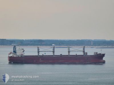
Bulk Carrier
Current Trip
| Time Travelled | 48 days |
|---|---|
| Remaining Time | --- |
| Distance Travelled | 13011.91 nm |
| Remaining Distance | --- |
| AVG Speed | 11 Knop |
| MAX Speed | 15.8 Knop |
| AVG Wind | 13.8 knots |
| MAX Wind | 32 knots |
| MIN Temp | 0.2°C / 32.36°F |
| MAX Temp | 30.8°C / 87.44°F |
| Djupgående | 12.5 m |
| Position mottagen | 23 h, 31 m sen |
Current Position
| Longitud | -17.85853° |
|---|---|
| Latitude | 22.89437° |
| Status | Under way using engine |
| Fart | 10.9 Knop |
| Kurs | 29° |
| Område | North Atlantic Ocean |
| Station | T-AIS |
| Position mottagen | 23 h, 31 m sen |
Info
Information
The current position of CAPT EUGENE is in North Atlantic Ocean with coordinates 22.89437° / -17.85853° as reported on 2024-04-19 15:18 by AIS to our vessel tracker app. The vessel's current speed is 10.9 Knop and is heading at the port of GIBRALTAR. The estimated time of arrival as calculated by MyShipTracking vessel tracking app is 2024-04-21 03:00 LT
The vessel CAPT EUGENE (IMO: 9478767, MMSI: 352644000) is a Bulk Carrier that was built in 2010 ( 14 År gammal ). It's sailing under the flag of [PA] Panama.
In this page you can find informations about the vessels current position, last detected port calls, and current voyage information. If the vessels is not in coverage by AIS you will find the latest position.
The current position of CAPT EUGENE is detected by our AIS receivers and we are not responsible for the reliability of the data. The last position was recorded while the vessel was in Coverage by the Ais receivers of our vessel tracking app.
The current draught of CAPT EUGENE as reported by AIS is 12.5 meters
Weather
| Temperature | 20°C / 68°F |
|---|---|
| Wind Speed | 14 knots |
| Direction | 27° NNE |
| Pressure | 1015.2 hPa |
| Humidity | 78.6 % |
| Cloud Coverage | 100 % |
Featured Company
Events
| Tid | Event | Detaljer | Position / Dest | Information |
|---|---|---|---|---|
| 2024-04-19 15:52 | Status ändrad | Default Under way using engine |
22.98442 / -17.79751
GI GIB
|
Fart: 10.9 kn Kurs: 29° |
| 2024-04-19 15:18 | UTANFÖR täckningsområde |
22.89437 / -17.85853
North Atlantic Ocean
GI GIB
|
Fart: 10.9 kn Kurs: 29° |
|
| 2024-04-19 15:13 | Status ändrad | Under way using engine Default |
22.88064 / -17.86603
GI GIB
|
Fart: 10 kn Kurs: 28° |
| 2024-04-19 14:53 | I täckningsområde |
22.88064 / -17.86603
North Atlantic Ocean
GI GIB
|
Fart: 11 kn Kurs: 21.9° |
|
| 2024-04-19 11:30 | Status ändrad | Default Under way using engine |
22.26014 / -18.12128
GI GIB
|
Fart: 10.6 kn Kurs: 12.8° |
| 2024-04-19 10:43 | UTANFÖR täckningsområde |
22.11824 / -18.14433
North Atlantic Ocean
GI GIB
|
Fart: 10.6 kn Kurs: 12.8° |
|
| 2024-04-19 10:33 | Status ändrad | Under way using engine Default |
22.08873 / -18.14965
GI GIB
|
Fart: 11 kn Kurs: 7° |
| 2024-04-19 10:33 | I täckningsområde |
22.08873 / -18.14965
North Atlantic Ocean
GI GIB
|
Fart: 10.7 kn Kurs: 6.3° |
|
| 2024-04-19 09:38 | Status ändrad | Default Under way using engine |
21.92500 / -18.17667
GI GIB
|
Fart: 11.3 kn Kurs: 8.5° |
| 2024-04-19 09:15 | UTANFÖR täckningsområde |
21.85380 / -18.18608
North Atlantic Ocean
GI GIB
|
Fart: 11.3 kn Kurs: 8.5° |