
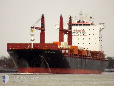
CAPE ALTIUS
Cargo
Current Trip
| Time Travelled | 5 days |
|---|---|
| Remaining Time | 4 days |
| Distance Travelled | 2336.98 nm |
| Remaining Distance | 1721.09 nm |
| AVG Speed | 16.1 Knop |
| MAX Speed | 18.2 Knop |
| AVG Wind | 9.5 knots |
| MAX Wind | 18 knots |
| MIN Temp | 15.6°C / 60.08°F |
| MAX Temp | 31.7°C / 89.06°F |
| Djupgående | 10 m |
| Position mottagen | 10 h, 38 m sen |
Current Position
| Longitud | -38.18751° |
|---|---|
| Latitude | 40.75664° |
| Status | Under way using engine |
| Fart | 16.4 Knop |
| Kurs | 60.1° |
| Område | North Atlantic Ocean |
| Station | T-AIS |
| Position mottagen | 10 h, 38 m sen |
Info
Information
The current position of CAPE ALTIUS is in North Atlantic Ocean with coordinates 40.75664° / -38.18751° as reported on 2024-04-25 04:43 by AIS to our vessel tracker app. The vessel's current speed is 16.4 Knop and is heading at the port of ANTWERP. The estimated time of arrival as calculated by MyShipTracking vessel tracking app is 2024-04-29 22:22 LT
The vessel CAPE ALTIUS (IMO: 9848730, MMSI: 209888000) is a Cargo It's sailing under the flag of [CY] Cyprus.
In this page you can find informations about the vessels current position, last detected port calls, and current voyage information. If the vessels is not in coverage by AIS you will find the latest position.
The current position of CAPE ALTIUS is detected by our AIS receivers and we are not responsible for the reliability of the data. The last position was recorded while the vessel was in Coverage by the Ais receivers of our vessel tracking app.
The current draught of CAPE ALTIUS as reported by AIS is 10 meters
Weather
| Temperature | 15.8°C / 60.44°F |
|---|---|
| Wind Speed | 1 knots |
| Direction | 55° NE |
| Pressure | 1030.4 hPa |
| Humidity | 88.6 % |
| Cloud Coverage | 100 % |
Featured Company
Last Port Calls
| Port | Arrival | Departure | Time In Port |
|---|---|---|---|
| 2024-04-18 22:30 | 2024-04-19 17:09 | 18 h | |
| 2024-04-12 14:19 | 2024-04-12 23:03 | 8 h | |
| 2024-04-08 13:47 | 2024-04-09 05:27 | 15 h | |
| 2024-04-04 08:17 | 2024-04-05 04:13 | 19 h | |
| 2024-04-01 07:00 | 2024-04-02 06:46 | 23 h | |
| 2024-03-21 01:37 | 2024-03-22 00:50 | 23 h | |
| 2024-03-19 13:30 | 2024-03-20 12:46 | 23 h | |
| 2024-03-17 01:16 | 2024-03-17 14:29 | 13 h | |
| 2024-03-15 05:03 | 2024-03-15 17:28 | 12 h | |
| 2024-03-13 16:18 | 2024-03-14 15:42 | 23 h |
Most Visited Ports (Last year)
| Port | Arrivals | |
|---|---|---|
| 9 | ||
| 6 | ||
| 6 | ||
| 5 | ||
| 5 | ||
| 5 |
Last Trips
| Origin | Departure | Destination | Arrival | Distance | |
|---|---|---|---|---|---|
| 2024-04-12 18:03 | 2024-04-18 18:30 | 1506.44 nm | |||
| 2024-04-09 00:27 | 2024-04-12 09:19 | 449.76 nm | |||
| 2024-04-05 00:13 | 2024-04-08 08:47 | 1283.27 nm | |||
| 2024-04-02 03:46 | 2024-04-04 04:17 | 755.94 nm | |||
| 2024-03-22 01:50 | 2024-04-01 04:00 | 3541.34 nm | |||
| 2024-03-20 13:46 | 2024-03-21 02:37 | 106.00 nm | |||
| 2024-03-17 15:29 | 2024-03-19 14:30 | 336.03 nm | |||
| 2024-03-15 17:28 | 2024-03-17 02:16 | 426.92 nm | |||
| 2024-03-14 16:42 | 2024-03-15 05:03 | 180.84 nm | |||
| 2024-03-01 06:55 | 2024-03-13 17:18 | 4078.94 nm |
Events
| Tid | Event | Detaljer | Position / Dest | Information |
|---|---|---|---|---|
| 2024-04-25 04:48 | Status ändrad | Default Under way using engine |
40.76953 / -38.15836
BEANR
|
Fart: 16.4 kn Kurs: 60.1° |
| 2024-04-25 04:43 | UTANFÖR täckningsområde |
40.75664 / -38.18751
North Atlantic Ocean
BEANR
|
Fart: 16.4 kn Kurs: 60.1° |
|
| 2024-04-25 04:40 | Byter havsområde | High seas of the North Atlantic Ocean Domican Republic part of the Caribbean Sea |
40.75117 / -38.19997
North Atlantic Ocean
BEANR
|
Fart: 16.4 kn Kurs: 60.7° |
| 2024-04-25 04:39 | Status ändrad | Under way using engine Default |
40.74760 / -38.20827
BEANR
|
Fart: 16.3 kn Kurs: 61° |
| 2024-04-25 04:24 | I täckningsområde |
40.75117 / -38.19997
North Atlantic Ocean
BEANR
|
Fart: 16.4 kn Kurs: 60.7° |
|
| 2024-04-19 17:09 | STARTAR förflyttning | 0.52 nm, South East of BOCA CHIKA |
18.42833 / -69.61667
BEANR
|
Fart: 6 kn Kurs: -1° |
| 2024-04-19 17:09 | AVGÅTT HAMN |
|
18.42833 / -69.61667
BEANR
|
Fart: 2 kn Kurs: -1° |
| 2024-04-19 13:34 | Status ändrad | Default Moored |
18.42140 / -69.62959
[DO] BOCA CHIKA
|
Fart: Kurs: 349° |
| 2024-04-19 13:13 | I täckningsområde |
18.42140 / -69.62961
Caribbean Sea
[DO] BOCA CHIKA
|
Fart: Kurs: 349.1° |
|
| 2024-04-19 13:13 | UTANFÖR täckningsområde |
18.42140 / -69.62961
Caribbean Sea
[DO] BOCA CHIKA
|
Fart: Kurs: 349.1° |