
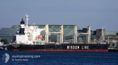
BUNUN KALON
Cargo
Current Trip
| Time Travelled | 4 days |
|---|---|
| Remaining Time | --- |
| Distance Travelled | 209.63 nm |
| Remaining Distance | --- |
| AVG Speed | 10.5 Knop |
| MAX Speed | 13.3 Knop |
| AVG Wind | 8.3 knots |
| MAX Wind | 14.8 knots |
| MIN Temp | 3.7°C / 38.66°F |
| MAX Temp | 6.1°C / 42.98°F |
| Djupgående | 7.2 m |
| Position mottagen | 3 m sen |
Current Position
| Longitud | 5.06764° |
|---|---|
| Latitude | 61.60968° |
| Status | Moored |
| Fart | |
| Kurs | 256° |
| Område | Norwegian Sea |
| Station | T-AIS |
| Position mottagen | 3 m sen |
Info
Information
The current position of BUNUN KALON is in Norwegian Sea with coordinates 61.60968° / 5.06764° as reported on 2024-04-25 15:02 by AIS to our vessel tracker app. The vessel's current speed is 0 Knop
The vessel BUNUN KALON (IMO: 9768033, MMSI: 371576000) is a Cargo It's sailing under the flag of [PA] Panama.
In this page you can find informations about the vessels current position, last detected port calls, and current voyage information. If the vessels is not in coverage by AIS you will find the latest position.
The current position of BUNUN KALON is detected by our AIS receivers and we are not responsible for the reliability of the data. The last position was recorded while the vessel was in Coverage by the Ais receivers of our vessel tracking app.
The current draught of BUNUN KALON as reported by AIS is 7.2 meters
Weather
| Temperature | 4.6°C / 40.28°F |
|---|---|
| Wind Speed | 1 knots |
| Direction | 302° WNW |
| Pressure | 1005.2 hPa |
| Humidity | 60.3 % |
| Cloud Coverage | 100 % |
Featured Company
Last Port Calls
| Port | Arrival | Departure | Time In Port |
|---|---|---|---|
| 2024-04-18 21:59 | 2024-04-20 20:36 | 1 d | |
| 2024-04-15 10:25 | 2024-04-17 00:57 | 1 d | |
| 2024-04-07 11:15 | 2024-04-12 19:10 | 5 d | |
| 2024-04-01 04:35 | 2024-04-02 00:30 | 19 h | |
| 2024-03-31 19:32 | 2024-03-31 20:07 | 35 m | |
| 2024-02-06 21:27 | 2024-02-08 08:01 | 1 d | |
| 2024-02-01 22:38 | 2024-02-04 23:03 | 3 d |
Last Trips
| Origin | Departure | Destination | Arrival | Distance | |
|---|---|---|---|---|---|
| 2024-04-17 02:57 | 2024-04-18 23:59 | 496.81 nm | |||
| 2024-04-12 21:10 | 2024-04-15 12:25 | 753.50 nm | |||
| 2024-04-02 01:30 | 2024-04-07 13:15 | 1233.38 nm | |||
| 2024-03-31 21:07 | 2024-04-01 05:35 | 31.66 nm | |||
| 2024-02-08 17:01 | 2024-03-31 20:32 | 14032.50 nm | |||
| 2024-02-05 08:03 | 2024-02-07 06:27 | 278.01 nm | |||
| 2024-01-29 22:42 | 2024-02-02 07:38 | 328.31 nm |
Events
| Tid | Event | Detaljer | Position / Dest | Information |
|---|---|---|---|---|
| 2024-04-25 14:05 | Status ändrad | Moored Default |
61.60968 / 5.06768
FLORO
|
Fart: Kurs: 256° |
| 2024-04-25 14:02 | Status ändrad | Default Moored |
61.60967 / 5.06766
FLORO
|
Fart: Kurs: 256° |
| 2024-04-25 12:44 | Status ändrad | Moored Default |
61.60968 / 5.06764
FLORO
|
Fart: Kurs: 256° |
| 2024-04-25 12:38 | Status ändrad | Default Moored |
61.60968 / 5.06764
FLORO
|
Fart: Kurs: 256° |
| 2024-04-25 10:41 | Status ändrad | Moored Default |
61.60969 / 5.06766
FLORO
|
Fart: Kurs: 256° |
| 2024-04-25 10:38 | Status ändrad | Default Moored |
61.60967 / 5.06767
FLORO
|
Fart: Kurs: 256° |
| 2024-04-21 15:53 | Status ändrad | Moored Under way using engine |
61.60970 / 5.06769
FLORO
|
Fart: Kurs: 257° |
| 2024-04-21 15:41 | STOPPAR förflyttning | 1.18 nm, North East of FLORO |
61.60988 / 5.06785
FLORO
|
Fart: 0.3 kn Kurs: 255° |
| 2024-04-21 09:15 | Byter havsområde | Norwegian part of the Norwegian Sea Norwegian part of the North Sea |
61.00643 / 4.28122
Norwegian Sea
FLORO
|
Fart: 11.9 kn Kurs: 1.7° |
| 2024-04-20 23:36 | ETA ändrat | 2024/04/21 15:00 2024/04/21 17:00 |
59.15931 / 4.85388
FLORO
|
Fart: 11 kn Kurs: 304° |