
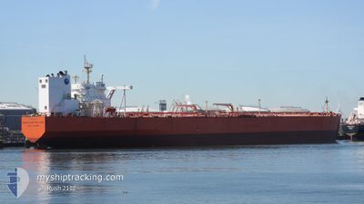
BUNGA KASTURI LIMA
Crude Oil Tanker
Current Trip
| Time Travelled | --- |
|---|---|
| Remaining Time | 4 h, 54 mins |
| Distance Travelled | 13386.43 nm |
| Remaining Distance | 55.84 nm |
| AVG Speed | 11.6 Knop |
| MAX Speed | 15.5 Knop |
| AVG Wind | 11.7 knots |
| MAX Wind | 29 knots |
| MIN Temp | 18.6°C / 65.48°F |
| MAX Temp | 29.8°C / 85.64°F |
| Djupgående | 20.3 m |
| Position mottagen | 11 h, 20 m sen |
Current Position
| Longitud | 123.23017° |
|---|---|
| Latitude | 34.23596° |
| Status | Under way using engine |
| Fart | 12.7 Knop |
| Kurs | 322.2° |
| Område | Yellow Sea |
| Station | T-AIS |
| Position mottagen | 11 h, 20 m sen |
Info
Information
The current position of BUNGA KASTURI LIMA is in Yellow Sea with coordinates 34.23596° / 123.23017° as reported on 2024-04-16 07:47 by AIS to our vessel tracker app. The vessel's current speed is 12.7 Knop and is heading at the port of QINGDAO. The estimated time of arrival as calculated by MyShipTracking vessel tracking app is 2024-04-17 00:01 LT
The vessel BUNGA KASTURI LIMA (IMO: 9327114, MMSI: 533914000) is a Crude Oil Tanker that was built in 2007 ( 17 År gammal ). It's sailing under the flag of [MY] Malaysia.
In this page you can find informations about the vessels current position, last detected port calls, and current voyage information. If the vessels is not in coverage by AIS you will find the latest position.
The current position of BUNGA KASTURI LIMA is detected by our AIS receivers and we are not responsible for the reliability of the data. The last position was recorded while the vessel was in Coverage by the Ais receivers of our vessel tracking app.
The current draught of BUNGA KASTURI LIMA as reported by AIS is 20.3 meters
Weather
| Temperature | 11.1°C / 51.98°F |
|---|---|
| Wind Speed | 7 knots |
| Direction | 99° E |
| Pressure | 1014.1 hPa |
| Humidity | 73.1 % |
| Cloud Coverage | 99 % |
Featured Company
Last Port Calls
Most Visited Ports (Last year)
| Port | Arrivals | |
|---|---|---|
| 2 | ||
| 1 | ||
| 1 | ||
| 1 |
Last Trips
| Origin | Departure | Destination | Arrival | Distance |
|---|
Events
| Tid | Event | Detaljer | Position / Dest | Information |
|---|---|---|---|---|
| 2024-04-16 07:50 | Status ändrad | Default Under way using engine |
34.24529 / 123.22147
QINGDAO
|
Fart: 12.7 kn Kurs: 322.2° |
| 2024-04-16 07:47 | UTANFÖR täckningsområde |
34.23596 / 123.23017
Yellow Sea
QINGDAO
|
Fart: 12.7 kn Kurs: 322.2° |
|
| 2024-04-16 07:18 | ETA ändrat | 2024/04/16 20:00 2024/04/16 17:00 |
34.14939 / 123.29923
QINGDAO
|
Fart: 12.6 kn Kurs: 328.4° |
| 2024-04-16 06:58 | Byter havsområde | South Korean part of the Yellow Sea Malaysian part of the South China Sea |
34.09137 / 123.34083
Yellow Sea
QINGDAO
|
Fart: 12.7 kn Kurs: 331.1° |
| 2024-04-16 06:58 | Status ändrad | Under way using engine Default |
34.08980 / 123.34186
QINGDAO
|
Fart: 12.6 kn Kurs: 331° |
| 2024-04-16 06:51 | I täckningsområde |
34.09137 / 123.34083
Yellow Sea
QINGDAO
|
Fart: 12.7 kn Kurs: 331.1° |
|
| 2024-04-08 04:09 | Status ändrad | Default Constrained by her draught |
1.39713 / 104.46292
QINGDAO
|
Fart: 13.1 kn Kurs: 48.2° |
| 2024-04-08 04:02 | UTANFÖR täckningsområde |
1.38048 / 104.44421
South China Sea
QINGDAO
|
Fart: 13.1 kn Kurs: 48.2° |
|
| 2024-04-08 03:47 | Byter havsområde | Malaysian part of the South China Sea Malaysian part of the Singapore Strait |
1.34282 / 104.40209
South China Sea
QINGDAO
|
Fart: 12.7 kn Kurs: 48.4° |
| 2024-04-08 03:45 | Status ändrad | Constrained by her draught Default |
1.34012 / 104.39905
QINGDAO
|
Fart: 12.6 kn Kurs: 49° |