
BOYNE
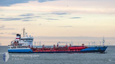
Oil/Chemical Tanker
Current Trip
| Time Travelled | 1 day |
|---|---|
| Remaining Time | 1 h, 3 mins |
| Distance Travelled | 193.50 nm |
| Remaining Distance | 43.42 nm |
| AVG Speed | 10.4 Knop |
| MAX Speed | 12.8 Knop |
| AVG Wind | 21.3 knots |
| MAX Wind | 34.8 knots |
| MIN Temp | 2.3°C / 36.14°F |
| MAX Temp | 9.4°C / 48.92°F |
| Djupgående | 5 m |
| Position mottagen | 6 h, 10 m sen |
Current Position
| Longitud | -4.11990° |
|---|---|
| Latitude | 53.47812° |
| Status | Under way using engine |
| Fart | 7.2 Knop |
| Kurs | 170° |
| Område | Irish Sea and St. George's Channel |
| Station | T-AIS |
| Position mottagen | 6 h, 10 m sen |
Info
Information
The current position of BOYNE is in Irish Sea and St. George's Channel with coordinates 53.47812° / -4.11990° as reported on 2024-04-15 23:53 by AIS to our vessel tracker app. The vessel's current speed is 7.2 Knop and is heading at the port of LIVERPOOL. The estimated time of arrival as calculated by MyShipTracking vessel tracking app is 2024-04-16 07:06 LT
The vessel BOYNE (IMO: 9369928, MMSI: 256247000) is a Oil/Chemical Tanker that was built in 2007 ( 17 År gammal ). It's sailing under the flag of [MT] Malta.
In this page you can find informations about the vessels current position, last detected port calls, and current voyage information. If the vessels is not in coverage by AIS you will find the latest position.
The current position of BOYNE is detected by our AIS receivers and we are not responsible for the reliability of the data. The last position was recorded while the vessel was in Coverage by the Ais receivers of our vessel tracking app.
The current draught of BOYNE as reported by AIS is 5 meters
Weather
| Temperature | 8.1°C / 46.58°F |
|---|---|
| Wind Speed | 23 knots |
| Direction | 316° NW |
| Pressure | 1013.8 hPa |
| Humidity | 82.3 % |
| Cloud Coverage | 51 % |
Featured Company
Last Port Calls
| Port | Arrival | Departure | Time In Port |
|---|---|---|---|
| 2024-04-14 15:38 | 2024-04-15 05:10 | 13 h | |
| 2024-04-11 18:11 | 2024-04-11 18:21 | 10 m | |
| 2024-04-05 12:08 | 2024-04-06 11:50 | 23 h | |
| 2024-03-29 21:14 | 2024-03-31 06:34 | 1 d | |
| 2024-03-22 09:08 | 2024-03-22 17:13 | 8 h | |
| 2024-03-19 21:46 | 2024-03-20 10:59 | 13 h | |
| 2024-03-15 15:17 | 2024-03-16 21:18 | 1 d | |
| 2024-03-12 20:36 | 2024-03-13 23:25 | 1 d | |
| 2024-03-08 11:12 | 2024-03-10 04:59 | 1 d | |
| 2024-03-05 19:15 | 2024-03-06 15:42 | 20 h |
Last Trips
| Origin | Departure | Destination | Arrival | Distance | |
|---|---|---|---|---|---|
| 2024-04-11 19:21 | 2024-04-14 16:38 | 466.60 nm | |||
| 2024-04-06 12:50 | 2024-04-11 19:11 | 324.15 nm | |||
| 2024-03-31 08:34 | 2024-04-05 13:08 | 806.80 nm | |||
| 2024-03-22 18:13 | 2024-03-29 22:14 | 1215.37 nm | |||
| 2024-03-20 11:59 | 2024-03-22 10:08 | 521.03 nm | |||
| 2024-03-16 22:18 | 2024-03-19 22:46 | 548.61 nm | |||
| 2024-03-13 23:25 | 2024-03-15 16:17 | 284.86 nm | |||
| 2024-03-10 04:59 | 2024-03-12 20:36 | 128.77 nm | |||
| 2024-03-06 15:42 | 2024-03-08 11:12 | 292.32 nm | |||
| 2024-03-02 17:46 | 2024-03-05 19:15 | 166.07 nm |
Events
| Tid | Event | Detaljer | Position / Dest | Information |
|---|---|---|---|---|
| 2024-04-16 01:17 | STOPPAR förflyttning | 11.97 nm, North West of CONWY |
53.38856 / -4.12898
GB LIV
|
Fart: 0.1 kn Kurs: 310° |
| 2024-04-15 23:57 | Status ändrad | Default Under way using engine |
53.46860 / -4.11720
GB LIV
|
Fart: 7.2 kn Kurs: 170° |
| 2024-04-15 23:53 | Status ändrad | Under way using engine Default |
53.47812 / -4.11990
GB LIV
|
Fart: 7.3 kn Kurs: 170° |
| 2024-04-15 23:53 | UTANFÖR täckningsområde |
53.47812 / -4.11990
Irish Sea and St. George's Channel
GB LIV
|
Fart: 7.2 kn Kurs: 170° |
|
| 2024-04-15 23:45 | I täckningsområde |
53.47812 / -4.11990
Irish Sea and St. George's Channel
GB LIV
|
Fart: 7.2 kn Kurs: 170° |
|
| 2024-04-15 21:41 | Status ändrad | Default Under way using engine |
53.66845 / -4.44873
GB LIV
|
Fart: 8.2 kn Kurs: 140° |
| 2024-04-15 21:37 | UTANFÖR täckningsområde |
53.67577 / -4.45962
Irish Sea and St. George's Channel
GB LIV
|
Fart: 8.2 kn Kurs: 140° |
|
| 2024-04-15 21:30 | Status ändrad | Under way using engine Default |
53.68612 / -4.47477
GB LIV
|
Fart: 7.9 kn Kurs: 139° |
| 2024-04-15 21:30 | I täckningsområde |
53.68437 / -4.47235
Irish Sea and St. George's Channel
GB LIV
|
Fart: 8.2 kn Kurs: 142° |
|
| 2024-04-15 16:00 | UTANFÖR täckningsområde |
54.30040 / -5.06043
Irish Sea and St. George's Channel
GB LIV
|
Fart: 7.4 kn Kurs: 171° |