
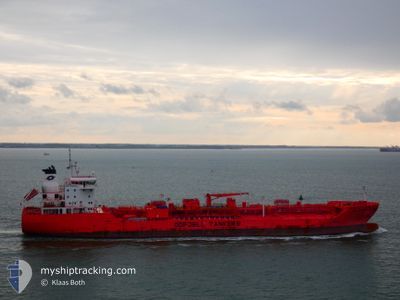
BOW TUNGSTEN
Tanker
Current Trip
| Time Travelled | 5 days |
|---|---|
| Remaining Time | --- |
| Distance Travelled | 879.26 nm |
| Remaining Distance | 657.02 nm |
| AVG Speed | 12.5 Knop |
| MAX Speed | 15.2 Knop |
| AVG Wind | 13.3 knots |
| MAX Wind | 25 knots |
| MIN Temp | 15.2°C / 59.36°F |
| MAX Temp | 26.3°C / 79.34°F |
| Djupgående | 8.6 m |
| Position mottagen | 5 d sen |
Current Position
| Longitud | -94.80357° |
|---|---|
| Latitude | 29.37052° |
| Status | Under way using engine |
| Fart | 11.6 Knop |
| Kurs | 156.5° |
| Område | Gulf of Mexico |
| Station | T-AIS |
| Position mottagen | 5 d sen |
Info
Information
The current position of BOW TUNGSTEN is in Gulf of Mexico with coordinates 29.37052° / -94.80357° as reported on 2024-04-20 15:40 by AIS to our vessel tracker app. The vessel's current speed is 11.6 Knop and is heading at the port of CORPUS CHRISTI. The estimated time of arrival as calculated by MyShipTracking vessel tracking app is 2024-04-21 04:00 LT
The vessel BOW TUNGSTEN (IMO: 9777400, MMSI: 257290000) is a Tanker It's sailing under the flag of [NO] Norway.
In this page you can find informations about the vessels current position, last detected port calls, and current voyage information. If the vessels is not in coverage by AIS you will find the latest position.
The current position of BOW TUNGSTEN is detected by our AIS receivers and we are not responsible for the reliability of the data. The last position was recorded while the vessel was in Coverage by the Ais receivers of our vessel tracking app.
The current draught of BOW TUNGSTEN as reported by AIS is 8.6 meters
Weather
| Temperature | 26.2°C / 79.16°F |
|---|---|
| Wind Speed | 13 knots |
| Direction | 106° ESE |
| Pressure | 1016.1 hPa |
| Humidity | 74.3 % |
| Cloud Coverage | --- |
Featured Company
Last Port Calls
| Port | Arrival | Departure | Time In Port |
|---|---|---|---|
| 2024-04-18 19:59 | 2024-04-20 14:21 | 1 d | |
| 2024-04-16 12:49 | 2024-04-17 05:10 | 16 h | |
| 2024-04-13 15:14 | 2024-04-14 12:44 | 21 h | |
| 2024-04-05 17:41 | 2024-04-06 16:52 | 23 h | |
| 2024-04-04 13:09 | 2024-04-05 08:25 | 19 h | |
| 2024-04-01 00:23 | 2024-04-02 20:49 | 1 d | |
| 2024-03-30 03:19 | 2024-03-31 13:03 | 1 d | |
| 2024-03-22 07:38 | 2024-03-23 18:07 | 1 d | |
| 2024-03-07 10:35 | 2024-03-10 16:32 | 3 d | |
| 2024-02-08 13:03 | 2024-02-08 14:21 | 1 h |
Most Visited Ports (Last year)
| Port | Arrivals | |
|---|---|---|
| 11 | ||
| 3 | ||
| 3 | ||
| 3 | ||
| 2 | ||
| 2 |
Last Trips
| Origin | Departure | Destination | Arrival | Distance | |
|---|---|---|---|---|---|
| 2024-04-17 00:10 | 2024-04-18 14:59 | 62.35 nm | |||
| 2024-04-14 07:44 | 2024-04-16 07:49 | 201.12 nm | |||
| 2024-04-06 11:52 | 2024-04-13 10:14 | 420.93 nm | |||
| 2024-04-05 03:25 | 2024-04-05 12:41 | 56.62 nm | |||
| 2024-04-02 15:49 | 2024-04-04 08:09 | 77.76 nm | |||
| 2024-03-31 08:03 | 2024-03-31 19:23 | 65.60 nm | |||
| 2024-03-23 14:07 | 2024-03-29 22:19 | 1986.91 nm | |||
| 2024-03-10 13:32 | 2024-03-22 03:38 | 3023.88 nm | |||
| 2024-02-08 11:21 | 2024-03-07 07:35 | 2743.52 nm | |||
| 2024-01-17 04:01 | 2024-02-08 10:03 | 5621.81 nm |
Events
| Tid | Event | Detaljer | Position / Dest | Information |
|---|---|---|---|---|
| 2024-04-23 18:46 | STARTAR förflyttning | 3.09 nm, East of PORTLAND (TX) |
27.87866 / -97.27887
US HOU>US CRP
|
Fart: 4.5 kn Kurs: 78° |
| 2024-04-22 09:26 | STOPPAR förflyttning | 2.73 nm, East of PORTLAND (TX) |
27.87870 / -97.28556
US HOU>US CRP
|
Fart: 0.1 kn Kurs: 78° |
| 2024-04-22 06:42 | STARTAR förflyttning | 8.69 nm, East of PORT ARANSAS |
27.79061 / -96.91409
US HOU>US CRP
|
Fart: 4.1 kn Kurs: 294° |
| 2024-04-21 05:25 | STOPPAR förflyttning | 8.78 nm, East of PORT ARANSAS |
27.78833 / -96.91333
US HOU>US CRP
|
Fart: Kurs: -1° |
| 2024-04-20 15:46 | Status ändrad | Default Under way using engine |
29.35494 / -94.78919
US HOU>US CRP
|
Fart: 11.6 kn Kurs: 156.5° |
| 2024-04-20 15:40 | UTANFÖR täckningsområde |
29.37052 / -94.80357
Gulf of Mexico
US HOU>US CRP
|
Fart: 11.6 kn Kurs: 156.5° |
|
| 2024-04-20 14:21 | AVGÅTT HAMN |
|
29.59019 / -94.93994
US HOU>US CRP
|
Fart: 9.4 kn Kurs: 145° |
| 2024-04-20 13:15 | Djupgående ändrat | 8.6 7 |
29.72202 / -95.02080
[US] HOUSTON
|
Fart: 6.8 kn Kurs: 176° |
| 2024-04-20 13:15 | Destination ändrad | US HOU>US CRP US HOU>VOPAK DP2 |
29.72202 / -95.02080
[US] HOUSTON
|
Fart: 6.8 kn Kurs: 176° |
| 2024-04-20 13:15 | ETA ändrat | 2024/04/21 04:00 2024/04/18 22:00 |
29.72202 / -95.02080
[US] HOUSTON
|
Fart: 6.8 kn Kurs: 176° |