
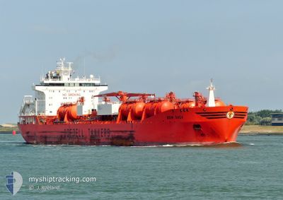
BOW SAGA
Oil/Chemical Tanker
Current Trip
ES>ALG
| Time Travelled | 5 days |
|---|---|
| Remaining Time | --- |
| Distance Travelled | 1146.49 nm |
| Remaining Distance | --- |
| AVG Speed | 12.7 Knop |
| MAX Speed | 16.4 Knop |
| AVG Wind | 13.5 knots |
| MAX Wind | 30.8 knots |
| MIN Temp | 17.3°C / 63.14°F |
| MAX Temp | 30.5°C / 86.9°F |
| Djupgående | 11.7 m |
| Position mottagen | 1 d sen |
Current Position
| Longitud | 28.11183° |
|---|---|
| Latitude | 33.14854° |
| Status | Under way using engine |
| Fart | 14.6 Knop |
| Kurs | 286.1° |
| Område | Mediterranean Sea - Eastern Basin |
| Station | T-AIS |
| Position mottagen | 1 d sen |
Info
Information
The current position of BOW SAGA is in Mediterranean Sea - Eastern Basin with coordinates 33.14854° / 28.11183° as reported on 2024-04-17 10:42 by AIS to our vessel tracker app. The vessel's current speed is 14.6 Knop
The vessel BOW SAGA (IMO: 9215309, MMSI: 258960000) is a Oil/Chemical Tanker that was built in 2007 ( 17 År gammal ). It's sailing under the flag of [NO] Norway.
In this page you can find informations about the vessels current position, last detected port calls, and current voyage information. If the vessels is not in coverage by AIS you will find the latest position.
The current position of BOW SAGA is detected by our AIS receivers and we are not responsible for the reliability of the data. The last position was recorded while the vessel was in Coverage by the Ais receivers of our vessel tracking app.
The current draught of BOW SAGA as reported by AIS is 11.7 meters
Weather
| Temperature | 17.3°C / 63.14°F |
|---|---|
| Wind Speed | 21 knots |
| Direction | 275° W |
| Pressure | 1009.5 hPa |
| Humidity | 80.4 % |
| Cloud Coverage | 10 % |
Featured Company
Last Port Calls
| Port | Arrival | Departure | Time In Port |
|---|---|---|---|
| 2024-04-16 06:51 | 2024-04-16 16:35 | 9 h | |
| 2024-04-11 05:01 | 2024-04-13 12:25 | 2 d | |
| 2024-04-05 03:41 | 2024-04-05 12:32 | 8 h | |
| 2024-03-22 10:25 | 2024-03-24 19:58 | 2 d | |
| 2024-03-14 09:35 | 2024-03-20 05:19 | 5 d | |
| 2024-02-24 06:22 | 2024-02-26 15:25 | 2 d | |
| 2024-02-21 23:34 | 2024-02-22 20:13 | 20 h | |
| 2024-02-16 02:41 | 2024-02-17 18:52 | 1 d | |
| 2024-02-12 09:59 | 2024-02-14 04:53 | 1 d | |
| 2024-02-09 16:38 | 2024-02-10 09:15 | 16 h |
Most Visited Ports (Last year)
| Port | Arrivals | |
|---|---|---|
| 16 | ||
| 7 | ||
| 5 | ||
| 3 | ||
| 2 | ||
| 2 |
Last Trips
| Origin | Departure | Destination | Arrival | Distance | |
|---|---|---|---|---|---|
| 2024-04-13 15:25 | 2024-04-16 08:51 | 590.87 nm | |||
| 2024-03-24 20:58 | 2024-04-11 08:01 | 4574.91 nm | |||
| 2024-03-24 20:58 | 2024-04-05 05:41 | 3695.71 nm | |||
| 2024-03-20 06:19 | 2024-03-22 11:25 | 372.91 nm | |||
| 2024-02-26 09:25 | 2024-03-14 10:35 | 4971.84 nm | |||
| 2024-02-22 14:13 | 2024-02-24 00:22 | 439.91 nm | |||
| 2024-02-17 12:52 | 2024-02-21 17:34 | 61.52 nm | |||
| 2024-02-13 22:53 | 2024-02-15 20:41 | 60.18 nm | |||
| 2024-02-10 03:15 | 2024-02-12 03:59 | 40.33 nm | |||
| 2024-02-08 03:24 | 2024-02-09 10:38 | 59.80 nm |
Events
| Tid | Event | Detaljer | Position / Dest | Information |
|---|---|---|---|---|
| 2024-04-17 10:48 | Status ändrad | Default Under way using engine |
33.15562 / 28.08353
ES>ALG
|
Fart: 14.6 kn Kurs: 286.1° |
| 2024-04-17 10:42 | UTANFÖR täckningsområde |
33.14854 / 28.11183
Mediterranean Sea - Eastern Basin
ES>ALG
|
Fart: 14.6 kn Kurs: 286.1° |
|
| 2024-04-17 09:14 | Status ändrad | Under way using engine Default |
33.04683 / 28.52134
ES>ALG
|
Fart: 15.1 kn Kurs: 285° |
| 2024-04-17 09:01 | I täckningsområde |
33.04969 / 28.50981
Mediterranean Sea - Eastern Basin
ES>ALG
|
Fart: 15 kn Kurs: 286.4° |
|
| 2024-04-17 06:19 | Status ändrad | Default Under way using engine |
32.83689 / 29.36717
ES>ALG
|
Fart: 15.2 kn Kurs: 286.5° |
| 2024-04-17 06:18 | UTANFÖR täckningsområde |
32.83566 / 29.37208
Mediterranean Sea - Eastern Basin
ES>ALG
|
Fart: 15.2 kn Kurs: 286.5° |
|
| 2024-04-16 21:10 | Status ändrad | Under way using engine Default |
31.91065 / 31.74136
ES>ALG
|
Fart: 14 kn Kurs: 307° |
| 2024-04-16 20:57 | I täckningsområde |
31.91065 / 31.74136
Mediterranean Sea - Eastern Basin
ES>ALG
|
Fart: 14.7 kn Kurs: 306.8° |
|
| 2024-04-16 20:07 | Status ändrad | Default Under way using engine |
31.75565 / 31.97655
ES>ALG
|
Fart: 14.5 kn Kurs: 312.4° |
| 2024-04-16 20:02 | UTANFÖR täckningsområde |
31.74139 / 31.99322
Mediterranean Sea - Eastern Basin
ES>ALG
|
Fart: 14.5 kn Kurs: 312.4° |