
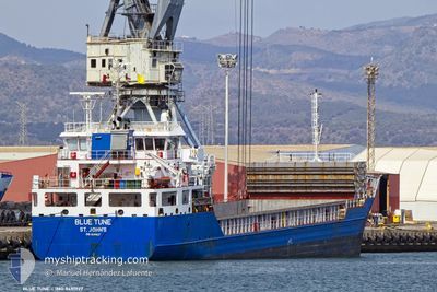
BLUE TUNE
General Cargo
Current Trip
IT SAL
| Time Travelled | 2 days |
|---|---|
| Remaining Time | --- |
| Distance Travelled | 13.71 nm |
| Remaining Distance | --- |
| AVG Speed | 3.3 Knop |
| MAX Speed | 3.3 Knop |
| AVG Wind | 4.3 knots |
| MAX Wind | 9.9 knots |
| MIN Temp | 7.6°C / 45.68°F |
| MAX Temp | 15°C / 59°F |
| Djupgående | 4.8 m |
| Position mottagen | 3 d sen |
Current Position
| Longitud | 14.64522° |
|---|---|
| Latitude | 40.60677° |
| Status | Under way using engine |
| Fart | 10 Knop |
| Kurs | 68.2° |
| Område | Tyrrhenian Sea |
| Station | T-AIS |
| Position mottagen | 3 d sen |
Info
Information
The current position of BLUE TUNE is in Tyrrhenian Sea with coordinates 40.60677° / 14.64522° as reported on 2024-04-21 20:44 by AIS to our vessel tracker app. The vessel's current speed is 10 Knop
The vessel BLUE TUNE (IMO: 9491927, MMSI: 305566000) is a General Cargo that was built in 2010 ( 14 År gammal ). It's sailing under the flag of [AG] Antigua Barbuda.
In this page you can find informations about the vessels current position, last detected port calls, and current voyage information. If the vessels is not in coverage by AIS you will find the latest position.
The current position of BLUE TUNE is detected by our AIS receivers and we are not responsible for the reliability of the data. The last position was recorded while the vessel was in Coverage by the Ais receivers of our vessel tracking app.
The current draught of BLUE TUNE as reported by AIS is 4.8 meters
Weather
| Temperature | 11°C / 51.8°F |
|---|---|
| Wind Speed | 4 knots |
| Direction | 209° SSW |
| Pressure | 1010.4 hPa |
| Humidity | 74.4 % |
| Cloud Coverage | 100 % |
Featured Company
Last Port Calls
| Port | Arrival | Departure | Time In Port |
|---|---|---|---|
| 2024-04-23 03:18 | 2024-04-23 13:06 | 9 h | |
| 2024-04-17 10:11 | 2024-04-20 09:45 | 2 d | |
| 2024-04-11 12:52 | 2024-04-11 16:30 | 3 h | |
| 2024-04-04 09:19 | 2024-04-07 13:27 | 3 d | |
| 2024-04-02 13:46 | 2024-04-03 13:44 | 23 h | |
| 2024-03-27 20:46 | 2024-03-29 01:22 | 1 d | |
| 2024-03-25 23:24 | 2024-03-27 20:28 | 1 d | |
| 2024-03-24 04:54 | 2024-03-25 18:27 | 1 d | |
| 2024-03-20 00:02 | 2024-03-22 23:27 | 2 d | |
| 2024-03-16 18:37 | 2024-03-18 21:33 | 2 d |
Last Trips
| Origin | Departure | Destination | Arrival | Distance | |
|---|---|---|---|---|---|
| 2024-04-20 11:45 | 2024-04-23 05:18 | 362.08 nm | |||
| 2024-04-11 18:30 | 2024-04-17 12:11 | 885.72 nm | |||
| 2024-04-07 15:27 | 2024-04-11 14:52 | 806.38 nm | |||
| 2024-04-03 15:44 | 2024-04-04 11:19 | 183.19 nm | |||
| 2024-03-29 02:22 | 2024-04-02 15:46 | 845.22 nm | |||
| 2024-03-27 21:28 | 2024-03-27 21:46 | 0.36 nm | |||
| 2024-03-25 19:27 | 2024-03-26 00:24 | 49.65 nm | |||
| 2024-03-22 23:27 | 2024-03-24 05:54 | 256.69 nm | |||
| 2024-03-18 22:33 | 2024-03-20 00:02 | 257.84 nm | |||
| 2024-03-13 13:28 | 2024-03-16 19:37 | 678.16 nm |
Events
| Tid | Event | Detaljer | Position / Dest | Information |
|---|---|---|---|---|
| 2024-04-23 13:40 | STOPPAR förflyttning | 1.2 nm, South of SALERNO |
40.64667 / 14.75667
IT SAL
|
Fart: Kurs: -1° |
| 2024-04-23 13:06 | AVGÅTT HAMN |
|
40.66262 / 14.73920
IT SAL
|
Fart: 4.2 kn Kurs: 212° |
| 2024-04-23 13:00 | STARTAR förflyttning |
40.66767 / 14.74813
[IT] SALERNO
|
Fart: 4.2 kn Kurs: 212° |
|
| 2024-04-23 03:40 | STOPPAR förflyttning |
40.67333 / 14.74500
[IT] SALERNO
|
Fart: Kurs: -1° |
|
| 2024-04-23 03:18 | ANLÄNDER HAMN |
|
40.66415 / 14.74281
[IT] SALERNO
|
Fart: 4 kn Kurs: -1° |
| 2024-04-23 03:06 | STARTAR förflyttning | 0.94 nm, South of SALERNO |
40.65212 / 14.74733
IT SAL
|
Fart: 7.6 kn Kurs: 302° |
| 2024-04-21 22:03 | STOPPAR förflyttning | 1.2 nm, South of SALERNO |
40.64660 / 14.75517
IT SAL
|
Fart: Kurs: 16° |
| 2024-04-21 20:45 | Status ändrad | Default Under way using engine |
40.60796 / 14.64852
IT SAL
|
Fart: 10 kn Kurs: 68.2° |
| 2024-04-21 20:44 | UTANFÖR täckningsområde |
40.60677 / 14.64522
Tyrrhenian Sea
IT SAL
|
Fart: 10 kn Kurs: 68.2° |
|
| 2024-04-21 17:00 | ETA ändrat | 2024/04/21 23:00 2024/04/21 22:00 |
40.59730 / 13.85377
IT SAL
|
Fart: 10.1 kn Kurs: 106.1° |