
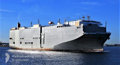
BLUE RIDGE HIGHWAY
Vehicles Carrier
Current Trip
PH BAU
| Time Travelled | 9 h, 37 mins |
|---|---|
| Remaining Time | --- |
| Distance Travelled | 135.48 nm |
| Remaining Distance | --- |
| AVG Speed | 10.6 Knop |
| MAX Speed | 17 Knop |
| AVG Wind | 10.4 knots |
| MAX Wind | 29 knots |
| MIN Temp | 26°C / 78.8°F |
| MAX Temp | 29.1°C / 84.38°F |
| Djupgående | 8.4 m |
| Position mottagen | 6 h, 31 m sen |
Current Position
| Longitud | 106.91555° |
|---|---|
| Latitude | 20.54713° |
| Status | Under way using engine |
| Fart | 13.2 Knop |
| Kurs | 176° |
| Område | South China Sea |
| Station | T-AIS |
| Position mottagen | 6 h, 31 m sen |
Info
Information
The current position of BLUE RIDGE HIGHWAY is in South China Sea with coordinates 20.54713° / 106.91555° as reported on 2024-04-25 08:25 by AIS to our vessel tracker app. The vessel's current speed is 13.2 Knop
The vessel BLUE RIDGE HIGHWAY (IMO: 9510151, MMSI: 355558000) is a Vehicles Carrier that was built in 2009 ( 15 År gammal ). It's sailing under the flag of [PA] Panama.
In this page you can find informations about the vessels current position, last detected port calls, and current voyage information. If the vessels is not in coverage by AIS you will find the latest position.
The current position of BLUE RIDGE HIGHWAY is detected by our AIS receivers and we are not responsible for the reliability of the data. The last position was recorded while the vessel was in Coverage by the Ais receivers of our vessel tracking app.
The current draught of BLUE RIDGE HIGHWAY as reported by AIS is 8.4 meters
Weather
| Temperature | 27.5°C / 81.5°F |
|---|---|
| Wind Speed | 29 knots |
| Direction | 152° SSE |
| Pressure | 1003 hPa |
| Humidity | 89 % |
| Cloud Coverage | --- |
Featured Company
Last Port Calls
| Port | Arrival | Departure | Time In Port |
|---|---|---|---|
| 2024-04-24 08:11 | 2024-04-25 05:20 | 21 h | |
| 2024-04-17 23:17 | 2024-04-18 17:19 | 18 h | |
| 2024-04-15 04:18 | 2024-04-15 18:51 | 14 h | |
| 2024-04-13 23:58 | 2024-04-14 13:02 | 13 h | |
| 2024-04-10 23:16 | 2024-04-12 03:32 | 1 d | |
| 2024-04-08 23:38 | 2024-04-09 09:22 | 9 h | |
| 2024-04-05 23:13 | 2024-04-06 17:36 | 18 h | |
| 2024-03-31 14:10 | 2024-04-01 17:28 | 1 d | |
| 2024-03-25 23:16 | 2024-03-26 10:18 | 11 h | |
| 2024-03-21 01:27 | 2024-03-21 14:10 | 12 h |
Most Visited Ports (Last year)
| Port | Arrivals | |
|---|---|---|
| 28 | ||
| 25 | ||
| 15 | ||
| 13 | ||
| 9 | ||
| 6 |
Last Trips
| Origin | Departure | Destination | Arrival | Distance | |
|---|---|---|---|---|---|
| 2024-04-19 00:19 | 2024-04-24 15:11 | 1509.22 nm | |||
| 2024-04-16 02:51 | 2024-04-18 06:17 | 827.42 nm | |||
| 2024-04-14 21:02 | 2024-04-15 12:18 | 199.15 nm | |||
| 2024-04-12 10:32 | 2024-04-14 07:58 | 762.83 nm | |||
| 2024-04-09 17:22 | 2024-04-11 06:16 | 568.30 nm | |||
| 2024-04-07 00:36 | 2024-04-09 07:38 | 816.30 nm | |||
| 2024-04-02 00:28 | 2024-04-06 06:13 | 1374.76 nm | |||
| 2024-03-26 17:18 | 2024-03-31 21:10 | 1455.12 nm | |||
| 2024-03-21 22:10 | 2024-03-26 06:16 | 1203.10 nm | |||
| 2024-03-21 07:58 | 2024-03-21 09:27 | 11.54 nm |
Events
| Tid | Event | Detaljer | Position / Dest | Information |
|---|---|---|---|---|
| 2024-04-25 08:32 | Status ändrad | Default Under way using engine |
20.52372 / 106.92786
PH BAU
|
Fart: 13.2 kn Kurs: 176° |
| 2024-04-25 08:25 | UTANFÖR täckningsområde |
20.54713 / 106.91555
South China Sea
PH BAU
|
Fart: 13.2 kn Kurs: 176° |
|
| 2024-04-25 08:19 | Status ändrad | Under way using engine Default |
20.56962 / 106.91477
PH BAU
|
Fart: 13.1 kn Kurs: 164° |
| 2024-04-25 08:08 | Status ändrad | Default Under way using engine |
20.60698 / 106.90186
PH BAU
|
Fart: 8.9 kn Kurs: 170° |
| 2024-04-25 05:20 | AVGÅTT HAMN |
|
20.83422 / 106.78570
PH BAU
|
Fart: 5.9 kn Kurs: 129° |
| 2024-04-25 05:17 | STARTAR förflyttning |
20.83630 / 106.78207
[VN] HAI PHONG
|
Fart: 3.7 kn Kurs: 118° |
|
| 2024-04-25 05:05 | Status ändrad | Under way using engine Moored |
20.83578 / 106.77963
[VN] HAI PHONG
|
Fart: Kurs: 127° |
| 2024-04-25 04:43 | Djupgående ändrat | 8.4 8.7 |
20.83575 / 106.77960
[VN] HAI PHONG
|
Fart: Kurs: 127° |
| 2024-04-25 04:43 | Destination ändrad | PH BAU VN HPG |
20.83575 / 106.77960
[VN] HAI PHONG
|
Fart: Kurs: 127° |
| 2024-04-25 04:43 | ETA ändrat | 2024/04/27 19:00 2024/04/24 05:30 |
20.83575 / 106.77960
[VN] HAI PHONG
|
Fart: Kurs: 127° |