
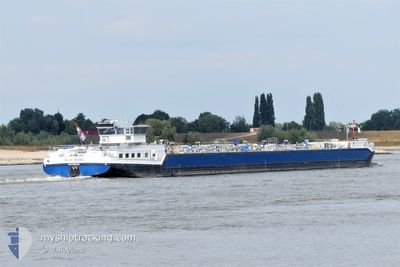
BLUE RENEE
Tanker
Current Trip
| Time Travelled | 1 h, 24 mins |
|---|---|
| Remaining Time | --- |
| Distance Travelled | 6.35 nm |
| Remaining Distance | --- |
| AVG Speed | 7.6 Knop |
| MAX Speed | 8.1 Knop |
| AVG Wind | 4.9 knots |
| MAX Wind | 5 knots |
| MIN Temp | 2.6°C / 36.68°F |
| MAX Temp | 3°C / 37.4°F |
| Djupgående | 1.9 m |
| Position mottagen | 2 m sen |
Current Position
| Longitud | 5.01174° |
|---|---|
| Latitude | 52.14950° |
| Status | Under way using engine |
| Fart | 8.2 Knop |
| Kurs | 312° |
| Område | North Sea |
| Station | T-AIS |
| Position mottagen | 2 m sen |
Info
Information
The current position of BLUE RENEE is in North Sea with coordinates 52.14950° / 5.01174° as reported on 2024-04-18 02:49 by AIS to our vessel tracker app. The vessel's current speed is 8.2 Knop
The vessel BLUE RENEE (MMSI: 244376509) is a Tanker It's sailing under the flag of [NL] Netherlands.
In this page you can find informations about the vessels current position, last detected port calls, and current voyage information. If the vessels is not in coverage by AIS you will find the latest position.
The current position of BLUE RENEE is detected by our AIS receivers and we are not responsible for the reliability of the data. The last position was recorded while the vessel was in Coverage by the Ais receivers of our vessel tracking app.
The current draught of BLUE RENEE as reported by AIS is 1.9 meters
Weather
| Temperature | 3°C / 37.4°F |
|---|---|
| Wind Speed | 4 knots |
| Direction | 12° NNE |
| Pressure | 1016.4 hPa |
| Humidity | 92.9 % |
| Cloud Coverage | 14 % |
Featured Company
Last Port Calls
| Port | Arrival | Departure | Time In Port |
|---|---|---|---|
| 2024-04-18 00:25 | 2024-04-18 01:27 | 1 h | |
| 2024-04-17 10:59 | 2024-04-17 12:28 | 1 h | |
| 2024-04-16 20:00 | 2024-04-17 09:07 | 13 h | |
| 2024-04-15 15:27 | 2024-04-16 06:39 | 15 h | |
| 2024-04-14 06:37 | 2024-04-15 15:01 | 1 d | |
| 2024-04-13 10:14 | 2024-04-13 13:14 | 3 h | |
| 2024-04-11 07:46 | 2024-04-12 04:16 | 20 h | |
| 2024-04-10 10:49 | 2024-04-11 04:28 | 17 h | |
| 2024-04-08 12:50 | 2024-04-10 04:24 | 1 d | |
| 2024-04-04 19:09 | 2024-04-06 10:41 | 1 d |
Most Visited Ports (Last year)
| Port | Arrivals | |
|---|---|---|
| 32 | ||
| 16 | ||
| 16 | ||
| 15 | ||
| 14 | ||
| 14 |
Last Trips
| Origin | Departure | Destination | Arrival | Distance | |
|---|---|---|---|---|---|
| 2024-04-17 14:28 | 2024-04-18 02:25 | 82.48 nm | |||
| 2024-04-17 11:07 | 2024-04-17 12:59 | 9.16 nm | |||
| 2024-04-16 08:39 | 2024-04-16 22:00 | 83.58 nm | |||
| 2024-04-15 17:01 | 2024-04-15 17:27 | 3.51 nm | |||
| 2024-04-13 15:14 | 2024-04-14 08:37 | 161.13 nm | |||
| 2024-04-12 06:16 | 2024-04-13 12:14 | 93.48 nm | |||
| 2024-04-11 06:28 | 2024-04-11 09:46 | 29.31 nm | |||
| 2024-04-10 06:24 | 2024-04-10 12:49 | 29.35 nm | |||
| 2024-04-06 12:41 | 2024-04-08 14:50 | 189.90 nm | |||
| 2024-04-04 19:39 | 2024-04-04 21:09 | 14.02 nm |
Events
| Tid | Event | Detaljer | Position / Dest | Information |
|---|---|---|---|---|
| 2024-04-18 01:27 | AVGÅTT HAMN |
|
52.04732 / 5.10698
AMSTERDAM AMERIKAHAV
|
Fart: 7.3 kn Kurs: 344° |
| 2024-04-18 00:25 | ANLÄNDER HAMN |
|
52.00658 / 5.10708
[NL] NIEUWEGEIN
|
Fart: 1.6 kn Kurs: 21° |
| 2024-04-17 19:31 | Destination ändrad | AMSTERDAM AMERIKAHAV ROTTERDAM BOTLEK |
51.69644 / 4.42066
AMSTERDAM AMERIKAHAV
|
Fart: 8.6 kn Kurs: 57° |
| 2024-04-17 19:31 | ETA ändrat | 2024/04/18 14:08 2024/04/18 03:14 |
51.69644 / 4.42066
AMSTERDAM AMERIKAHAV
|
Fart: 8.6 kn Kurs: 57° |
| 2024-04-17 19:27 | Status ändrad | Under way using engine Default |
51.69253 / 4.41284
ROTTERDAM BOTLEK
|
Fart: 0.8 kn Kurs: 50° |
| 2024-04-17 18:56 | Status ändrad | Default Under way using engine |
51.68911 / 4.40688
ROTTERDAM BOTLEK
|
Fart: 1.7 kn Kurs: 51° |
| 2024-04-17 18:41 | Status ändrad | Under way using engine Default |
51.68064 / 4.39170
ROTTERDAM BOTLEK
|
Fart: 8.9 kn Kurs: 28° |
| 2024-04-17 18:37 | Status ändrad | Default Under way using engine |
51.67388 / 4.38448
ROTTERDAM BOTLEK
|
Fart: 9 kn Kurs: 54° |
| 2024-04-17 18:03 | Status ändrad | Under way using engine Default |
51.63941 / 4.25993
ROTTERDAM BOTLEK
|
Fart: 9 kn Kurs: 91° |
| 2024-04-17 17:58 | Status ändrad | Default Under way using engine |
51.63667 / 4.23833
ROTTERDAM BOTLEK
|
Fart: 9.1 kn Kurs: 108° |