
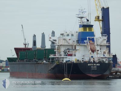
BIRTE SELMER
Bulk Carrier
Current Trip
| Time Travelled | 21 days |
|---|---|
| Remaining Time | --- |
| Distance Travelled | 766.99 nm |
| Remaining Distance | --- |
| AVG Speed | 10.4 Knop |
| MAX Speed | 13.8 Knop |
| AVG Wind | 9.2 knots |
| MAX Wind | 20 knots |
| MIN Temp | 21.4°C / 70.52°F |
| MAX Temp | 28.2°C / 82.76°F |
| Djupgående | 6.2 m |
| Position mottagen | 6 d sen |
Current Position
| Longitud | -46.17115° |
|---|---|
| Latitude | -24.16317° |
| Status | At anchor |
| Fart | 0.1 Knop |
| Kurs | 216° |
| Område | South Atlantic Ocean |
| Station | T-AIS |
| Position mottagen | 6 d sen |
Info
Information
The current position of BIRTE SELMER is in South Atlantic Ocean with coordinates -24.16317° / -46.17115° as reported on 2024-04-12 05:19 by AIS to our vessel tracker app. The vessel's current speed is 0.1 Knop
The vessel BIRTE SELMER (IMO: 9474254, MMSI: 538007973) is a Bulk Carrier that was built in 2011 ( 13 År gammal ). It's sailing under the flag of [MH] Marshall Is.
In this page you can find informations about the vessels current position, last detected port calls, and current voyage information. If the vessels is not in coverage by AIS you will find the latest position.
The current position of BIRTE SELMER is detected by our AIS receivers and we are not responsible for the reliability of the data. The last position was recorded while the vessel was in Coverage by the Ais receivers of our vessel tracking app.
The current draught of BIRTE SELMER as reported by AIS is 6.2 meters
Weather
| Temperature | 22.8°C / 73.04°F |
|---|---|
| Wind Speed | 5 knots |
| Direction | 172° S |
| Pressure | 1015.4 hPa |
| Humidity | 83.6 % |
| Cloud Coverage | 100 % |
Featured Company
Last Port Calls
| Port | Arrival | Departure | Time In Port |
|---|---|---|---|
| 2024-03-27 05:06 | 2024-03-28 01:29 | 20 h | |
| 2024-03-15 19:45 | 2024-03-25 00:12 | 9 d | |
| 2024-02-14 10:47 | 2024-02-23 07:12 | 8 d | |
| 2024-02-11 13:28 |
Most Visited Ports (Last year)
| Port | Arrivals | |
|---|---|---|
| 4 | ||
| 2 | ||
| 2 | ||
| 2 | ||
| 2 | ||
| 1 |
Last Trips
| Origin | Departure | Destination | Arrival | Distance | |
|---|---|---|---|---|---|
| 2024-03-24 21:12 | 2024-03-27 02:06 | 614.91 nm | |||
| 2024-02-23 01:12 | 2024-03-15 16:45 | 5438.92 nm | |||
| 2024-02-11 07:28 | 2024-02-14 04:47 | 792.17 nm |
Events
| Tid | Event | Detaljer | Position / Dest | Information |
|---|---|---|---|---|
| 2024-04-16 17:36 | STOPPAR förflyttning | 12.27 nm, South East of SANTOS |
-24.11167 / -46.16500
SANTOS
|
Fart: Kurs: -1° |
| 2024-04-16 16:52 | STARTAR förflyttning | 14.45 nm, South East of SANTOS |
-24.16478 / -46.17212
SANTOS
|
Fart: 3.3 kn Kurs: 3° |
| 2024-04-12 05:25 | Status ändrad | Default At anchor |
-24.16336 / -46.17103
SANTOS
|
Fart: 0.1 kn Kurs: 216° |
| 2024-04-12 05:19 | UTANFÖR täckningsområde |
-24.16317 / -46.17115
South Atlantic Ocean
|
Fart: 0.1 kn Kurs: 198.6° |
|
| 2024-04-12 04:49 | Status ändrad | At anchor Default |
-24.16268 / -46.17143
SANTOS
|
Fart: 1 kn Kurs: 200° |
| 2024-04-12 04:49 | I täckningsområde |
-24.16268 / -46.17143
South Atlantic Ocean
|
Fart: 0.7 kn Kurs: 46.5° |
|
| 2024-04-11 18:54 | Status ändrad | Default At anchor |
-24.16167 / -46.17166
SANTOS
|
Fart: 0.5 kn Kurs: 175° |
| 2024-04-11 18:49 | UTANFÖR täckningsområde |
-24.16243 / -46.17253
South Atlantic Ocean
|
Fart: 0.5 kn Kurs: 12.4° |
|
| 2024-04-11 18:43 | Status ändrad | At anchor Default |
-24.16250 / -46.17246
SANTOS
|
Fart: Kurs: -1° |
| 2024-04-11 18:36 | Status ändrad | Default At anchor |
-24.16167 / -46.17166
SANTOS
|
Fart: 0.3 kn Kurs: 179° |