
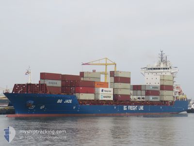
BG JADE
Cargo A
Current Trip
| Time Travelled | 1 day |
|---|---|
| Remaining Time | 58 mins |
| Distance Travelled | 625.25 nm |
| Remaining Distance | 14.75 nm |
| AVG Speed | 14.9 Knop |
| MAX Speed | 19.6 Knop |
| AVG Wind | 6 knots |
| MAX Wind | 13.9 knots |
| MIN Temp | 5.7°C / 42.26°F |
| MAX Temp | 11.3°C / 52.34°F |
| Djupgående | 8 m |
| Position mottagen | 1 m sen |
Current Position
| Longitud | 3.77043° |
|---|---|
| Latitude | 51.99947° |
| Status | Under way using engine |
| Fart | 8 Knop |
| Kurs | 94.7° |
| Område | North Sea |
| Station | T-AIS |
| Position mottagen | 1 m sen |
Info
Information
The current position of BG JADE is in North Sea with coordinates 51.99947° / 3.77043° as reported on 2024-04-23 09:55 by AIS to our vessel tracker app. The vessel's current speed is 8 Knop and is heading at the port of ROTTERDAM. The estimated time of arrival as calculated by MyShipTracking vessel tracking app is 2024-04-23 10:54 LT
The vessel BG JADE (IMO: 9803687, MMSI: 212752000) is a Cargo A It's sailing under the flag of [CY] Cyprus.
In this page you can find informations about the vessels current position, last detected port calls, and current voyage information. If the vessels is not in coverage by AIS you will find the latest position.
The current position of BG JADE is detected by our AIS receivers and we are not responsible for the reliability of the data. The last position was recorded while the vessel was in Coverage by the Ais receivers of our vessel tracking app.
The current draught of BG JADE as reported by AIS is 8 meters
Weather
| Temperature | 6.5°C / 43.7°F |
|---|---|
| Wind Speed | 3 knots |
| Direction | 3° N |
| Pressure | 1022 hPa |
| Humidity | 54.7 % |
| Cloud Coverage | 93 % |
Featured Company
Last Port Calls
| Port | Arrival | Departure | Time In Port |
|---|---|---|---|
| 2024-04-20 05:02 | 2024-04-21 17:19 | 1 d | |
| 2024-04-17 21:19 | 2024-04-18 10:11 | 12 h | |
| 2024-04-16 21:16 | 2024-04-17 19:23 | 22 h | |
| 2024-04-16 13:47 | 2024-04-16 19:24 | 5 h | |
| 2024-04-15 16:33 | 2024-04-16 13:42 | 21 h | |
| 2024-04-11 21:46 | 2024-04-13 11:49 | 1 d | |
| 2024-04-09 05:08 | 2024-04-10 00:51 | 19 h | |
| 2024-04-06 17:16 | 2024-04-09 03:16 | 2 d | |
| 2024-04-06 04:22 | 2024-04-06 16:02 | 11 h | |
| 2024-04-02 08:36 | 2024-04-04 00:39 | 1 d |
Most Visited Ports (Last year)
| Port | Arrivals | |
|---|---|---|
| 61 | ||
| 22 | ||
| 22 | ||
| 21 | ||
| 18 | ||
| 13 |
Last Trips
| Origin | Departure | Destination | Arrival | Distance | |
|---|---|---|---|---|---|
| 2024-04-18 12:11 | 2024-04-20 06:02 | 626.46 nm | |||
| 2024-04-17 21:23 | 2024-04-17 23:19 | 15.33 nm | |||
| 2024-04-16 21:24 | 2024-04-16 23:16 | 16.83 nm | |||
| 2024-04-16 15:42 | 2024-04-16 15:47 | 0.38 nm | |||
| 2024-04-13 12:49 | 2024-04-15 18:33 | 643.31 nm | |||
| 2024-04-10 02:51 | 2024-04-11 22:46 | 639.44 nm | |||
| 2024-04-09 05:16 | 2024-04-09 07:08 | 16.54 nm | |||
| 2024-04-06 18:02 | 2024-04-06 19:16 | 15.29 nm | |||
| 2024-04-04 01:39 | 2024-04-06 06:22 | 749.57 nm | |||
| 2024-03-31 10:18 | 2024-04-02 09:36 | 735.73 nm |
Events
| Tid | Event | Detaljer | Position / Dest | Information |
|---|---|---|---|---|
| 2024-04-23 09:22 | Status ändrad | Under way using engine Default |
51.95908 / 3.59815
NLRTM
|
Fart: 14 kn Kurs: 69° |
| 2024-04-23 09:17 | Status ändrad | Default Under way using engine |
51.95320 / 3.57273
NLRTM
|
Fart: 13.8 kn Kurs: 68.9° |
| 2024-04-23 06:44 | Byter havsområde | Dutch part of the North Sea Belgian part of the North Sea |
51.78572 / 2.71063
North Sea
NLRTM
|
Fart: 12.9 kn Kurs: 73.7° |
| 2024-04-23 04:59 | Byter havsområde | Belgian part of the North Sea French part of the North Sea |
51.49248 / 2.28307
North Sea
NLRTM
|
Fart: 13.5 kn Kurs: 37.3° |
| 2024-04-23 02:11 | Byter havsområde | French part of the North Sea French part of the English Channel |
51.01708 / 1.60302
North Sea
NLRTM
|
Fart: 14.3 kn Kurs: 43.4° |
| 2024-04-22 23:57 | Status ändrad | Under way using engine Default |
50.59905 / 1.10778
NLRTM
|
Fart: 14.5 kn Kurs: 48° |
| 2024-04-22 23:56 | Status ändrad | Default Under way using engine |
50.59692 / 1.10398
NLRTM
|
Fart: 14.3 kn Kurs: 49° |
| 2024-04-22 23:35 | Byter havsområde | French part of the English Channel United Kingdom part of the English Channel |
50.54138 / 1.00000
English Channel
NLRTM
|
Fart: 14.2 kn Kurs: 52.2° |
| 2024-04-22 23:34 | Status ändrad | Under way using engine Default |
50.54090 / .99902
NLRTM
|
Fart: 14.2 kn Kurs: 59° |
| 2024-04-22 23:00 | Status ändrad | Default Under way using engine |
50.49505 / .80172
NLRTM
|
Fart: 14.3 kn Kurs: 73.4° |