
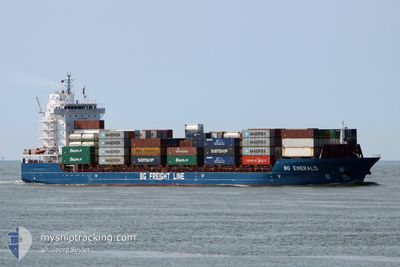
BG EMERALD
Cargo
Current Trip
| Time Travelled | 1 day |
|---|---|
| Remaining Time | 6 h, 55 mins |
| Distance Travelled | 606.28 nm |
| Remaining Distance | 112.52 nm |
| AVG Speed | 15.1 Knop |
| MAX Speed | 18.5 Knop |
| AVG Wind | 14.6 knots |
| MAX Wind | 24.9 knots |
| MIN Temp | 8.1°C / 46.58°F |
| MAX Temp | 10.6°C / 51.08°F |
| Djupgående | 6.6 m |
| Position mottagen | Nu |
Current Position
| Longitud | 1.76703° |
|---|---|
| Latitude | 51.11309° |
| Status | Under way using engine |
| Fart | 15.6 Knop |
| Kurs | 44.5° |
| Område | North Sea |
| Station | T-AIS |
| Position mottagen | Nu |
Info
Information
The current position of BG EMERALD is in North Sea with coordinates 51.11309° / 1.76703° as reported on 2024-04-19 05:04 by AIS to our vessel tracker app. The vessel's current speed is 15.6 Knop and is heading at the port of ROTTERDAM. The estimated time of arrival as calculated by MyShipTracking vessel tracking app is 2024-04-19 12:00 LT
The vessel BG EMERALD (IMO: 9803704, MMSI: 209248000) is a Cargo It's sailing under the flag of [CY] Cyprus.
In this page you can find informations about the vessels current position, last detected port calls, and current voyage information. If the vessels is not in coverage by AIS you will find the latest position.
The current position of BG EMERALD is detected by our AIS receivers and we are not responsible for the reliability of the data. The last position was recorded while the vessel was in Coverage by the Ais receivers of our vessel tracking app.
The current draught of BG EMERALD as reported by AIS is 6.6 meters
Weather
| Temperature | 9.4°C / 48.92°F |
|---|---|
| Wind Speed | 22 knots |
| Direction | 280° W |
| Pressure | 1014.7 hPa |
| Humidity | 87 % |
| Cloud Coverage | 100 % |
Featured Company
Last Port Calls
| Port | Arrival | Departure | Time In Port |
|---|---|---|---|
| 2024-04-14 13:06 | 2024-04-17 16:05 | 3 d | |
| 2024-04-12 01:06 | 2024-04-12 10:28 | 9 h | |
| 2024-04-11 10:31 | 2024-04-12 01:02 | 14 h | |
| 2024-04-11 04:52 | 2024-04-11 09:03 | 4 h | |
| 2024-04-09 05:31 | 2024-04-11 02:57 | 1 d | |
| 2024-04-05 04:44 | 2024-04-07 00:52 | 1 d | |
| 2024-03-31 23:37 | 2024-04-02 22:49 | 1 d | |
| 2024-03-31 14:34 | 2024-03-31 22:15 | 7 h | |
| 2024-03-30 14:15 | 2024-03-31 12:48 | 22 h | |
| 2024-03-25 20:18 | 2024-03-28 05:40 | 2 d |
Most Visited Ports (Last year)
| Port | Arrivals | |
|---|---|---|
| 87 | ||
| 34 | ||
| 26 | ||
| 11 | ||
| 10 | ||
| 5 |
Last Trips
| Origin | Departure | Destination | Arrival | Distance | |
|---|---|---|---|---|---|
| 2024-04-12 12:28 | 2024-04-14 14:06 | 700.82 nm | |||
| 2024-04-12 03:02 | 2024-04-12 03:06 | 0.56 nm | |||
| 2024-04-11 11:03 | 2024-04-11 12:31 | 15.28 nm | |||
| 2024-04-11 04:57 | 2024-04-11 06:52 | 16.17 nm | |||
| 2024-04-07 01:52 | 2024-04-09 07:31 | 728.51 nm | |||
| 2024-04-03 00:49 | 2024-04-05 05:44 | 700.48 nm | |||
| 2024-04-01 00:15 | 2024-04-01 01:37 | 15.29 nm | |||
| 2024-03-31 14:48 | 2024-03-31 16:34 | 15.96 nm | |||
| 2024-03-28 05:40 | 2024-03-30 15:15 | 722.64 nm | |||
| 2024-03-23 11:57 | 2024-03-25 20:18 | 701.27 nm |
Events
| Tid | Event | Detaljer | Position / Dest | Information |
|---|---|---|---|---|
| 2024-04-19 04:31 | Byter havsområde | French part of the North Sea French part of the English Channel |
51.00932 / 1.60831
North Sea
NLRTM
|
Fart: 15.7 kn Kurs: 41.3° |
| 2024-04-19 02:04 | Byter havsområde | French part of the English Channel United Kingdom part of the English Channel |
50.52520 / .98045
English Channel
NLRTM
|
Fart: 16 kn Kurs: 68° |
| 2024-04-18 20:00 | Status ändrad | Under way using engine Default |
50.23460 / -1.51425
NLRTM
|
Fart: 17.1 kn Kurs: 96° |
| 2024-04-18 19:57 | Status ändrad | Default Under way using engine |
50.23600 / -1.53957
NLRTM
|
Fart: 17.5 kn Kurs: 87.6° |
| 2024-04-18 19:21 | Status ändrad | Under way using engine Default |
50.22695 / -1.81047
NLRTM
|
Fart: 17.7 kn Kurs: 84° |
| 2024-04-18 19:15 | Status ändrad | Default Under way using engine |
50.22392 / -1.85735
NLRTM
|
Fart: 17.9 kn Kurs: 84.1° |
| 2024-04-18 11:49 | Status ändrad | Under way using engine Default |
49.90340 / -5.23742
NLRTM
|
Fart: 16.6 kn Kurs: 88° |
| 2024-04-18 11:45 | Status ändrad | Default Under way using engine |
49.90283 / -5.27130
NLRTM
|
Fart: 16.5 kn Kurs: 92.8° |
| 2024-04-18 11:02 | Byter havsområde | United Kingdom part of the English Channel United Kingdom part of the Celtic Sea |
49.91142 / -5.57702
English Channel
NLRTM
|
Fart: 16.5 kn Kurs: 94.5° |
| 2024-04-18 11:02 | Status ändrad | Under way using engine Default |
49.91142 / -5.57702
NLRTM
|
Fart: 16.5 kn Kurs: 95° |