
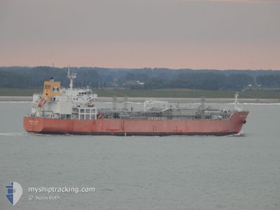
BERING GAS
Tanker
Current Trip
| Time Travelled | 18 days |
|---|---|
| Remaining Time | --- |
| Distance Travelled | 6343.15 nm |
| Remaining Distance | --- |
| AVG Speed | 14.7 Knop |
| MAX Speed | 18 Knop |
| AVG Wind | 11 knots |
| MAX Wind | 29.8 knots |
| MIN Temp | 4.7°C / 40.46°F |
| MAX Temp | 31.5°C / 88.7°F |
| Djupgående | 8.8 m |
| Position mottagen | 9 d sen |
Current Position
| Longitud | 103.57951° |
|---|---|
| Latitude | 1.19684° |
| Status | Under way using engine |
| Fart | 15.1 Knop |
| Kurs | 275.9° |
| Område | Singapore Strait |
| Station | T-AIS |
| Position mottagen | 9 d sen |
Info
Information
The current position of BERING GAS is in Singapore Strait with coordinates 1.19684° / 103.57951° as reported on 2024-04-09 23:15 by AIS to our vessel tracker app. The vessel's current speed is 15.1 Knop and is heading at the port of ANTWERP. The estimated time of arrival as calculated by MyShipTracking vessel tracking app is 2024-05-12 08:00 LT
The vessel BERING GAS (IMO: 9745536, MMSI: 219672000) is a Tanker It's sailing under the flag of [DK] Denmark.
In this page you can find informations about the vessels current position, last detected port calls, and current voyage information. If the vessels is not in coverage by AIS you will find the latest position.
The current position of BERING GAS is detected by our AIS receivers and we are not responsible for the reliability of the data. The last position was recorded while the vessel was in Coverage by the Ais receivers of our vessel tracking app.
The current draught of BERING GAS as reported by AIS is 8.8 meters
Weather
| Temperature | 25.5°C / 77.9°F |
|---|---|
| Wind Speed | 18 knots |
| Direction | 112° ESE |
| Pressure | 1018.3 hPa |
| Humidity | 66.6 % |
| Cloud Coverage | 99 % |
Featured Company
Most Visited Ports (Last year)
| Port | Arrivals | |
|---|---|---|
| 4 | ||
| 3 | ||
| 2 | ||
| 2 | ||
| 2 | ||
| 1 |
Events
| Tid | Event | Detaljer | Position / Dest | Information |
|---|---|---|---|---|
| 2024-04-09 23:21 | Status ändrad | Default Under way using engine |
1.19934 / 103.55374
BE ANR
|
Fart: 15.1 kn Kurs: 275.9° |
| 2024-04-09 23:15 | UTANFÖR täckningsområde |
1.19684 / 103.57951
Singapore Strait
|
Fart: 15.1 kn Kurs: 275.9° |
|
| 2024-04-09 23:13 | Byter havsområde | Malaysian part of the Singapore Strait Indonesian part of the Singapore Strait |
1.19590 / 103.58958
Singapore Strait
|
Fart: 15.1 kn Kurs: 276° |
| 2024-04-09 22:34 | Byter havsområde | Indonesian part of the Singapore Strait Singaporean part of the Singapore Strait |
1.13810 / 103.72948
Singapore Strait
|
Fart: 13.1 kn Kurs: 285.6° |
| 2024-04-09 22:01 | STARTAR förflyttning | 3.03 nm, South of BUKOM ISLAND |
1.18618 / 103.75869
BE ANR
|
Fart: 3.1 kn Kurs: 122° |
| 2024-04-09 21:44 | ETA ändrat | 2024/05/12 08:00 2024/05/13 04:00 |
1.18610 / 103.75814
BE ANR
|
Fart: 0.4 kn Kurs: 318° |
| 2024-04-09 21:44 | Status ändrad | Under way using engine At anchor |
1.18609 / 103.75816
BE ANR
|
Fart: 0.4 kn Kurs: 317° |
| 2024-04-09 20:06 | Djupgående ändrat | 8.8 8.6 |
1.18624 / 103.75858
BE ANR
|
Fart: 0.3 kn Kurs: 275° |
| 2024-04-09 20:06 | Destination ändrad | BE ANR SG SIN PGBG |
1.18624 / 103.75858
BE ANR
|
Fart: 0.3 kn Kurs: 275° |
| 2024-04-09 20:06 | ETA ändrat | 2024/05/13 04:00 2024/04/09 01:00 |
1.18624 / 103.75858
BE ANR
|
Fart: 0.3 kn Kurs: 275° |