
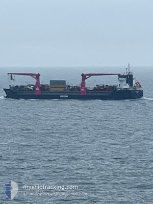
BEAUTRADER
General Cargo
Current Trip
| Trip Time | 14 days |
|---|---|
| Trip Distance | 3241.68 nm |
| AVG Speed | 11.3 Knop |
| MAX Speed | 17.3 Knop |
| Djupgående | 6.6 m |
| AVG Wind | 11.1 knots |
| MAX Wind | 35.8 knots |
| MIN Temp | -5.5°C / 22.1°F |
| MAX Temp | 18.1°C / 64.58°F |
| Position mottagen | 8 h, 1 m sen |
Current Position
| Longitud | --- |
|---|---|
| Latitude | --- |
| Status | Under way using engine |
| Fart | 12.8 Knop |
| Kurs | 17° |
| Område | North Atlantic Ocean |
| Station | T-AIS |
| Position mottagen | 8 h, 1 m sen |
Info
Information
The current position of BEAUTRADER is in North Atlantic Ocean with coordinates 36.95265° / -6.18138° as reported on 2025-12-08 17:47 by AIS to our vessel tracker app. The vessel's current speed is 12.8 Knop and is currently inside the port of SEVILLA.
The vessel BEAUTRADER (IMO: 9428657, MMSI: 246232000) is a General Cargo that was built in 2009 ( 16 År gammal ). It's sailing under the flag of [NL] Netherlands.
In this page you can find informations about the vessels current position, last detected port calls, and current voyage information. If the vessels is not in coverage by AIS you will find the latest position.
The current position of BEAUTRADER is detected by our AIS receivers and we are not responsible for the reliability of the data. The last position was recorded while the vessel was in Coverage by the Ais receivers of our vessel tracking app.
The current draught of BEAUTRADER as reported by AIS is 6.6 meters
Weather
| Temperature | 13.4°C / 56.12°F |
|---|---|
| Wind Speed | 4 knots |
| Direction | 78° ENE |
| Pressure | 1022.9 hPa |
| Humidity | 72.3 % |
| Cloud Coverage | 99 % |
Featured Company
Last Port Calls
| Port | Arrival | Departure | Time In Port |
|---|---|---|---|
| 2025-12-08 21:16 | |||
| 2025-11-23 21:14 | 2025-11-23 23:05 | 1 h | |
| 2025-11-21 17:46 | 2025-11-23 18:33 | 2 d | |
| 2025-11-20 11:19 | 2025-11-20 11:52 | 33 m | |
| 2025-11-15 06:36 | 2025-11-15 07:13 | 36 m | |
| 2025-11-13 16:04 | 2025-11-13 16:56 | 52 m | |
| 2025-10-26 19:54 | 2025-10-26 20:06 | 12 m | |
| 2025-10-22 05:34 | 2025-10-23 16:22 | 1 d | |
| 2025-10-19 18:02 | 2025-10-21 05:10 | 1 d | |
| 2025-10-06 09:53 | 2025-10-06 17:34 | 7 h |
Most Visited Ports (Last year)
| Port | Arrivals | |
|---|---|---|
| 6 | ||
| 4 | ||
| 3 | ||
| 3 | ||
| 3 | ||
| 2 |
Last Trips
| Origin | Departure | Destination | Arrival | Distance | |
|---|---|---|---|---|---|
| 2025-11-23 23:05 | 2025-12-08 21:16 | 3241.68 nm | |||
| 2025-11-23 18:33 | 2025-11-23 21:14 | 7.64 nm | |||
| 2025-11-20 11:52 | 2025-11-21 17:46 | 296.80 nm | |||
| 2025-11-15 07:13 | 2025-11-20 11:19 | 12.57 nm | |||
| 2025-11-13 16:56 | 2025-11-15 06:36 | 298.10 nm | |||
| 2025-10-26 20:06 | 2025-11-13 16:04 | 3314.18 nm | |||
| 2025-10-23 16:22 | 2025-10-26 19:54 | 216.68 nm | |||
| 2025-10-21 05:10 | 2025-10-22 05:34 | 214.66 nm | |||
| 2025-10-06 17:34 | 2025-10-19 18:02 | 3701.19 nm | |||
| 2025-10-02 02:40 | 2025-10-06 09:53 | 917.19 nm |
Events
| Tid | Event | Detaljer | Position / Dest | Information |
|---|---|---|---|---|
| 2025-12-08 21:29 | STOPPAR förflyttning |
37.35662 / -5.99587
[ES] SEVILLA
|
Fart: 0.1 kn Kurs: 318° |
|
| 2025-12-08 20:53 | STARTAR förflyttning |
37.32383 / -5.99700
[ES] SEVILLA
|
Fart: 4.5 kn Kurs: 25° |
|
| 2025-12-08 20:41 | STOPPAR förflyttning |
37.31881 / -6.00585
[ES] SEVILLA
|
Fart: Kurs: 64° |
|
| 2025-12-08 20:16 | ANLÄNDER HAMN |
|
37.31383 / -6.01663
[ES] SEVILLA
|
Fart: 3.1 kn Kurs: 40° |
| 2025-12-08 17:51 | Status ändrad | Default Under way using engine |
36.96808 / -6.17365
SEVILLE
|
Fart: 12.8 kn Kurs: 17° |
| 2025-12-08 17:47 | UTANFÖR täckningsområde |
36.95265 / -6.18138
North Atlantic Ocean
|
Fart: 12.8 kn Kurs: 17° |
|
| 2025-12-08 17:19 | Status ändrad | Under way using engine Default |
36.89442 / -6.26127
SEVILLE
|
Fart: 12.6 kn Kurs: 120° |
| 2025-12-08 17:14 | Status ändrad | Default Under way using engine |
36.90985 / -6.27283
SEVILLE
|
Fart: 12.6 kn Kurs: 75° |
| 2025-12-08 15:46 | STARTAR förflyttning | 2.11 nm, West of CHIPIONA |
36.75747 / -6.47120
SEVILLE
|
Fart: 3.5 kn Kurs: 102° |
| 2025-12-08 15:40 | Status ändrad | Under way using engine At anchor |
36.75923 / -6.47080
SEVILLE
|
Fart: 0.5 kn Kurs: 297° |