
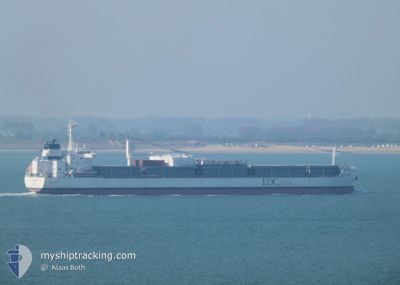
ATLANTIC ORCHARD
Cargo
Current Trip
| Time Travelled | 9 days |
|---|---|
| Remaining Time | 6 days |
| Distance Travelled | 3226.43 nm |
| Remaining Distance | 2253.06 nm |
| AVG Speed | 12.6 Knop |
| MAX Speed | 17.6 Knop |
| AVG Wind | 11.2 knots |
| MAX Wind | 25 knots |
| MIN Temp | 8.2°C / 46.76°F |
| MAX Temp | 27.8°C / 82.04°F |
| Djupgående | 7.1 m |
| Position mottagen | 7 h, 1 m sen |
Current Position
| Longitud | -25.47391° |
|---|---|
| Latitude | 7.30064° |
| Status | Under way using engine |
| Fart | 14 Knop |
| Kurs | 194.9° |
| Område | North Atlantic Ocean |
| Station | T-AIS |
| Position mottagen | 7 h, 1 m sen |
Info
Information
The current position of ATLANTIC ORCHARD is in North Atlantic Ocean with coordinates 7.30064° / -25.47391° as reported on 2024-04-19 11:01 by AIS to our vessel tracker app. The vessel's current speed is 14 Knop and is heading at the port of SANTOS. The estimated time of arrival as calculated by MyShipTracking vessel tracking app is 2024-04-26 08:03 LT
The vessel ATLANTIC ORCHARD (IMO: 9638159, MMSI: 636018592) is a Cargo It's sailing under the flag of [LR] Liberia.
In this page you can find informations about the vessels current position, last detected port calls, and current voyage information. If the vessels is not in coverage by AIS you will find the latest position.
The current position of ATLANTIC ORCHARD is detected by our AIS receivers and we are not responsible for the reliability of the data. The last position was recorded while the vessel was in Coverage by the Ais receivers of our vessel tracking app.
The current draught of ATLANTIC ORCHARD as reported by AIS is 7.1 meters
Weather
| Temperature | 27.9°C / 82.22°F |
|---|---|
| Wind Speed | 7 knots |
| Direction | 19° NNE |
| Pressure | 1010.2 hPa |
| Humidity | 74.7 % |
| Cloud Coverage | 91 % |
Featured Company
Most Visited Ports (Last year)
| Port | Arrivals | |
|---|---|---|
| 10 | ||
| 8 | ||
| 1 |
Last Trips
| Origin | Departure | Destination | Arrival | Distance | |
|---|---|---|---|---|---|
| 2024-03-18 11:38 | 2024-04-06 22:48 | 5453.85 nm | |||
| 2024-03-13 22:20 | 2024-03-13 22:57 | 3.06 nm | |||
| 2024-02-26 13:36 | 2024-03-13 14:43 | 5103.37 nm | |||
| 2024-02-02 15:37 | 2024-02-17 20:00 | 5115.01 nm |
Events
| Tid | Event | Detaljer | Position / Dest | Information |
|---|---|---|---|---|
| 2024-04-19 11:27 | Status ändrad | Default Under way using engine |
7.21063 / -25.52050
BR SSZ
|
Fart: 14 kn Kurs: 194.9° |
| 2024-04-19 11:01 | UTANFÖR täckningsområde |
7.30064 / -25.47391
North Atlantic Ocean
BR SSZ
|
Fart: 14 kn Kurs: 194.9° |
|
| 2024-04-19 10:56 | Status ändrad | Under way using engine Default |
7.31927 / -25.46902
BR SSZ
|
Fart: 14.1 kn Kurs: 206° |
| 2024-04-19 10:56 | I täckningsområde |
7.30976 / -25.47153
North Atlantic Ocean
BR SSZ
|
Fart: 14 kn Kurs: 195.2° |
|
| 2024-04-19 06:35 | UTANFÖR täckningsområde |
8.24682 / -25.04139
North Atlantic Ocean
BR SSZ
|
Fart: 14.4 kn Kurs: 204.3° |
|
| 2024-04-19 05:16 | Status ändrad | Under way using engine Default |
8.53095 / -24.90719
BR SSZ
|
Fart: 14.5 kn Kurs: 205° |
| 2024-04-19 05:16 | I täckningsområde |
8.53095 / -24.90719
North Atlantic Ocean
BR SSZ
|
Fart: 14.4 kn Kurs: 206.9° |
|
| 2024-04-19 04:10 | Status ändrad | Default Under way using engine |
8.76963 / -24.79451
BR SSZ
|
Fart: 14.3 kn Kurs: 205.9° |
| 2024-04-19 03:54 | UTANFÖR täckningsområde |
8.82331 / -24.76907
North Atlantic Ocean
BR SSZ
|
Fart: 14.3 kn Kurs: 205.9° |
|
| 2024-04-19 01:54 | Status ändrad | Under way using engine Default |
9.25851 / -24.56355
BR SSZ
|
Fart: 14 kn Kurs: 204° |