
ASALET
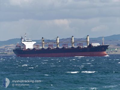
Bulk Carrier
Current Trip
| Trip Time | 7 days |
|---|---|
| Trip Distance | 1338.90 nm |
| AVG Speed | 10.8 Knop |
| MAX Speed | 15.1 Knop |
| Djupgående | 9 m |
| AVG Wind | 7.4 knots |
| MAX Wind | 24.8 knots |
| MIN Temp | 8.9°C / 48.02°F |
| MAX Temp | 23.9°C / 75.02°F |
| Position mottagen | 1 m sen |
Current Position
| Longitud | 12.25535° |
|---|---|
| Latitude | 45.44995° |
| Status | Moored |
| Fart | |
| Kurs | 297° |
| Område | Adriatic Sea |
| Station | T-AIS |
| Position mottagen | 1 m sen |
Info
Information
The current position of ASALET is in Adriatic Sea with coordinates 45.44995° / 12.25535° as reported on 2024-04-19 07:54 by AIS to our vessel tracker app. The vessel's current speed is 0 Knop and is currently inside the port of VENEZIA.
The vessel ASALET (IMO: 9574169, MMSI: 271042325) is a Bulk Carrier that was built in 2010 ( 14 År gammal ). It's sailing under the flag of [TR] Turkey.
In this page you can find informations about the vessels current position, last detected port calls, and current voyage information. If the vessels is not in coverage by AIS you will find the latest position.
The current position of ASALET is detected by our AIS receivers and we are not responsible for the reliability of the data. The last position was recorded while the vessel was in Coverage by the Ais receivers of our vessel tracking app.
The current draught of ASALET as reported by AIS is 9 meters
Weather
| Temperature | 9.6°C / 49.28°F |
|---|---|
| Wind Speed | 4 knots |
| Direction | 325° NW |
| Pressure | 1017.3 hPa |
| Humidity | 67.9 % |
| Cloud Coverage | 18 % |
Featured Company
Last Port Calls
| Port | Arrival | Departure | Time In Port |
|---|---|---|---|
| 2024-04-18 05:17 | |||
| 2024-04-05 02:53 | 2024-04-10 17:02 | 5 d | |
| 2024-03-28 05:03 | 2024-03-28 14:22 | 9 h | |
| 2024-03-09 19:38 | 2024-03-12 04:42 | 2 d |
Most Visited Ports (Last year)
| Port | Arrivals | |
|---|---|---|
| 2 | ||
| 2 | ||
| 1 | ||
| 1 | ||
| 1 | ||
| 1 |
Last Trips
| Origin | Departure | Destination | Arrival | Distance | |
|---|---|---|---|---|---|
| 2024-04-10 20:02 | 2024-04-18 07:17 | 1338.90 nm | |||
| 2024-03-12 10:12 | 2024-04-05 05:53 | 5487.08 nm | |||
| 2024-03-12 10:12 | 2024-03-28 07:03 | 4352.32 nm | |||
| 2024-01-31 01:15 | 2024-03-10 01:08 | 4548.56 nm |
Events
| Tid | Event | Detaljer | Position / Dest | Information |
|---|---|---|---|---|
| 2024-04-18 05:54 | Status ändrad | Moored Under way using engine |
45.44991 / 12.25536
[IT] VENEZIA
|
Fart: Kurs: 299° |
| 2024-04-18 05:45 | STOPPAR förflyttning |
45.44975 / 12.25571
[IT] VENEZIA
|
Fart: 0.1 kn Kurs: 298° |
|
| 2024-04-18 05:17 | ANLÄNDER HAMN |
|
45.41658 / 12.26052
[IT] VENEZIA
|
Fart: 6.1 kn Kurs: 357.7° |
| 2024-04-18 01:03 | Status ändrad | Under way using engine Default |
45.02963 / 12.87033
ITPMA
|
Fart: 11 kn Kurs: 330° |
| 2024-04-18 01:03 | I täckningsområde |
45.02963 / 12.87033
Adriatic Sea
ITPMA
|
Fart: 11.6 kn Kurs: 331.9° |
|
| 2024-04-17 20:18 | Status ändrad | Default Under way using engine |
44.23167 / 13.37333
ITPMA
|
Fart: 11.3 kn Kurs: 307.6° |
| 2024-04-17 20:16 | UTANFÖR täckningsområde |
44.22992 / 13.38002
Adriatic Sea
ITPMA
|
Fart: 11.3 kn Kurs: 307.6° |
|
| 2024-04-17 18:27 | Status ändrad | Under way using engine Default |
44.00059 / 13.77904
ITPMA
|
Fart: 12 kn Kurs: 309° |
| 2024-04-17 18:24 | Status ändrad | Default Under way using engine |
43.99333 / 13.78833
ITPMA
|
Fart: 12.2 kn Kurs: 309.7° |
| 2024-04-17 18:20 | Status ändrad | Under way using engine Default |
43.98601 / 13.80338
ITPMA
|
Fart: 12.2 kn Kurs: 308° |