
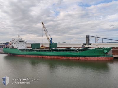
ARKLOW MEADOW
General Cargo
Current Trip
| Time Travelled | 2 days |
|---|---|
| Remaining Time | 3 days |
| Distance Travelled | 602.84 nm |
| Remaining Distance | 1194.74 nm |
| AVG Speed | 10 Knop |
| MAX Speed | 12.3 Knop |
| AVG Wind | 11.7 knots |
| MAX Wind | 37 knots |
| MIN Temp | 14.2°C / 57.56°F |
| MAX Temp | 17.2°C / 62.96°F |
| Djupgående | 9.2 m |
| Position mottagen | 1 d sen |
Current Position
| Longitud | --- |
|---|---|
| Latitude | --- |
| Status | Under way using engine |
| Fart | 11.3 Knop |
| Kurs | 2.2° |
| Område | North Atlantic Ocean |
| Station | T-AIS |
| Position mottagen | 1 d sen |
Info
Information
The current position of ARKLOW MEADOW is in North Atlantic Ocean with coordinates 39.27166° / -9.84182° as reported on 2025-12-07 14:23 by AIS to our vessel tracker app. The vessel's current speed is 11.3 Knop and is heading at the port of TEES. The estimated time of arrival as calculated by MyShipTracking vessel tracking app is 2025-12-12 15:07 LT
The vessel ARKLOW MEADOW (IMO: 9440277, MMSI: 250002133) is a General Cargo that was built in 2010 ( 15 År gammal ). It's sailing under the flag of [IE] Ireland.
In this page you can find informations about the vessels current position, last detected port calls, and current voyage information. If the vessels is not in coverage by AIS you will find the latest position.
The current position of ARKLOW MEADOW is detected by our AIS receivers and we are not responsible for the reliability of the data. The last position was recorded while the vessel was in Coverage by the Ais receivers of our vessel tracking app.
The current draught of ARKLOW MEADOW as reported by AIS is 9.2 meters
Weather
| Temperature | 16°C / 60.8°F |
|---|---|
| Wind Speed | 43 knots |
| Direction | 197° SSW |
| Pressure | 1005.3 hPa |
| Humidity | 80 % |
| Cloud Coverage | 100 % |
Featured Company
Last Port Calls
| Port | Arrival | Departure | Time In Port |
|---|---|---|---|
| 2025-12-06 01:22 | 2025-12-06 05:27 | 4 h | |
| 2025-12-02 01:44 | 2025-12-03 23:55 | 1 d | |
| 2025-11-15 08:21 | 2025-12-01 12:39 | 16 d | |
| 2025-11-04 20:43 | 2025-11-06 18:41 | 1 d | |
| 2025-10-31 11:20 | 2025-11-04 02:37 | 3 d | |
| 2025-10-24 04:11 | 2025-10-28 12:39 | 4 d | |
| 2025-10-22 23:59 | 2025-10-24 03:09 | 1 d | |
| 2025-10-19 09:35 | 2025-10-20 20:26 | 1 d | |
| 2025-10-11 20:49 | 2025-10-12 00:42 | 3 h | |
| 2025-10-02 08:12 | 2025-10-08 12:36 | 6 d |
Last Trips
| Origin | Departure | Destination | Arrival | Distance | |
|---|---|---|---|---|---|
| 2025-12-03 23:55 | 2025-12-06 01:22 | 518.91 nm | |||
| 2025-12-01 12:39 | 2025-12-02 01:44 | 191.14 nm | |||
| 2025-11-06 18:41 | 2025-11-15 08:21 | 2138.39 nm | |||
| 2025-11-04 02:37 | 2025-11-04 20:43 | 204.56 nm | |||
| 2025-10-28 12:39 | 2025-10-31 11:20 | 211.65 nm | |||
| 2025-10-24 03:09 | 2025-10-24 04:11 | 6.15 nm | |||
| 2025-10-20 20:26 | 2025-10-22 23:59 | 564.39 nm | |||
| 2025-10-12 00:42 | 2025-10-19 09:35 | 1910.48 nm | |||
| 2025-10-08 12:36 | 2025-10-11 20:49 | 922.19 nm | |||
| 2025-09-27 14:47 | 2025-10-02 08:12 | 586.88 nm |
Events
| Tid | Event | Detaljer | Position / Dest | Information |
|---|---|---|---|---|
| 2025-12-07 14:31 | Status ändrad | Default Under way using engine |
39.29541 / -9.84277
TEESPORT
|
Fart: 11.3 kn Kurs: 2.2° |
| 2025-12-07 14:23 | UTANFÖR täckningsområde |
39.27166 / -9.84182
North Atlantic Ocean
TEESPORT
|
Fart: 11.3 kn Kurs: 2.2° |
|
| 2025-12-07 08:11 | Status ändrad | Under way using engine Default |
38.20514 / -9.68047
TEESPORT
|
Fart: 10.3 kn Kurs: 347° |
| 2025-12-07 08:07 | I täckningsområde |
38.20793 / -9.68128
North Atlantic Ocean
TEESPORT
|
Fart: 10.2 kn Kurs: 344.8° |
|
| 2025-12-07 05:23 | Status ändrad | Default Under way using engine |
37.73069 / -9.55088
TEESPORT
|
Fart: 10.4 kn Kurs: 345.3° |
| 2025-12-07 05:18 | Status ändrad | Under way using engine Default |
37.71661 / -9.54673
TEESPORT
|
Fart: 10.3 kn Kurs: 345° |
| 2025-12-07 05:18 | UTANFÖR täckningsområde |
37.71661 / -9.54673
North Atlantic Ocean
TEESPORT
|
Fart: 10.4 kn Kurs: 345.3° |
|
| 2025-12-07 04:31 | Status ändrad | Default Under way using engine |
37.58701 / -9.50674
TEESPORT
|
Fart: 10.1 kn Kurs: 346.2° |
| 2025-12-07 04:24 | Status ändrad | Under way using engine Default |
37.56955 / -9.50071
TEESPORT
|
Fart: 10.1 kn Kurs: 346° |
| 2025-12-07 04:23 | Status ändrad | Default Under way using engine |
37.56553 / -9.49937
TEESPORT
|
Fart: 10.2 kn Kurs: 345.3° |