
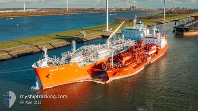
ARCTIC GAS
Tanker D
Current Trip
| Time Travelled | --- |
|---|---|
| Remaining Time | --- |
| Distance Travelled | 2871.36 nm |
| Remaining Distance | --- |
| AVG Speed | 9.7 Knop |
| MAX Speed | 15.4 Knop |
| AVG Wind | 13.8 knots |
| MAX Wind | 35 knots |
| MIN Temp | 13.7°C / 56.66°F |
| MAX Temp | 24.6°C / 76.28°F |
| Djupgående | 7.1 m |
| Position mottagen | 1 h, 34 m sen |
Current Position
| Longitud | -79.30557° |
|---|---|
| Latitude | 26.18964° |
| Status | Under way using engine |
| Fart | 12.2 Knop |
| Kurs | 72.6° |
| Område | North Atlantic Ocean |
| Station | T-AIS |
| Position mottagen | 1 h, 34 m sen |
Info
Information
The current position of ARCTIC GAS is in North Atlantic Ocean with coordinates 26.18964° / -79.30557° as reported on 2024-04-25 11:06 by AIS to our vessel tracker app. The vessel's current speed is 12.2 Knop and is heading at the port of VLISSINGEN. The estimated time of arrival as calculated by MyShipTracking vessel tracking app is 2024-05-10 02:00 LT
The vessel ARCTIC GAS (IMO: 9745512, MMSI: 219025000) is a Tanker D It's sailing under the flag of [DK] Denmark.
In this page you can find informations about the vessels current position, last detected port calls, and current voyage information. If the vessels is not in coverage by AIS you will find the latest position.
The current position of ARCTIC GAS is detected by our AIS receivers and we are not responsible for the reliability of the data. The last position was recorded while the vessel was in Coverage by the Ais receivers of our vessel tracking app.
The current draught of ARCTIC GAS as reported by AIS is 7.1 meters
Weather
| Temperature | 23°C / 73.4°F |
|---|---|
| Wind Speed | 12 knots |
| Direction | 77° ENE |
| Pressure | 1020.5 hPa |
| Humidity | 64 % |
| Cloud Coverage | 100 % |
Featured Company
Last Port Calls
Most Visited Ports (Last year)
| Port | Arrivals | |
|---|---|---|
| 2 | ||
| 2 | ||
| 2 | ||
| 1 | ||
| 1 | ||
| 1 |
Last Trips
| Origin | Departure | Destination | Arrival | Distance |
|---|
Events
| Tid | Event | Detaljer | Position / Dest | Information |
|---|---|---|---|---|
| 2024-04-25 11:09 | Status ändrad | Default Under way using engine |
26.19167 / -79.29166
US GAL > NL VLI
|
Fart: 12.2 kn Kurs: 72.6° |
| 2024-04-25 11:06 | UTANFÖR täckningsområde |
26.18964 / -79.30557
North Atlantic Ocean
US GAL > NL VLI
|
Fart: 12.2 kn Kurs: 72.6° |
|
| 2024-04-25 08:06 | Destination ändrad | US GAL > NL VLI FOR ORDERS |
25.53816 / -79.48801
US GAL > NL VLI
|
Fart: 13.9 kn Kurs: 1.7° |
| 2024-04-25 08:06 | ETA ändrat | 2024/05/10 02:00 2024/04/03 19:00 |
25.53816 / -79.48801
US GAL > NL VLI
|
Fart: 13.9 kn Kurs: 1.7° |
| 2024-04-25 07:11 | Byter havsområde | Bahamas part of the North Atlantic Ocean Mexican part of the Gulf of Mexico |
25.33174 / -79.49588
North Atlantic Ocean
|
Fart: 13.3 kn Kurs: 1.9° |
| 2024-04-25 07:11 | Status ändrad | Under way using engine Default |
25.33174 / -79.49588
FOR ORDERS
|
Fart: 13 kn Kurs: 2° |
| 2024-04-25 06:51 | I täckningsområde |
25.33174 / -79.49588
North Atlantic Ocean
|
Fart: 13.3 kn Kurs: 1.9° |
|
| 2024-04-22 17:08 | STARTAR förflyttning |
23.71227 / -92.39465
FOR ORDERS
|
Fart: 6.8 kn Kurs: 74° |
|
| 2024-04-21 22:21 | STOPPAR förflyttning |
24.21167 / -92.21833
FOR ORDERS
|
Fart: Kurs: -1° |
|
| 2024-04-21 13:18 | STARTAR förflyttning |
24.09833 / -94.03167
FOR ORDERS
|
Fart: 8 kn Kurs: 89° |