
AQUAGRACE
Cargo
Current Trip
| Time Travelled | 13 days |
|---|---|
| Remaining Time | --- |
| Distance Travelled | 2569.81 nm |
| Remaining Distance | --- |
| AVG Speed | 11.6 Knop |
| MAX Speed | 13.6 Knop |
| AVG Wind | 12.4 knots |
| MAX Wind | 30 knots |
| MIN Temp | 10.4°C / 50.72°F |
| MAX Temp | 25.8°C / 78.44°F |
| Djupgående | 12.5 m |
| Position mottagen | 1 d sen |
Current Position
| Longitud | -7.41749° |
|---|---|
| Latitude | 43.73931° |
| Status | At anchor |
| Fart | |
| Kurs | 32° |
| Område | Bay of Biscay |
| Station | T-AIS |
| Position mottagen | 1 d sen |
Info
Information
The current position of AQUAGRACE is in Bay of Biscay with coordinates 43.73931° / -7.41749° as reported on 2024-04-24 11:57 by AIS to our vessel tracker app. The vessel's current speed is 0 Knop
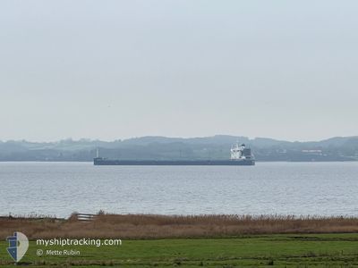
The vessel AQUAGRACE (IMO: 9764087, MMSI: 371355000) is a Cargo It's sailing under the flag of [PA] Panama.
In this page you can find informations about the vessels current position, last detected port calls, and current voyage information. If the vessels is not in coverage by AIS you will find the latest position.
The current position of AQUAGRACE is detected by our AIS receivers and we are not responsible for the reliability of the data. The last position was recorded while the vessel was in Coverage by the Ais receivers of our vessel tracking app.
The current draught of AQUAGRACE as reported by AIS is 12.5 meters
Weather
| Temperature | 11.3°C / 52.34°F |
|---|---|
| Wind Speed | 10 knots |
| Direction | 275° W |
| Pressure | 1014.5 hPa |
| Humidity | 85.7 % |
| Cloud Coverage | 100 % |
Featured Company
Most Visited Ports (Last year)
| Port | Arrivals | |
|---|---|---|
| 2 | ||
| 1 | ||
| 1 | ||
| 1 | ||
| 1 | ||
| 1 |
Last Trips
| Origin | Departure | Destination | Arrival | Distance |
|---|
Events
| Tid | Event | Detaljer | Position / Dest | Information |
|---|---|---|---|---|
| 2024-04-24 11:57 | UTANFÖR täckningsområde |
43.73931 / -7.41749
Bay of Biscay
|
Fart: Kurs: 108° |
|
| 2024-04-24 11:36 | Status ändrad | At anchor Default |
43.73924 / -7.41751
SAN CIPRIAN SPAIN
|
Fart: 0.1 kn Kurs: 48° |
| 2024-04-24 11:36 | I täckningsområde |
43.73924 / -7.41751
Bay of Biscay
|
Fart: Kurs: 127° |
|
| 2024-04-23 12:50 | STOPPAR förflyttning | 2.69 nm, North East of SAN CIPRIAN |
43.74195 / -7.41646
SAN CIPRIAN SPAIN
|
Fart: 0.2 kn Kurs: 119° |
| 2024-04-23 12:27 | Status ändrad | Default Under way using engine |
43.75928 / -7.43555
SAN CIPRIAN SPAIN
|
Fart: 11.9 kn Kurs: 159.1° |
| 2024-04-23 12:05 | UTANFÖR täckningsområde |
43.81320 / -7.46748
Bay of Biscay
|
Fart: 11.9 kn Kurs: 159.1° |
|
| 2024-04-23 11:22 | Status ändrad | Under way using engine Default |
43.90809 / -7.54233
SAN CIPRIAN SPAIN
|
Fart: 0.8 kn Kurs: 348° |
| 2024-04-23 11:15 | Status ändrad | Default Not under command |
43.90633 / -7.53995
SAN CIPRIAN SPAIN
|
Fart: 0.8 kn Kurs: 341° |
| 2024-04-23 11:09 | Status ändrad | Not under command Default |
43.90626 / -7.53815
SAN CIPRIAN SPAIN
|
Fart: 0.8 kn Kurs: 316° |
| 2024-04-23 11:09 | I täckningsområde |
43.90626 / -7.53815
Bay of Biscay
|
Fart: 0.8 kn Kurs: 270.9° |