
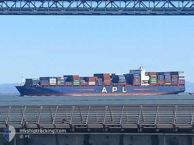
APL SANTIAGO
Container Ship
Current Trip
| Time Travelled | 7 days |
|---|---|
| Remaining Time | --- |
| Distance Travelled | 2753.33 nm |
| Remaining Distance | --- |
| AVG Speed | 16.9 Knop |
| MAX Speed | 20.5 Knop |
| AVG Wind | 12.5 knots |
| MAX Wind | 23 knots |
| MIN Temp | -0.6°C / 30.92°F |
| MAX Temp | 15.5°C / 59.9°F |
| Djupgående | 14.2 m |
| Position mottagen | 5 d sen |
Current Position
| Longitud | 142.22235° |
|---|---|
| Latitude | 41.70023° |
| Status | Under way using engine |
| Fart | 18.7 Knop |
| Kurs | 86.6° |
| Område | North Pacific Ocean |
| Station | T-AIS |
| Position mottagen | 5 d sen |
Info
Information
The current position of APL SANTIAGO is in North Pacific Ocean with coordinates 41.70023° / 142.22235° as reported on 2024-04-13 00:34 by AIS to our vessel tracker app. The vessel's current speed is 18.7 Knop and is heading at the port of SEATTLE. The estimated time of arrival as calculated by MyShipTracking vessel tracking app is 2024-04-21 07:00 LT
The vessel APL SANTIAGO (IMO: 9597563, MMSI: 566959000) is a Container Ship that was built in 2014 ( 10 År gammal ). It's sailing under the flag of [SG] Singapore.
In this page you can find informations about the vessels current position, last detected port calls, and current voyage information. If the vessels is not in coverage by AIS you will find the latest position.
The current position of APL SANTIAGO is detected by our AIS receivers and we are not responsible for the reliability of the data. The last position was recorded while the vessel was in Coverage by the Ais receivers of our vessel tracking app.
The current draught of APL SANTIAGO as reported by AIS is 14.2 meters
Weather
| Temperature | -0.6°C / 30.92°F |
|---|---|
| Wind Speed | 20 knots |
| Direction | 340° NNW |
| Pressure | 1024.9 hPa |
| Humidity | 62.8 % |
| Cloud Coverage | 100 % |
Featured Company
Last Port Calls
| Port | Arrival | Departure | Time In Port |
|---|---|---|---|
| 2024-04-10 05:32 | 2024-04-11 07:35 | 1 d | |
| 2024-04-07 04:22 | 2024-04-08 04:37 | 1 d | |
| 2024-04-01 15:04 | 2024-04-02 12:40 | 21 h | |
| 2024-03-31 02:10 | 2024-03-31 16:28 | 14 h | |
| 2024-03-14 22:44 | 2024-03-17 00:28 | 2 d | |
| 2024-03-08 11:06 | 2024-03-11 13:01 | 3 d | |
| 2024-02-21 03:20 | 2024-02-21 17:38 | 14 h | |
| 2024-02-13 12:07 | 2024-02-15 07:07 | 1 d | |
| 2024-02-09 23:41 | 2024-02-11 14:34 | 1 d | |
| 2024-02-06 19:58 | 2024-02-08 12:43 | 1 d |
Most Visited Ports (Last year)
| Port | Arrivals | |
|---|---|---|
| 8 | ||
| 4 | ||
| 4 | ||
| 3 | ||
| 3 | ||
| 3 |
Last Trips
| Origin | Departure | Destination | Arrival | Distance | |
|---|---|---|---|---|---|
| 2024-04-08 12:37 | 2024-04-10 14:32 | 515.39 nm | |||
| 2024-04-02 20:40 | 2024-04-07 12:22 | 978.35 nm | |||
| 2024-04-01 00:28 | 2024-04-01 23:04 | 343.94 nm | |||
| 2024-03-16 17:28 | 2024-03-31 10:10 | 5913.64 nm | |||
| 2024-03-11 06:01 | 2024-03-14 15:44 | 394.38 nm | |||
| 2024-02-22 01:38 | 2024-03-08 03:06 | 6796.14 nm | |||
| 2024-02-15 14:07 | 2024-02-21 11:20 | 1685.95 nm | |||
| 2024-02-11 22:34 | 2024-02-13 19:07 | 815.65 nm | |||
| 2024-02-08 20:43 | 2024-02-10 07:41 | 203.89 nm | |||
| 2024-01-19 08:54 | 2024-02-07 03:58 | 7099.93 nm |
Events
| Tid | Event | Detaljer | Position / Dest | Information |
|---|---|---|---|---|
| 2024-04-18 03:56 | STARTAR förflyttning |
53.85983 / -178.25325
USSEA
|
Fart: 5 kn Kurs: 88° |
|
| 2024-04-17 21:18 | STOPPAR förflyttning |
54.00667 / -178.20166
USSEA
|
Fart: Kurs: -1° |
|
| 2024-04-13 00:38 | Status ändrad | Default Under way using engine |
41.70115 / 142.24738
USSEA
|
Fart: 18.7 kn Kurs: 86.6° |
| 2024-04-13 00:34 | UTANFÖR täckningsområde |
41.70023 / 142.22235
North Pacific Ocean
USSEA
|
Fart: 18.7 kn Kurs: 86.6° |
|
| 2024-04-12 22:23 | Byter havsområde | Japanese part of the North Pacific Ocean Japanese part of the Japan Sea |
41.64080 / 141.29987
North Pacific Ocean
USSEA
|
Fart: 18.1 kn Kurs: 81.8° |
| 2024-04-12 21:53 | Status ändrad | Under way using engine Default |
41.62839 / 141.10852
USSEA
|
Fart: 17 kn Kurs: 85° |
| 2024-04-12 21:48 | Status ändrad | Default Under way using engine |
41.62667 / 141.07666
USSEA
|
Fart: 17.1 kn Kurs: 97.4° |
| 2024-04-12 21:28 | Status ändrad | Under way using engine Default |
41.63338 / 140.94870
USSEA
|
Fart: 18.6 kn Kurs: 97° |
| 2024-04-12 21:22 | Status ändrad | Default Under way using engine |
41.63671 / 140.90439
USSEA
|
Fart: 17.5 kn Kurs: 95.4° |
| 2024-04-12 21:02 | Status ändrad | Under way using engine Default |
41.60034 / 140.80647
USSEA
|
Fart: 15.5 kn Kurs: 48° |