
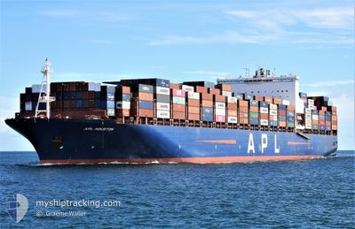
APL HOUSTON
Container Ship
Current Trip
ZADUR
| Time Travelled | 23 days |
|---|---|
| Remaining Time | --- |
| Distance Travelled | 2778.08 nm |
| Remaining Distance | --- |
| AVG Speed | 8.8 Knop |
| MAX Speed | 19.3 Knop |
| AVG Wind | 15.8 knots |
| MAX Wind | 36.7 knots |
| MIN Temp | 19.7°C / 67.46°F |
| MAX Temp | 27.1°C / 80.78°F |
| Djupgående | 12.1 m |
| Position mottagen | 1 m sen |
Current Position
| Longitud | 31.36122° |
|---|---|
| Latitude | -29.78862° |
| Status | Under way using engine |
| Fart | 0.5 Knop |
| Kurs | 122° |
| Område | Indian Ocean |
| Station | T-AIS |
| Position mottagen | 1 m sen |
Info
Information
The current position of APL HOUSTON is in Indian Ocean with coordinates -29.78862° / 31.36122° as reported on 2024-04-25 10:39 by AIS to our vessel tracker app. The vessel's current speed is 0.5 Knop
The vessel APL HOUSTON (IMO: 9597537, MMSI: 566956000) is a Container Ship that was built in 2014 ( 10 År gammal ). It's sailing under the flag of [SG] Singapore.
In this page you can find informations about the vessels current position, last detected port calls, and current voyage information. If the vessels is not in coverage by AIS you will find the latest position.
The current position of APL HOUSTON is detected by our AIS receivers and we are not responsible for the reliability of the data. The last position was recorded while the vessel was in Coverage by the Ais receivers of our vessel tracking app.
The current draught of APL HOUSTON as reported by AIS is 12.1 meters
Weather
| Temperature | 23°C / 73.4°F |
|---|---|
| Wind Speed | 13 knots |
| Direction | 204° SSW |
| Pressure | 1017.6 hPa |
| Humidity | 79.4 % |
| Cloud Coverage | 100 % |
Featured Company
Last Port Calls
| Port | Arrival | Departure | Time In Port |
|---|---|---|---|
| 2024-03-31 09:13 | 2024-04-02 07:53 | 1 d | |
| 2024-03-21 12:00 | 2024-03-23 05:49 | 1 d | |
| 2024-03-11 06:16 | 2024-03-12 09:50 | 1 d | |
| 2024-03-04 22:45 | 2024-03-05 21:26 | 22 h | |
| 2024-02-14 07:01 | 2024-02-22 14:17 | 8 d |
Most Visited Ports (Last year)
| Port | Arrivals | |
|---|---|---|
| 5 | ||
| 5 | ||
| 4 | ||
| 4 | ||
| 3 | ||
| 2 |
Last Trips
| Origin | Departure | Destination | Arrival | Distance | |
|---|---|---|---|---|---|
| 2024-03-23 13:49 | 2024-03-31 13:13 | 3340.08 nm | |||
| 2024-03-12 17:50 | 2024-03-21 20:00 | 2427.85 nm | |||
| 2024-03-06 05:26 | 2024-03-11 14:16 | 2184.59 nm | |||
| 2024-02-22 16:17 | 2024-03-05 06:45 | 4875.76 nm | |||
| 2024-01-29 22:47 | 2024-02-14 09:01 | 2521.50 nm |
Events
| Tid | Event | Detaljer | Position / Dest | Information |
|---|---|---|---|---|
| 2024-04-25 10:22 | Status ändrad | Under way using engine Default |
-29.79261 / 31.36211
ZADUR
|
Fart: 1 kn Kurs: -1° |
| 2024-04-25 10:05 | Status ändrad | Default Under way using engine |
-29.79667 / 31.36333
ZADUR
|
Fart: 0.5 kn Kurs: 125° |
| 2024-04-25 09:51 | Status ändrad | Under way using engine Default |
-29.79996 / 31.36368
ZADUR
|
Fart: 1 kn Kurs: -1° |
| 2024-04-25 09:05 | Status ändrad | Default Under way using engine |
-29.80988 / 31.36580
ZADUR
|
Fart: 1 kn Kurs: 127° |
| 2024-04-25 08:58 | Status ändrad | Under way using engine Default |
-29.81140 / 31.36610
ZADUR
|
Fart: 0.7 kn Kurs: 121° |
| 2024-04-25 08:13 | Status ändrad | Default Under way using engine |
-29.81833 / 31.36500
ZADUR
|
Fart: 0.8 kn Kurs: 135° |
| 2024-04-25 08:04 | STOPPAR förflyttning | 17.96 nm, East of DURBAN |
-29.81865 / 31.36296
ZADUR
|
Fart: 0.3 kn Kurs: 150° |
| 2024-04-25 06:57 | Status ändrad | Under way using engine Default |
-29.72589 / 31.35973
ZADUR
|
Fart: 9 kn Kurs: 176° |
| 2024-04-25 06:39 | Status ändrad | Default Under way using engine |
-29.67982 / 31.35718
ZADUR
|
Fart: 7.6 kn Kurs: 177.3° |
| 2024-04-25 06:24 | STARTAR förflyttning |
-29.65457 / 31.35048
ZADUR
|
Fart: 3.4 kn Kurs: 132° |