
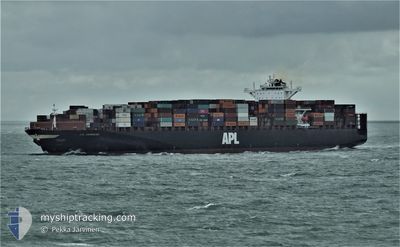
APL CHONGQING
Container Ship
Current Trip
| Time Travelled | 2 days |
|---|---|
| Remaining Time | --- |
| Distance Travelled | 1117.19 nm |
| Remaining Distance | --- |
| AVG Speed | 17.4 Knop |
| MAX Speed | 20.7 Knop |
| AVG Wind | 15.9 knots |
| MAX Wind | 34 knots |
| MIN Temp | 5.6°C / 42.08°F |
| MAX Temp | 10.1°C / 50.18°F |
| Djupgående | 11.2 m |
| Position mottagen | 2 d sen |
Current Position
| Longitud | -126.40664° |
|---|---|
| Latitude | 48.48052° |
| Status | Under way using engine |
| Fart | 16.3 Knop |
| Kurs | 269.2° |
| Område | North Pacific Ocean |
| Station | T-AIS |
| Position mottagen | 2 d sen |
Info
Information
The current position of APL CHONGQING is in North Pacific Ocean with coordinates 48.48052° / -126.40664° as reported on 2024-04-16 03:15 by AIS to our vessel tracker app. The vessel's current speed is 16.3 Knop and is heading at the port of GWANGYANG. The estimated time of arrival as calculated by MyShipTracking vessel tracking app is 2024-04-26 09:00 LT
The vessel APL CHONGQING (IMO: 9461867, MMSI: 566318000) is a Container Ship that was built in 2011 ( 13 År gammal ). It's sailing under the flag of [SG] Singapore.
In this page you can find informations about the vessels current position, last detected port calls, and current voyage information. If the vessels is not in coverage by AIS you will find the latest position.
The current position of APL CHONGQING is detected by our AIS receivers and we are not responsible for the reliability of the data. The last position was recorded while the vessel was in Coverage by the Ais receivers of our vessel tracking app.
The current draught of APL CHONGQING as reported by AIS is 11.2 meters
Weather
| Temperature | 5.6°C / 42.08°F |
|---|---|
| Wind Speed | 15 knots |
| Direction | 172° S |
| Pressure | 1005 hPa |
| Humidity | 89.9 % |
| Cloud Coverage | 100 % |
Featured Company
Last Port Calls
| Port | Arrival | Departure | Time In Port |
|---|---|---|---|
| 2024-04-12 12:06 | 2024-04-15 16:35 | 3 d | |
| 2024-04-09 10:36 | 2024-04-12 03:38 | 2 d | |
| 2024-03-27 20:04 | 2024-03-29 08:40 | 1 d | |
| 2024-03-25 16:53 | 2024-03-26 11:44 | 18 h | |
| 2024-03-18 21:01 | 2024-03-19 11:13 | 14 h | |
| 2024-02-29 01:10 | 2024-03-02 20:58 | 2 d | |
| 2024-02-25 12:43 | 2024-02-28 16:03 | 3 d | |
| 2024-02-13 12:06 | 2024-02-15 04:40 | 1 d |
Last Trips
| Origin | Departure | Destination | Arrival | Distance | |
|---|---|---|---|---|---|
| 2024-04-11 20:38 | 2024-04-12 05:06 | 133.46 nm | |||
| 2024-03-29 17:40 | 2024-04-09 03:36 | 4703.03 nm | |||
| 2024-03-26 19:44 | 2024-03-28 05:04 | 475.36 nm | |||
| 2024-03-19 19:13 | 2024-03-26 00:53 | 1029.52 nm | |||
| 2024-03-02 12:58 | 2024-03-19 05:01 | 5884.20 nm | |||
| 2024-02-28 08:03 | 2024-02-28 17:10 | 157.77 nm | |||
| 2024-02-15 13:40 | 2024-02-25 04:43 | 4703.78 nm | |||
| 2024-01-22 17:30 | 2024-02-13 21:06 | 6814.48 nm |
Events
| Tid | Event | Detaljer | Position / Dest | Information |
|---|---|---|---|---|
| 2024-04-16 03:18 | Status ändrad | Default Under way using engine |
48.48032 / -126.42025
KRKAN
|
Fart: 16.3 kn Kurs: 269.2° |
| 2024-04-16 03:15 | UTANFÖR täckningsområde |
48.48052 / -126.40664
North Pacific Ocean
KRKAN
|
Fart: 16.3 kn Kurs: 269.2° |
|
| 2024-04-16 00:16 | Upptäckt i hav | Canadian part of the North Pacific Ocean |
48.51612 / -125.16615
North Pacific Ocean
KRKAN
|
Fart: 16.9 kn Kurs: 268.6° |
| 2024-04-16 00:14 | Status ändrad | Under way using engine Default |
48.51633 / -125.15137
KRKAN
|
Fart: 16.6 kn Kurs: 271° |
| 2024-04-16 00:14 | I täckningsområde |
48.51612 / -125.16615
North Pacific Ocean
KRKAN
|
Fart: 16.9 kn Kurs: 268.6° |
|
| 2024-04-15 20:54 | Status ändrad | Default Under way using engine |
48.28003 / -123.78625
KRKAN
|
Fart: 17.4 kn Kurs: 280.1° |
| 2024-04-15 20:46 | UTANFÖR täckningsområde |
48.27280 / -123.72532
The Coastal Waters of Southeast Alaska and British Columbia
KRKAN
|
Fart: 17.4 kn Kurs: 280.1° |
|
| 2024-04-15 20:44 | Status ändrad | Under way using engine Default |
48.27112 / -123.71107
KRKAN
|
Fart: 17.6 kn Kurs: 280° |
| 2024-04-15 20:36 | Status ändrad | Default Under way using engine |
48.26514 / -123.65757
KRKAN
|
Fart: 18.4 kn Kurs: 280.9° |
| 2024-04-15 18:32 | Byter havsområde | Canadian part of the The Coastal Waters of Southeast Alaska and British Columbia United States part of the The Coastal Waters of Southeast Alaska and British Columbia |
48.52441 / -123.20887
The Coastal Waters of Southeast Alaska and British Columbia
KRKAN
|
Fart: 20.4 kn Kurs: 173.6° |