
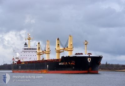
ANGELE N
Bulk Carrier
Current Trip
SANGKULIRANG
| Time Travelled | 5 days |
|---|---|
| Remaining Time | --- |
| Distance Travelled | 1810.34 nm |
| Remaining Distance | --- |
| AVG Speed | 12.8 Knop |
| MAX Speed | 16.7 Knop |
| AVG Wind | 11.8 knots |
| MAX Wind | 26.6 knots |
| MIN Temp | 16.7°C / 62.06°F |
| MAX Temp | 31.2°C / 88.16°F |
| Djupgående | 6.3 m |
| Position mottagen | 5 d sen |
Current Position
| Longitud | 128.59367° |
|---|---|
| Latitude | 33.75792° |
| Status | Under way using engine |
| Fart | 13 Knop |
| Kurs | 202° |
| Område | Japan Sea |
| Station | T-AIS |
| Position mottagen | 5 d sen |
Info
Information
The current position of ANGELE N is in Japan Sea with coordinates 33.75792° / 128.59367° as reported on 2024-04-19 21:14 by AIS to our vessel tracker app. The vessel's current speed is 13 Knop
The vessel ANGELE N (IMO: 9509528, MMSI: 477634100) is a Bulk Carrier that was built in 2010 ( 14 År gammal ). It's sailing under the flag of [HK] Hong Kong.
In this page you can find informations about the vessels current position, last detected port calls, and current voyage information. If the vessels is not in coverage by AIS you will find the latest position.
The current position of ANGELE N is detected by our AIS receivers and we are not responsible for the reliability of the data. The last position was recorded while the vessel was in Coverage by the Ais receivers of our vessel tracking app.
The current draught of ANGELE N as reported by AIS is 6.3 meters
Weather
| Temperature | 28.6°C / 83.48°F |
|---|---|
| Wind Speed | 4 knots |
| Direction | 159° SSE |
| Pressure | 1006.3 hPa |
| Humidity | 74 % |
| Cloud Coverage | 56 % |
Featured Company
Last Port Calls
| Port | Arrival | Departure | Time In Port |
|---|---|---|---|
| 2024-04-10 22:38 | 2024-04-19 12:16 | 8 d | |
| 2024-03-30 10:58 | 2024-04-01 23:49 | 2 d | |
| 2024-03-23 07:09 | 2024-03-27 08:13 | 4 d |
Most Visited Ports (Last year)
| Port | Arrivals | |
|---|---|---|
| 4 | ||
| 2 | ||
| 2 | ||
| 1 | ||
| 1 | ||
| 1 |
Last Trips
| Origin | Departure | Destination | Arrival | Distance | |
|---|---|---|---|---|---|
| 2024-04-02 06:49 | 2024-04-11 07:38 | 2606.90 nm | |||
| 2024-03-27 15:13 | 2024-03-30 17:58 | 665.05 nm | |||
| 2024-01-27 15:22 | 2024-03-23 14:09 | 12654.78 nm |
Events
| Tid | Event | Detaljer | Position / Dest | Information |
|---|---|---|---|---|
| 2024-04-19 21:20 | Status ändrad | Default Under way using engine |
33.73900 / 128.58406
SANGKULIRANG
|
Fart: 13 kn Kurs: 202° |
| 2024-04-19 21:14 | UTANFÖR täckningsområde |
33.75792 / 128.59367
Japan Sea
SANGKULIRANG
|
Fart: 13 kn Kurs: 202° |
|
| 2024-04-19 20:39 | Status ändrad | Under way using engine Default |
33.87098 / 128.66598
SANGKULIRANG
|
Fart: 13.3 kn Kurs: 210° |
| 2024-04-19 20:36 | Status ändrad | Default Under way using engine |
33.88102 / 128.67328
SANGKULIRANG
|
Fart: 13.3 kn Kurs: 210° |
| 2024-04-19 20:29 | Status ändrad | Under way using engine Default |
33.90387 / 128.68970
SANGKULIRANG
|
Fart: 13.3 kn Kurs: 210° |
| 2024-04-19 20:28 | Status ändrad | Default Under way using engine |
33.90663 / 128.69170
SANGKULIRANG
|
Fart: 13.3 kn Kurs: 207° |
| 2024-04-19 19:29 | Status ändrad | Under way using engine Default |
34.11037 / 128.80123
SANGKULIRANG
|
Fart: 13.5 kn Kurs: 202° |
| 2024-04-19 19:24 | Status ändrad | Default Under way using engine |
34.12598 / 128.80913
SANGKULIRANG
|
Fart: 13.5 kn Kurs: 203° |
| 2024-04-19 19:06 | Status ändrad | Under way using engine Default |
34.18888 / 128.84265
SANGKULIRANG
|
Fart: 13.6 kn Kurs: 207° |
| 2024-04-19 19:00 | Status ändrad | Default Under way using engine |
34.20868 / 128.85524
SANGKULIRANG
|
Fart: 13.5 kn Kurs: 212° |