
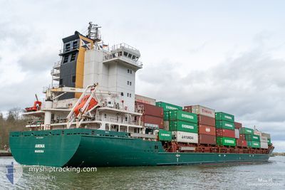
AMINA
Container Ship
Current Trip
| Time Travelled | 5 h, 4 mins |
|---|---|
| Remaining Time | 1 day |
| Distance Travelled | 43.91 nm |
| Remaining Distance | 419.47 nm |
| AVG Speed | 12.7 Knop |
| MAX Speed | 13.2 Knop |
| AVG Wind | 7.8 knots |
| MAX Wind | 8.8 knots |
| MIN Temp | 2.7°C / 36.86°F |
| MAX Temp | 3.9°C / 39.02°F |
| Djupgående | 7.2 m |
| Position mottagen | 1 h, 16 m sen |
Current Position
| Longitud | 19.00007° |
|---|---|
| Latitude | 55.07133° |
| Status | Under way using engine |
| Fart | 13 Knop |
| Kurs | 351.7° |
| Område | Baltic Sea |
| Station | T-AIS |
| Position mottagen | 1 h, 16 m sen |
Info
Information
The current position of AMINA is in Baltic Sea with coordinates 55.07133° / 19.00007° as reported on 2024-04-19 05:55 by AIS to our vessel tracker app. The vessel's current speed is 13 Knop and is heading at the port of RAUMA. The estimated time of arrival as calculated by MyShipTracking vessel tracking app is 2024-04-20 14:03 LT
The vessel AMINA (IMO: 9448683, MMSI: 255806464) is a Container Ship that was built in 2011 ( 13 År gammal ). It's sailing under the flag of [PT] Portugal.
In this page you can find informations about the vessels current position, last detected port calls, and current voyage information. If the vessels is not in coverage by AIS you will find the latest position.
The current position of AMINA is detected by our AIS receivers and we are not responsible for the reliability of the data. The last position was recorded while the vessel was in Coverage by the Ais receivers of our vessel tracking app.
The current draught of AMINA as reported by AIS is 7.2 meters
Weather
| Temperature | 3.5°C / 38.3°F |
|---|---|
| Wind Speed | 7 knots |
| Direction | 192° SSW |
| Pressure | 1006.8 hPa |
| Humidity | 90.1 % |
| Cloud Coverage | 100 % |
Featured Company
Last Port Calls
| Port | Arrival | Departure | Time In Port |
|---|---|---|---|
| 2024-04-18 03:36 | 2024-04-19 02:07 | 22 h | |
| 2024-04-15 02:17 | 2024-04-16 18:15 | 1 d | |
| 2024-04-12 21:24 | 2024-04-12 21:26 | 2 m | |
| 2024-04-09 22:22 | 2024-04-11 12:09 | 1 d | |
| 2024-04-09 12:35 | 2024-04-09 21:04 | 8 h | |
| 2024-04-08 08:21 | 2024-04-09 10:32 | 1 d | |
| 2024-04-07 14:36 | 2024-04-07 21:08 | 6 h | |
| 2024-04-06 08:56 | 2024-04-06 13:33 | 4 h | |
| 2024-04-03 08:43 | 2024-04-05 22:21 | 2 d | |
| 2024-03-31 20:01 | 2024-04-01 17:58 | 21 h |
Most Visited Ports (Last year)
| Port | Arrivals | |
|---|---|---|
| 32 | ||
| 24 | ||
| 22 | ||
| 20 | ||
| 11 | ||
| 10 |
Last Trips
| Origin | Departure | Destination | Arrival | Distance | |
|---|---|---|---|---|---|
| 2024-04-16 21:15 | 2024-04-18 05:36 | 437.41 nm | |||
| 2024-04-12 23:26 | 2024-04-15 05:17 | 647.46 nm | |||
| 2024-04-11 14:09 | 2024-04-12 23:24 | 316.98 nm | |||
| 2024-04-09 23:04 | 2024-04-10 00:22 | 15.60 nm | |||
| 2024-04-09 12:32 | 2024-04-09 14:35 | 16.41 nm | |||
| 2024-04-07 22:08 | 2024-04-08 10:21 | 146.54 nm | |||
| 2024-04-06 14:33 | 2024-04-07 15:36 | 347.11 nm | |||
| 2024-04-05 23:21 | 2024-04-06 09:56 | 156.33 nm | |||
| 2024-04-01 18:58 | 2024-04-03 09:43 | 482.23 nm | |||
| 2024-03-31 08:52 | 2024-03-31 21:01 | 115.09 nm |
Events
| Tid | Event | Detaljer | Position / Dest | Information |
|---|---|---|---|---|
| 2024-04-19 05:55 | UTANFÖR täckningsområde |
55.07133 / 19.00007
Baltic Sea
FIRAU
|
Fart: 13 kn Kurs: 351.7° |
|
| 2024-04-19 02:48 | ETA ändrat | 2024/04/20 18:00 2024/04/20 12:00 |
54.43294 / 18.95138
FIRAU
|
Fart: 12.8 kn Kurs: 79° |
| 2024-04-19 02:07 | AVGÅTT HAMN |
|
54.40218 / 18.73987
FIRAU
|
Fart: 8.2 kn Kurs: 74° |
| 2024-04-19 01:53 | STARTAR förflyttning |
54.38828 / 18.71588
[PL] GDANSK
|
Fart: 3.2 kn Kurs: 41° |
|
| 2024-04-19 01:38 | Status ändrad | Under way using engine Moored |
54.38585 / 18.71635
[PL] GDANSK
|
Fart: Kurs: 220° |
| 2024-04-19 01:24 | Djupgående ändrat | 7.2 7.4 |
54.38582 / 18.71628
[PL] GDANSK
|
Fart: Kurs: 221° |
| 2024-04-19 00:42 | Djupgående ändrat | 7.4 8.8 |
54.38587 / 18.71638
[PL] GDANSK
|
Fart: Kurs: 222° |
| 2024-04-18 13:47 | Destination ändrad | FIRAU PLGDN |
54.38604 / 18.71630
[PL] GDANSK
|
Fart: Kurs: 221° |
| 2024-04-18 13:47 | ETA ändrat | 2024/04/20 12:00 2024/04/18 00:00 |
54.38604 / 18.71630
[PL] GDANSK
|
Fart: Kurs: 221° |
| 2024-04-18 04:06 | Status ändrad | Moored Under way using engine |
54.38583 / 18.71639
[PL] GDANSK
|
Fart: Kurs: 221° |