
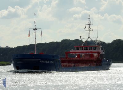
AMADEUS GOLD
General Cargo
Current Trip
| Time Travelled | 1 day |
|---|---|
| Remaining Time | 13 h, 42 mins |
| Distance Travelled | 323.42 nm |
| Remaining Distance | 142.08 nm |
| AVG Speed | 10.2 Knop |
| MAX Speed | 10.8 Knop |
| AVG Wind | 10.1 knots |
| MAX Wind | 14 knots |
| MIN Temp | 2.9°C / 37.22°F |
| MAX Temp | 6.4°C / 43.52°F |
| Djupgående | 2.6 m |
| Position mottagen | 11 h, 54 m sen |
Current Position
| Longitud | 16.74960° |
|---|---|
| Latitude | 56.07167° |
| Status | Under way using engine |
| Fart | 10.3 Knop |
| Kurs | 53.6° |
| Område | Baltic Sea |
| Station | T-AIS |
| Position mottagen | 11 h, 54 m sen |
Info
Information
The current position of AMADEUS GOLD is in Baltic Sea with coordinates 56.07167° / 16.74960° as reported on 2024-04-24 04:49 by AIS to our vessel tracker app. The vessel's current speed is 10.3 Knop and is heading at the port of MERSRAGS. The estimated time of arrival as calculated by MyShipTracking vessel tracking app is 2024-04-25 06:26 LT
The vessel AMADEUS GOLD (IMO: 9479565, MMSI: 244810730) is a General Cargo that was built in 2010 ( 14 År gammal ). It's sailing under the flag of [NL] Netherlands.
In this page you can find informations about the vessels current position, last detected port calls, and current voyage information. If the vessels is not in coverage by AIS you will find the latest position.
The current position of AMADEUS GOLD is detected by our AIS receivers and we are not responsible for the reliability of the data. The last position was recorded while the vessel was in Coverage by the Ais receivers of our vessel tracking app.
The current draught of AMADEUS GOLD as reported by AIS is 2.6 meters
Weather
| Temperature | 4°C / 39.2°F |
|---|---|
| Wind Speed | 6 knots |
| Direction | 57° ENE |
| Pressure | 1009.3 hPa |
| Humidity | 83.8 % |
| Cloud Coverage | 100 % |
Featured Company
Last Port Calls
| Port | Arrival | Departure | Time In Port |
|---|---|---|---|
| 2024-04-22 13:13 | 2024-04-23 09:02 | 19 h | |
| 2024-04-20 17:55 | 2024-04-20 17:58 | 3 m | |
| 2024-04-18 02:58 | 2024-04-18 20:18 | 17 h | |
| 2024-04-16 19:44 | 2024-04-16 20:42 | 57 m | |
| 2024-04-12 18:01 | 2024-04-13 16:18 | 22 h | |
| 2024-04-09 10:42 | 2024-04-12 12:30 | 3 d | |
| 2024-04-03 20:20 | 2024-04-05 12:09 | 1 d | |
| 2024-04-02 19:29 | 2024-04-02 20:04 | 34 m | |
| 2024-03-27 16:18 | 2024-03-28 10:07 | 17 h | |
| 2024-03-21 00:29 | 2024-03-21 22:18 | 21 h |
Most Visited Ports (Last year)
| Port | Arrivals | |
|---|---|---|
| 27 | ||
| 4 | ||
| 4 | ||
| 4 | ||
| 4 | ||
| 4 |
Last Trips
| Origin | Departure | Destination | Arrival | Distance | |
|---|---|---|---|---|---|
| 2024-04-20 19:58 | 2024-04-22 15:13 | 82.44 nm | |||
| 2024-04-18 22:18 | 2024-04-20 19:55 | 319.87 nm | |||
| 2024-04-16 22:42 | 2024-04-18 04:58 | 183.93 nm | |||
| 2024-04-13 18:18 | 2024-04-16 21:44 | 585.30 nm | |||
| 2024-04-12 14:30 | 2024-04-12 20:01 | 44.00 nm | |||
| 2024-04-05 14:09 | 2024-04-09 12:42 | 885.81 nm | |||
| 2024-04-02 22:04 | 2024-04-03 22:20 | 195.20 nm | |||
| 2024-03-28 11:07 | 2024-04-02 21:29 | 763.78 nm | |||
| 2024-03-21 23:18 | 2024-03-27 17:18 | 777.33 nm | |||
| 2024-03-19 12:02 | 2024-03-21 01:29 | 87.57 nm |
Events
| Tid | Event | Detaljer | Position / Dest | Information |
|---|---|---|---|---|
| 2024-04-24 04:56 | Status ändrad | Default Under way using engine |
56.08367 / 16.77852
MERSRAGS
|
Fart: 10.3 kn Kurs: 53.6° |
| 2024-04-24 04:49 | UTANFÖR täckningsområde |
56.07167 / 16.74960
Baltic Sea
MERSRAGS
|
Fart: 10.3 kn Kurs: 53.6° |
|
| 2024-04-23 23:37 | Byter havsområde | Swedish part of the Baltic Sea Danish part of the Kattegat |
55.61633 / 15.38261
Baltic Sea
MERSRAGS
|
Fart: 10.4 kn Kurs: 60.9° |
| 2024-04-23 17:43 | Byter havsområde | Danish part of the Kattegat Swedish part of the Baltic Sea |
54.97873 / 14.01899
Kattegat
MERSRAGS
|
Fart: 10.3 kn Kurs: 69.6° |
| 2024-04-23 17:34 | Byter havsområde | Swedish part of the Baltic Sea German part of the Baltic Sea |
54.96969 / 13.97718
Baltic Sea
MERSRAGS
|
Fart: 10.3 kn Kurs: 69.3° |
| 2024-04-23 16:04 | Status ändrad | Under way using engine Default |
54.87154 / 13.56401
MERSRAGS
|
Fart: 10.1 kn Kurs: 70° |
| 2024-04-23 16:00 | Status ändrad | Default Under way using engine |
54.86817 / 13.54760
MERSRAGS
|
Fart: 10.1 kn Kurs: 70.1° |
| 2024-04-23 15:54 | Status ändrad | Under way using engine Default |
54.86178 / 13.51679
MERSRAGS
|
Fart: 10.1 kn Kurs: 70° |
| 2024-04-23 15:32 | Status ändrad | Default Under way using engine |
54.84049 / 13.41939
MERSRAGS
|
Fart: 10 kn Kurs: 68.2° |
| 2024-04-23 15:28 | Status ändrad | Under way using engine Default |
54.83559 / 13.39848
MERSRAGS
|
Fart: 10.1 kn Kurs: 67° |