
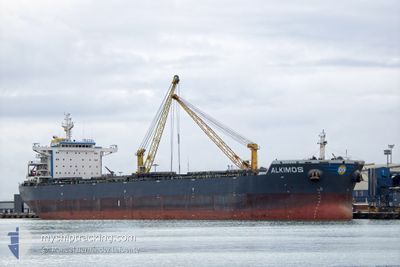
ALKIMOS
Bulk Carrier
Current Trip
| Time Travelled | 27 days |
|---|---|
| Remaining Time | 12 days |
| Distance Travelled | 6193.83 nm |
| Remaining Distance | 3233.86 nm |
| AVG Speed | 9.5 Knop |
| MAX Speed | 12.1 Knop |
| AVG Wind | 18.6 knots |
| MAX Wind | 37 knots |
| MIN Temp | 16.8°C / 62.24°F |
| MAX Temp | 29.2°C / 84.56°F |
| Djupgående | 15 m |
| Position mottagen | 1 d sen |
Current Position
| Longitud | 55.72977° |
|---|---|
| Latitude | -20.42968° |
| Status | Under way using engine |
| Fart | 10.7 Knop |
| Kurs | 63.7° |
| Område | Indian Ocean |
| Station | T-AIS |
| Position mottagen | 1 d sen |
Info
Information
The current position of ALKIMOS is in Indian Ocean with coordinates -20.42968° / 55.72977° as reported on 2024-04-18 08:19 by AIS to our vessel tracker app. The vessel's current speed is 10.7 Knop and is heading at the port of SINGAPORE. The estimated time of arrival as calculated by MyShipTracking vessel tracking app is 2024-05-02 00:20 LT
The vessel ALKIMOS (IMO: 9603001, MMSI: 210725000) is a Bulk Carrier that was built in 2013 ( 11 År gammal ). It's sailing under the flag of [CY] Cyprus.
In this page you can find informations about the vessels current position, last detected port calls, and current voyage information. If the vessels is not in coverage by AIS you will find the latest position.
The current position of ALKIMOS is detected by our AIS receivers and we are not responsible for the reliability of the data. The last position was recorded while the vessel was in Coverage by the Ais receivers of our vessel tracking app.
The current draught of ALKIMOS as reported by AIS is 15 meters
Weather
| Temperature | 27°C / 80.6°F |
|---|---|
| Wind Speed | 17 knots |
| Direction | 114° ESE |
| Pressure | 1013 hPa |
| Humidity | 70.7 % |
| Cloud Coverage | 56 % |
Featured Company
Last Port Calls
| Port | Arrival | Departure | Time In Port |
|---|---|---|---|
| 2024-03-20 02:49 | 2024-03-23 07:41 | 3 d | |
| 2024-03-10 03:41 | 2024-03-11 18:20 | 1 d |
Most Visited Ports (Last year)
| Port | Arrivals | |
|---|---|---|
| 2 | ||
| 1 | ||
| 1 | ||
| 1 | ||
| 1 | ||
| 1 |
Last Trips
| Origin | Departure | Destination | Arrival | Distance | |
|---|---|---|---|---|---|
| 2024-03-11 15:20 | 2024-03-19 23:49 | 1315.38 nm | |||
| 2023-12-15 14:59 | 2024-03-10 00:41 | 11073.24 nm |
Events
| Tid | Event | Detaljer | Position / Dest | Information |
|---|---|---|---|---|
| 2024-04-18 08:24 | Status ändrad | Default Under way using engine |
-20.42281 / 55.74324
SINGAPORE
|
Fart: 10.7 kn Kurs: 63.7° |
| 2024-04-18 08:19 | Status ändrad | Under way using engine Default |
-20.42968 / 55.72977
SINGAPORE
|
Fart: 10.7 kn Kurs: 66° |
| 2024-04-18 08:19 | UTANFÖR täckningsområde |
-20.42968 / 55.72977
Indian Ocean
SINGAPORE
|
Fart: 10.7 kn Kurs: 63.7° |
|
| 2024-04-18 08:15 | Status ändrad | Default Under way using engine |
-20.43446 / 55.71998
SINGAPORE
|
Fart: 10.5 kn Kurs: 60.1° |
| 2024-04-18 07:25 | ETA ändrat | 2024/04/30 20:00 2024/04/30 15:30 |
-20.50612 / 55.57889
SINGAPORE
|
Fart: 10.6 kn Kurs: 61.6° |
| 2024-04-18 00:45 | Status ändrad | Under way using engine Default |
-21.19931 / 54.57795
SINGAPORE
|
Fart: 10.8 kn Kurs: 61° |
| 2024-04-18 00:41 | Status ändrad | Default Under way using engine |
-21.20535 / 54.56771
SINGAPORE
|
Fart: 10.7 kn Kurs: 55.2° |
| 2024-04-18 00:39 | ETA ändrat | 2024/04/30 15:30 2024/04/29 03:00 |
-21.21523 / 54.55040
SINGAPORE
|
Fart: 10.7 kn Kurs: 57.4° |
| 2024-04-18 00:30 | Status ändrad | Under way using engine Default |
-21.22234 / 54.53846
SINGAPORE
|
Fart: 10.5 kn Kurs: 57° |
| 2024-04-18 00:23 | Status ändrad | Default Under way using engine |
-21.23425 / 54.51796
SINGAPORE
|
Fart: 10.5 kn Kurs: 58.8° |