
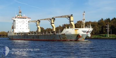
AL-MOTHANNA
Cargo
Current Trip
PORT QASIM
| Time Travelled | 2 days |
|---|---|
| Remaining Time | --- |
| Distance Travelled | 781.94 nm |
| Remaining Distance | --- |
| AVG Speed | 12.7 Knop |
| MAX Speed | 14 Knop |
| AVG Wind | 12.2 knots |
| MAX Wind | 19 knots |
| MIN Temp | 26°C / 78.8°F |
| MAX Temp | 29.9°C / 85.82°F |
| Djupgående | 5.8 m |
| Position mottagen | 9 d sen |
Current Position
| Longitud | 57.35088° |
|---|---|
| Latitude | 25.26488° |
| Status | Under way using engine |
| Fart | 11.8 Knop |
| Kurs | 103.3° |
| Område | Gulf of Oman |
| Station | T-AIS |
| Position mottagen | 9 d sen |
Info
Information
The current position of AL-MOTHANNA is in Gulf of Oman with coordinates 25.26488° / 57.35088° as reported on 2024-04-15 10:35 by AIS to our vessel tracker app. The vessel's current speed is 11.8 Knop
The vessel AL-MOTHANNA (IMO: 9649976, MMSI: 438031044) is a Cargo It's sailing under the flag of [JO] Jordan.
In this page you can find informations about the vessels current position, last detected port calls, and current voyage information. If the vessels is not in coverage by AIS you will find the latest position.
The current position of AL-MOTHANNA is detected by our AIS receivers and we are not responsible for the reliability of the data. The last position was recorded while the vessel was in Coverage by the Ais receivers of our vessel tracking app.
The current draught of AL-MOTHANNA as reported by AIS is 5.8 meters
Weather
| Temperature | 28.5°C / 83.3°F |
|---|---|
| Wind Speed | 9 knots |
| Direction | 1° N |
| Pressure | 1007.2 hPa |
| Humidity | 72 % |
| Cloud Coverage | 93 % |
Featured Company
Last Port Calls
| Port | Arrival | Departure | Time In Port |
|---|---|---|---|
| 2024-04-18 05:13 | 2024-04-22 06:10 | 4 d | |
| 2024-03-19 13:24 | 2024-03-27 14:59 | 8 d | |
| 2024-03-13 05:49 |
Last Trips
| Origin | Departure | Destination | Arrival | Distance | |
|---|---|---|---|---|---|
| 2024-03-27 18:59 | 2024-04-18 10:13 | 1205.60 nm | |||
| 2024-03-13 09:49 | 2024-03-19 17:24 | 31.08 nm |
Events
| Tid | Event | Detaljer | Position / Dest | Information |
|---|---|---|---|---|
| 2024-04-22 13:53 | STARTAR förflyttning | 15.15 nm, South of SALEHAABAD ISLAND |
24.55172 / 66.96761
PORT QASIM
|
Fart: 4.6 kn Kurs: 220° |
| 2024-04-22 09:26 | STOPPAR förflyttning | 14.97 nm, South of SALEHAABAD ISLAND |
24.55482 / 66.97379
PORT QASIM
|
Fart: 0.1 kn Kurs: 288° |
| 2024-04-22 06:10 | AVGÅTT HAMN |
|
24.77781 / 67.29572
PORT QASIM
|
Fart: 4.4 kn Kurs: 305° |
| 2024-04-22 06:01 | STARTAR förflyttning |
24.76942 / 67.31011
[PK] PORT QASIM
|
Fart: 4.4 kn Kurs: 305° |
|
| 2024-04-18 05:13 | ANLÄNDER HAMN |
|
24.76580 / 67.31926
[PK] PORT QASIM
|
Fart: 12.7 kn Kurs: 65° |
| 2024-04-18 02:40 | STARTAR förflyttning | 15.19 nm, South of SALEHAABAD ISLAND |
24.55253 / 66.99982
PORT QASIM
|
Fart: 5.1 kn Kurs: 82° |
| 2024-04-17 06:04 | STOPPAR förflyttning | 15.19 nm, South of SALEHAABAD ISLAND |
24.55126 / 66.95938
PORT QASIM
|
Fart: 0.2 kn Kurs: 311° |
| 2024-04-15 10:36 | Status ändrad | Default Under way using engine |
25.26370 / 57.35628
PORT QASIM
|
Fart: 11.8 kn Kurs: 103.3° |
| 2024-04-15 10:35 | UTANFÖR täckningsområde |
25.26488 / 57.35088
Gulf of Oman
PORT QASIM
|
Fart: 11.8 kn Kurs: 103.3° |
|
| 2024-04-15 10:16 | Status ändrad | Under way using engine Default |
25.27750 / 57.28348
PORT QASIM
|
Fart: 11.7 kn Kurs: 101° |