
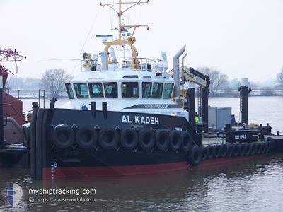
AL KADEH
Tug
Current Trip
NMDC
| Time Travelled | 48 days |
|---|---|
| Remaining Time | --- |
| Distance Travelled | 624.97 nm |
| Remaining Distance | --- |
| AVG Speed | 5.9 Knop |
| MAX Speed | 9.4 Knop |
| AVG Wind | 8.4 knots |
| MAX Wind | 29 knots |
| MIN Temp | 20.6°C / 69.08°F |
| MAX Temp | 28.5°C / 83.3°F |
| Djupgående | 2.6 m |
| Position mottagen | 1 m sen |
Current Position
| Longitud | 54.51349° |
|---|---|
| Latitude | 24.67414° |
| Status | Under way using engine |
| Fart | 0.3 Knop |
| Kurs | 340° |
| Område | Persian Gulf |
| Station | T-AIS |
| Position mottagen | 1 m sen |
Info
Information
The current position of AL KADEH is in Persian Gulf with coordinates 24.67414° / 54.51349° as reported on 2024-04-25 13:36 by AIS to our vessel tracker app. The vessel's current speed is 0.3 Knop
The vessel AL KADEH (IMO: 9569360, MMSI: 470411000) is a Tug that was built in 2011 ( 13 År gammal ). It's sailing under the flag of [AE] UAE.
In this page you can find informations about the vessels current position, last detected port calls, and current voyage information. If the vessels is not in coverage by AIS you will find the latest position.
The current position of AL KADEH is detected by our AIS receivers and we are not responsible for the reliability of the data. The last position was recorded while the vessel was in Coverage by the Ais receivers of our vessel tracking app.
The current draught of AL KADEH as reported by AIS is 2.6 meters
Weather
| Temperature | 26.4°C / 79.52°F |
|---|---|
| Wind Speed | 8 knots |
| Direction | 33° NNE |
| Pressure | 1005.2 hPa |
| Humidity | 67.1 % |
| Cloud Coverage | --- |
Featured Company
Last Trips
| Origin | Departure | Destination | Arrival | Distance |
|---|
Events
| Tid | Event | Detaljer | Position / Dest | Information |
|---|---|---|---|---|
| 2024-04-25 13:35 | STOPPAR förflyttning | 11.61 nm, South West of KHALIFA |
24.67420 / 54.51359
NMDC
|
Fart: 0.2 kn Kurs: 336° |
| 2024-04-25 13:00 | STARTAR förflyttning | 8.08 nm, South West of KHALIFA |
24.71402 / 54.56128
NMDC
|
Fart: 6.5 kn Kurs: 323.6° |
| 2024-04-25 09:17 | STOPPAR förflyttning | 8.11 nm, South West of KHALIFA |
24.71231 / 54.56231
NMDC
|
Fart: 0.2 kn Kurs: 191° |
| 2024-04-25 08:48 | STARTAR förflyttning | 9.83 nm, South West of KHALIFA |
24.72231 / 54.51395
NMDC
|
Fart: 5.5 kn Kurs: 1.3° |
| 2024-04-25 03:37 | Status ändrad | Under way using engine Default |
24.72036 / 54.51251
NMDC
|
Fart: 0.1 kn Kurs: 349° |
| 2024-04-25 03:28 | Status ändrad | Default Under way using engine |
24.72038 / 54.51247
NMDC
|
Fart: 0.1 kn Kurs: 348° |
| 2024-04-25 02:56 | STOPPAR förflyttning | 9.96 nm, South West of KHALIFA |
24.72026 / 54.51252
NMDC
|
Fart: 0.1 kn Kurs: 349° |
| 2024-04-25 02:33 | STARTAR förflyttning | 11.35 nm, South West of KHALIFA |
24.70185 / 54.49548
NMDC
|
Fart: 4.4 kn Kurs: 100° |
| 2024-04-24 22:54 | STOPPAR förflyttning | 11.22 nm, South West of KHALIFA |
24.70378 / 54.49684
NMDC
|
Fart: Kurs: 233° |
| 2024-04-24 22:36 | STARTAR förflyttning | 9.89 nm, South West of KHALIFA |
24.71942 / 54.51481
NMDC
|
Fart: 5.7 kn Kurs: 133.9° |