
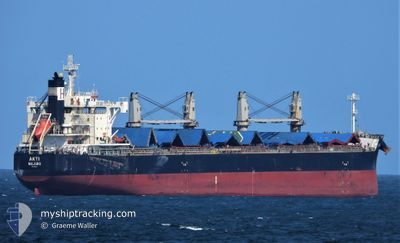
AKTI
Cargo
Current Trip
DURBAN
| Time Travelled | 4 days |
|---|---|
| Remaining Time | --- |
| Distance Travelled | 1345.43 nm |
| Remaining Distance | --- |
| AVG Speed | 12 Knop |
| MAX Speed | 14.6 Knop |
| AVG Wind | 8.9 knots |
| MAX Wind | 14.3 knots |
| MIN Temp | 20.2°C / 68.36°F |
| MAX Temp | 29.4°C / 84.92°F |
| Djupgående | 8.5 m |
| Position mottagen | 4 d sen |
Current Position
| Longitud | 31.20064° |
|---|---|
| Latitude | -29.71098° |
| Status | Under way using engine |
| Fart | 10.3 Knop |
| Kurs | 74.6° |
| Område | Indian Ocean |
| Station | T-AIS |
| Position mottagen | 4 d sen |
Info
Information
The current position of AKTI is in Indian Ocean with coordinates -29.71098° / 31.20064° as reported on 2024-04-18 21:26 by AIS to our vessel tracker app. The vessel's current speed is 10.3 Knop
The vessel AKTI (IMO: 9660619, MMSI: 538009278) is a Cargo It's sailing under the flag of [MH] Marshall Is.
In this page you can find informations about the vessels current position, last detected port calls, and current voyage information. If the vessels is not in coverage by AIS you will find the latest position.
The current position of AKTI is detected by our AIS receivers and we are not responsible for the reliability of the data. The last position was recorded while the vessel was in Coverage by the Ais receivers of our vessel tracking app.
The current draught of AKTI as reported by AIS is 8.5 meters
Weather
| Temperature | 29.5°C / 85.1°F |
|---|---|
| Wind Speed | 4 knots |
| Direction | 235° SW |
| Pressure | 1013.1 hPa |
| Humidity | 70.4 % |
| Cloud Coverage | 55 % |
Featured Company
Last Port Calls
| Port | Arrival | Departure | Time In Port |
|---|---|---|---|
| 2024-04-07 13:12 | 2024-04-18 18:11 | 11 d | |
| 2024-02-22 04:03 | 2024-02-22 13:23 | 9 h |
Most Visited Ports (Last year)
| Port | Arrivals | |
|---|---|---|
| 4 | ||
| 1 | ||
| 1 | ||
| 1 | ||
| 1 | ||
| 1 |
Last Trips
| Origin | Departure | Destination | Arrival | Distance |
|---|
Events
| Tid | Event | Detaljer | Position / Dest | Information |
|---|---|---|---|---|
| 2024-04-18 21:45 | Status ändrad | Default Under way using engine |
-29.68911 / 31.26140
DURBAN
|
Fart: 10.3 kn Kurs: 74.6° |
| 2024-04-18 21:26 | UTANFÖR täckningsområde |
-29.71098 / 31.20064
Indian Ocean
|
Fart: 10.3 kn Kurs: 74.6° |
|
| 2024-04-18 21:07 | STARTAR förflyttning | 11.32 nm, North East of DURBAN |
-29.72681 / 31.15515
DURBAN
|
Fart: 3.1 kn Kurs: 51° |
| 2024-04-18 20:19 | Status ändrad | Under way using engine At anchor |
-29.72108 / 31.15638
DURBAN
|
Fart: 0.3 kn Kurs: 8° |
| 2024-04-18 19:46 | Status ändrad | At anchor Under way using engine |
-29.72032 / 31.15619
DURBAN
|
Fart: 0.2 kn Kurs: 46° |
| 2024-04-18 19:44 | STOPPAR förflyttning | 11.67 nm, North East of DURBAN |
-29.72030 / 31.15610
DURBAN
|
Fart: 0.3 kn Kurs: 41° |
| 2024-04-18 18:11 | AVGÅTT HAMN |
|
-29.83994 / 31.09010
DURBAN
|
Fart: 5.2 kn Kurs: 41° |
| 2024-04-18 18:10 | Status ändrad | Under way using engine Default |
-29.87563 / 31.05136
[ZA] DURBAN
|
Fart: 5.3 kn Kurs: 132° |
| 2024-04-18 17:54 | STARTAR förflyttning |
-29.87045 / 31.02938
[ZA] DURBAN
|
Fart: 4.7 kn Kurs: 131° |
|
| 2024-04-18 17:54 | I täckningsområde |
-29.87525 / 31.05172
Indian Ocean
[ZA] DURBAN
|
Fart: 5.2 kn Kurs: 39.2° |