
AKRA
Cargo
Current Trip
ZA RCB
| Time Travelled | 7 days |
|---|---|
| Remaining Time | --- |
| Distance Travelled | 2218.30 nm |
| Remaining Distance | --- |
| AVG Speed | 12.2 Knop |
| MAX Speed | 17.2 Knop |
| AVG Wind | 12.1 knots |
| MAX Wind | 25.8 knots |
| MIN Temp | 11.5°C / 52.7°F |
| MAX Temp | 25°C / 77°F |
| Djupgående | 11.8 m |
| Position mottagen | 7 d sen |
Current Position
| Longitud | 31.49143° |
|---|---|
| Latitude | -29.86493° |
| Status | Under way using engine |
| Fart | 13.6 Knop |
| Kurs | 218.4° |
| Område | Indian Ocean |
| Station | T-AIS |
| Position mottagen | 7 d sen |
Info
Information
The current position of AKRA is in Indian Ocean with coordinates -29.86493° / 31.49143° as reported on 2024-04-17 23:10 by AIS to our vessel tracker app. The vessel's current speed is 13.6 Knop
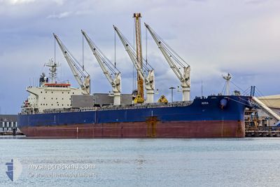
The vessel AKRA (IMO: 9757929, MMSI: 319093100) is a Cargo It's sailing under the flag of [KY] Cayman Is.
In this page you can find informations about the vessels current position, last detected port calls, and current voyage information. If the vessels is not in coverage by AIS you will find the latest position.
The current position of AKRA is detected by our AIS receivers and we are not responsible for the reliability of the data. The last position was recorded while the vessel was in Coverage by the Ais receivers of our vessel tracking app.
The current draught of AKRA as reported by AIS is 11.8 meters
Weather
| Temperature | 12.8°C / 55.04°F |
|---|---|
| Wind Speed | 17 knots |
| Direction | 334° NNW |
| Pressure | 1020.9 hPa |
| Humidity | 79 % |
| Cloud Coverage | 52 % |
Featured Company
Last Port Calls
| Port | Arrival | Departure | Time In Port |
|---|---|---|---|
| 2024-04-11 09:28 | 2024-04-17 17:44 | 6 d | |
| 2024-03-23 08:11 | 2024-03-25 03:43 | 1 d | |
| 2024-02-08 03:21 | 2024-02-15 08:58 | 7 d | |
| 2024-02-05 08:08 |
Most Visited Ports (Last year)
| Port | Arrivals | |
|---|---|---|
| 1 | ||
| 1 | ||
| 1 | ||
| 1 | ||
| 1 | ||
| 1 |
Events
| Tid | Event | Detaljer | Position / Dest | Information |
|---|---|---|---|---|
| 2024-04-17 23:14 | Status ändrad | Default Under way using engine |
-29.87766 / 31.47989
ZA RCB
|
Fart: 13.6 kn Kurs: 218.4° |
| 2024-04-17 23:10 | Byter havsområde | South African part of the Indian Ocean Australian part of the Indian Ocean |
-29.86493 / 31.49143
Indian Ocean
|
Fart: 13.6 kn Kurs: 218.4° |
| 2024-04-17 23:10 | Status ändrad | Under way using engine Default |
-29.86493 / 31.49143
ZA RCB
|
Fart: 13 kn Kurs: 217° |
| 2024-04-17 23:10 | UTANFÖR täckningsområde |
-29.86493 / 31.49143
Indian Ocean
|
Fart: 13.6 kn Kurs: 218.4° |
|
| 2024-04-17 22:52 | I täckningsområde |
-29.86493 / 31.49143
Indian Ocean
|
Fart: 13.6 kn Kurs: 218.4° |
|
| 2024-04-17 17:44 | AVGÅTT HAMN |
|
-28.81331 / 32.10316
ZA RCB
|
Fart: 6.7 kn Kurs: 107° |
| 2024-04-17 17:12 | STARTAR förflyttning |
-28.79546 / 32.04279
[ZA] RICHARDS BAY
|
Fart: 3.6 kn Kurs: 96° |