
TIPM NO.13406
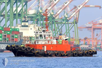
Tug
Current Trip
| Trip Time | --- |
|---|---|
| Trip Distance | --- |
| AVG Speed | --- |
| MAX Speed | --- |
| Djupgående | --- |
| AVG Wind | --- |
| MAX Wind | --- |
| MIN Temp | --- |
| MAX Temp | --- |
| Position mottagen | 5 h, 40 m sen |
Current Position
| Longitud | 120.27183° |
|---|---|
| Latitude | 22.61112° |
| Status | Default |
| Fart | 0.7 Knop |
| Kurs | --- |
| Område | South China Sea |
| Station | T-AIS |
| Position mottagen | 5 h, 40 m sen |
Info
Information
The current position of TIPM NO.13406 is in South China Sea with coordinates 22.61112° / 120.27183° as reported on 2024-04-18 08:41 by AIS to our vessel tracker app. The vessel's current speed is 0.7 Knop and is currently inside the port of KAOHSIUNG.
The vessel TIPM NO.13406 (MMSI: 416000093) is a Tug It's sailing under the flag of [TW] Taiwan.
In this page you can find informations about the vessels current position, last detected port calls, and current voyage information. If the vessels is not in coverage by AIS you will find the latest position.
The current position of TIPM NO.13406 is detected by our AIS receivers and we are not responsible for the reliability of the data. The last position was recorded while the vessel was in Coverage by the Ais receivers of our vessel tracking app.
Weather
| Temperature | 26.6°C / 79.88°F |
|---|---|
| Wind Speed | 9 knots |
| Direction | 298° WNW |
| Pressure | 1008.3 hPa |
| Humidity | 80.2 % |
| Cloud Coverage | 42 % |
Featured Company
Last Trips
| Origin | Departure | Destination | Arrival | Distance |
|---|
Events
| Tid | Event | Detaljer | Position / Dest | Information |
|---|---|---|---|---|
| 2024-04-18 08:41 | UTANFÖR täckningsområde |
22.61112 / 120.27183
South China Sea
[TW] KAOHSIUNG
|
Fart: 0.7 kn Kurs: 321.1° |
|
| 2024-04-18 00:10 | I täckningsområde |
22.61135 / 120.27180
South China Sea
[TW] KAOHSIUNG
|
Fart: 0.1 kn Kurs: 4.7° |
|
| 2024-04-17 08:48 | UTANFÖR täckningsområde |
22.61109 / 120.27190
South China Sea
[TW] KAOHSIUNG
|
Fart: 0.1 kn Kurs: 155.2° |
|
| 2024-04-17 00:08 | I täckningsområde |
22.61102 / 120.27184
South China Sea
[TW] KAOHSIUNG
|
Fart: 0.1 kn Kurs: 128.5° |
|
| 2024-04-16 08:50 | UTANFÖR täckningsområde |
22.61112 / 120.27186
South China Sea
[TW] KAOHSIUNG
|
Fart: 0.5 kn Kurs: 188.6° |
|
| 2024-04-16 00:06 | I täckningsområde |
22.61096 / 120.27188
South China Sea
[TW] KAOHSIUNG
|
Fart: 0.7 kn Kurs: 184.7° |
|
| 2024-04-15 00:48 | UTANFÖR täckningsområde |
22.61041 / 120.27125
South China Sea
[TW] KAOHSIUNG
|
Fart: 11.6 kn Kurs: 31.3° |
|
| 2024-04-15 00:17 | STOPPAR förflyttning |
22.61082 / 120.27229
[TW] KAOHSIUNG
|
Fart: 0.2 kn Kurs: 511° |
|
| 2024-04-15 00:14 | STARTAR förflyttning |
22.60369 / 120.27153
[TW] KAOHSIUNG
|
Fart: 7.5 kn Kurs: 189.5° |
|
| 2024-04-14 14:42 | STOPPAR förflyttning |
22.61124 / 120.27215
[TW] KAOHSIUNG
|
Fart: 0.2 kn Kurs: 511° |