
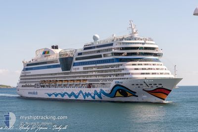
AIDAMAR
Passengers Ship
Current Trip
| Time Travelled | 21 h, 56 mins |
|---|---|
| Remaining Time | --- |
| Distance Travelled | 247.48 nm |
| Remaining Distance | --- |
| AVG Speed | 14.3 Knop |
| MAX Speed | 19.9 Knop |
| AVG Wind | 9.8 knots |
| MAX Wind | 14.1 knots |
| MIN Temp | 1.7°C / 35.06°F |
| MAX Temp | 4°C / 39.2°F |
| Djupgående | 7.3 m |
| Position mottagen | 11 h, 44 m sen |
Current Position
| Longitud | 18.62347° |
|---|---|
| Latitude | 58.39724° |
| Status | Under way using engine |
| Fart | 15.2 Knop |
| Kurs | 198.3° |
| Område | Baltic Sea |
| Station | T-AIS |
| Position mottagen | 11 h, 44 m sen |
Info
Information
The current position of AIDAMAR is in Baltic Sea with coordinates 58.39724° / 18.62347° as reported on 2024-04-25 01:45 by AIS to our vessel tracker app. The vessel's current speed is 15.2 Knop and is heading at the port of VISBY. The estimated time of arrival as calculated by MyShipTracking vessel tracking app is 2024-04-25 05:00 LT
The vessel AIDAMAR (IMO: 9490052, MMSI: 247312900) is a Passengers Ship that was built in 2012 ( 12 År gammal ). It's sailing under the flag of [IT] Italy.
In this page you can find informations about the vessels current position, last detected port calls, and current voyage information. If the vessels is not in coverage by AIS you will find the latest position.
The current position of AIDAMAR is detected by our AIS receivers and we are not responsible for the reliability of the data. The last position was recorded while the vessel was in Coverage by the Ais receivers of our vessel tracking app.
The current draught of AIDAMAR as reported by AIS is 7.3 meters
Weather
| Temperature | 2.9°C / 37.22°F |
|---|---|
| Wind Speed | 10 knots |
| Direction | 347° NNW |
| Pressure | 1006.2 hPa |
| Humidity | 90.6 % |
| Cloud Coverage | 100 % |
Featured Company
Last Port Calls
| Port | Arrival | Departure | Time In Port |
|---|---|---|---|
| 2024-04-24 04:45 | 2024-04-24 15:34 | 10 h | |
| 2024-04-22 04:50 | 2024-04-22 16:20 | 11 h | |
| 2024-04-20 05:14 | 2024-04-20 15:26 | 10 h | |
| 2024-04-18 04:35 | 2024-04-18 16:11 | 11 h | |
| 2024-04-16 07:30 | 2024-04-16 17:27 | 9 h | |
| 2024-04-14 04:32 | 2024-04-14 16:08 | 11 h | |
| 2024-04-12 05:01 | 2024-04-12 16:35 | 11 h | |
| 2024-04-10 02:51 | 2024-04-10 17:15 | 14 h | |
| 2024-04-08 06:23 | 2024-04-08 18:23 | 11 h | |
| 2024-04-05 04:38 | 2024-04-05 17:22 | 12 h |
Last Trips
| Origin | Departure | Destination | Arrival | Distance | |
|---|---|---|---|---|---|
| 2024-04-22 18:20 | 2024-04-24 06:45 | 529.99 nm | |||
| 2024-04-20 17:26 | 2024-04-22 06:50 | 532.76 nm | |||
| 2024-04-18 18:11 | 2024-04-20 07:14 | 529.05 nm | |||
| 2024-04-16 19:27 | 2024-04-18 06:35 | 522.99 nm | |||
| 2024-04-14 18:08 | 2024-04-16 09:30 | 534.41 nm | |||
| 2024-04-12 18:35 | 2024-04-14 06:32 | 374.70 nm | |||
| 2024-04-10 19:15 | 2024-04-12 07:01 | 501.22 nm | |||
| 2024-04-08 20:23 | 2024-04-10 04:51 | 373.45 nm | |||
| 2024-04-05 18:22 | 2024-04-08 08:23 | 908.23 nm | |||
| 2024-04-04 17:16 | 2024-04-05 05:38 | 196.28 nm |
Events
| Tid | Event | Detaljer | Position / Dest | Information |
|---|---|---|---|---|
| 2024-04-25 11:08 | STARTAR förflyttning | 0.84 nm, West of VISBY |
57.63150 / 18.25449
SE VBY
|
Fart: 6.8 kn Kurs: 278° |
| 2024-04-25 05:24 | STOPPAR förflyttning | 0.54 nm, South West of VISBY |
57.63031 / 18.26643
SE VBY
|
Fart: 0.3 kn Kurs: 287° |
| 2024-04-25 01:52 | Status ändrad | Default Under way using engine |
58.36641 / 18.60422
SE VBY
|
Fart: 15.2 kn Kurs: 198.3° |
| 2024-04-25 01:45 | UTANFÖR täckningsområde |
58.39724 / 18.62347
Baltic Sea
SE VBY
|
Fart: 15.2 kn Kurs: 198.3° |
|
| 2024-04-24 23:35 | Status ändrad | Under way using engine Default |
58.85767 / 19.30590
SE VBY
|
Fart: 19.2 kn Kurs: 210° |
| 2024-04-24 23:28 | Status ändrad | Default Under way using engine |
58.88593 / 19.34393
SE VBY
|
Fart: 19.2 kn Kurs: 209.8° |
| 2024-04-24 23:28 | I täckningsområde |
58.88831 / 19.34662
Baltic Sea
SE VBY
|
Fart: 19.2 kn Kurs: 209.8° |
|
| 2024-04-24 23:28 | Status ändrad | Under way using engine Default |
58.88831 / 19.34662
SE VBY
|
Fart: 19 kn Kurs: 206° |
| 2024-04-24 22:28 | Status ändrad | Default Under way using engine |
59.17565 / 19.60937
SE VBY
|
Fart: 19.1 kn Kurs: 210.5° |
| 2024-04-24 22:21 | UTANFÖR täckningsområde |
59.20942 / 19.64729
Baltic Sea
SE VBY
|
Fart: 19.1 kn Kurs: 210.5° |