
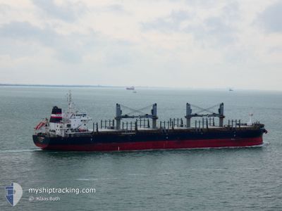
AFRICAN LOGRUNNER
Cargo
Current Trip
| Time Travelled | 1 day |
|---|---|
| Remaining Time | 2 days |
| Distance Travelled | 297.56 nm |
| Remaining Distance | 751.33 nm |
| AVG Speed | 9.6 Knop |
| MAX Speed | 12.3 Knop |
| AVG Wind | 21.6 knots |
| MAX Wind | 27 knots |
| MIN Temp | 20.9°C / 69.62°F |
| MAX Temp | 23°C / 73.4°F |
| Djupgående | 10.7 m |
| Position mottagen | 22 h, 54 m sen |
Current Position
| Longitud | --- |
|---|---|
| Latitude | --- |
| Status | Under way using engine |
| Fart | 8 Knop |
| Kurs | 54.2° |
| Område | Tasman Sea |
| Station | T-AIS |
| Position mottagen | 22 h, 54 m sen |
Info
Information
The current position of AFRICAN LOGRUNNER is in Tasman Sea with coordinates -32.65042° / 152.83681° as reported on 2025-12-08 12:22 by AIS to our vessel tracker app. The vessel's current speed is 8 Knop and is heading at the port of BAIE DE PRONY. The estimated time of arrival as calculated by MyShipTracking vessel tracking app is 2025-12-12 13:23 LT
The vessel AFRICAN LOGRUNNER (IMO: 9733258, MMSI: 311001205) is a Cargo It's sailing under the flag of [BS] Bahamas.
In this page you can find informations about the vessels current position, last detected port calls, and current voyage information. If the vessels is not in coverage by AIS you will find the latest position.
The current position of AFRICAN LOGRUNNER is detected by our AIS receivers and we are not responsible for the reliability of the data. The last position was recorded while the vessel was in Coverage by the Ais receivers of our vessel tracking app.
The current draught of AFRICAN LOGRUNNER as reported by AIS is 10.7 meters
Weather
| Temperature | 22.5°C / 72.5°F |
|---|---|
| Wind Speed | 9 knots |
| Direction | 37° NE |
| Pressure | 1017.2 hPa |
| Humidity | 83.9 % |
| Cloud Coverage | --- |
Featured Company
Last Port Calls
| Port | Arrival | Departure | Time In Port |
|---|---|---|---|
| 2025-12-07 00:28 | 2025-12-08 16:54 | 1 d | |
| 2025-11-19 07:58 | 2025-11-25 20:52 | 6 d | |
| 2025-11-11 06:59 | 2025-11-13 09:30 | 2 d | |
| 2025-11-05 12:10 | 2025-11-09 13:09 | 4 d | |
| 2025-10-18 09:14 | 2025-10-22 12:00 | 4 d | |
| 2025-10-08 20:56 | 2025-10-13 14:12 | 4 d |
Last Trips
| Origin | Departure | Destination | Arrival | Distance | |
|---|---|---|---|---|---|
| 2025-11-25 20:52 | 2025-12-07 00:28 | 1222.59 nm | |||
| 2025-11-13 09:30 | 2025-11-19 07:58 | 335.31 nm | |||
| 2025-11-09 13:09 | 2025-11-11 06:59 | 330.43 nm | |||
| 2025-10-22 12:00 | 2025-11-05 12:10 | 4084.91 nm | |||
| 2025-10-13 14:12 | 2025-10-18 09:14 | 735.22 nm | |||
| 2025-09-14 17:57 | 2025-10-08 20:56 | 5528.41 nm |
Events
| Tid | Event | Detaljer | Position / Dest | Information |
|---|---|---|---|---|
| 2025-12-08 12:28 | Status ändrad | Default Under way using engine |
-32.64285 / 152.85014
NCPNY
|
Fart: 8 kn Kurs: 54.2° |
| 2025-12-08 12:22 | UTANFÖR täckningsområde |
-32.65042 / 152.83681
Tasman Sea
NCPNY
|
Fart: 8 kn Kurs: 54.2° |
|
| 2025-12-08 12:08 | Status ändrad | Under way using engine Default |
-32.66812 / 152.80789
NCPNY
|
Fart: 8 kn Kurs: 63° |
| 2025-12-08 11:48 | Status ändrad | Default Under way using engine |
-32.68993 / 152.76094
NCPNY
|
Fart: 8.2 kn Kurs: 60.2° |
| 2025-12-08 11:25 | Status ändrad | Under way using engine Default |
-32.71723 / 152.70263
NCPNY
|
Fart: 9.9 kn Kurs: 60° |
| 2025-12-08 11:16 | Status ändrad | Default Under way using engine |
-32.73006 / 152.67688
NCPNY
|
Fart: 10.2 kn Kurs: 58° |
| 2025-12-08 11:10 | Status ändrad | Under way using engine Default |
-32.73905 / 152.65974
NCPNY
|
Fart: 10.2 kn Kurs: 58° |
| 2025-12-08 11:04 | Status ändrad | Default Under way using engine |
-32.74811 / 152.64310
NCPNY
|
Fart: 10.4 kn Kurs: 57.7° |
| 2025-12-08 10:31 | Status ändrad | Under way using engine Default |
-32.79817 / 152.54608
NCPNY
|
Fart: 10.2 kn Kurs: 58° |
| 2025-12-08 10:20 | Status ändrad | Default Under way using engine |
-32.81402 / 152.51477
NCPNY
|
Fart: 9.5 kn Kurs: 61.1° |