
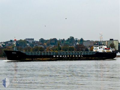
ABERDEEN
General Cargo
Current Trip
ITSAT
| Time Travelled | 4 days |
|---|---|
| Remaining Time | --- |
| Distance Travelled | 612.47 nm |
| Remaining Distance | --- |
| AVG Speed | 10 Knop |
| MAX Speed | 17.3 Knop |
| AVG Wind | 7.6 knots |
| MAX Wind | 24.9 knots |
| MIN Temp | 13.6°C / 56.48°F |
| MAX Temp | 22.3°C / 72.14°F |
| Djupgående | 3.3 m |
| Position mottagen | 1 d sen |
Current Position
| Longitud | 22.84419° |
|---|---|
| Latitude | 36.41948° |
| Status | Under way using engine |
| Fart | 9.3 Knop |
| Kurs | 254.2° |
| Område | Mediterranean Sea - Eastern Basin |
| Station | T-AIS |
| Position mottagen | 1 d sen |
Info
Information
The current position of ABERDEEN is in Mediterranean Sea - Eastern Basin with coordinates 36.41948° / 22.84419° as reported on 2024-04-17 04:50 by AIS to our vessel tracker app. The vessel's current speed is 9.3 Knop
The vessel ABERDEEN (IMO: 9313723, MMSI: 253612000) is a General Cargo that was built in 2009 ( 15 År gammal ). It's sailing under the flag of [LU] Luxembourg.
In this page you can find informations about the vessels current position, last detected port calls, and current voyage information. If the vessels is not in coverage by AIS you will find the latest position.
The current position of ABERDEEN is detected by our AIS receivers and we are not responsible for the reliability of the data. The last position was recorded while the vessel was in Coverage by the Ais receivers of our vessel tracking app.
The current draught of ABERDEEN as reported by AIS is 3.3 meters
Weather
| Temperature | 17°C / 62.6°F |
|---|---|
| Wind Speed | 17 knots |
| Direction | 310° NW |
| Pressure | 1008.6 hPa |
| Humidity | 65.8 % |
| Cloud Coverage | --- |
Featured Company
Last Port Calls
| Port | Arrival | Departure | Time In Port |
|---|---|---|---|
| 2024-03-09 06:14 | 2024-04-14 11:21 | ||
| 2024-03-02 06:39 | 2024-03-03 11:28 | 1 d | |
| 2024-02-21 22:10 | 2024-02-22 11:52 | 13 h | |
| 2024-02-15 06:07 | 2024-02-15 07:35 | 1 h | |
| 2024-02-14 23:18 | 2024-02-15 04:20 | 5 h | |
| 2024-02-10 16:11 | 2024-02-12 12:41 | 1 d | |
| 2024-02-09 03:13 | 2024-02-09 18:49 | 15 h | |
| 2024-02-05 04:48 | 2024-02-08 00:17 | 2 d | |
| 2024-02-01 14:22 | 2024-02-03 10:54 | 1 d |
Last Trips
| Origin | Departure | Destination | Arrival | Distance | |
|---|---|---|---|---|---|
| 2024-03-03 14:28 | 2024-03-09 08:14 | 330.43 nm | |||
| 2024-02-22 12:52 | 2024-03-02 09:39 | 1826.88 nm | |||
| 2024-02-15 08:35 | 2024-02-21 23:10 | 1411.99 nm | |||
| 2024-02-15 05:20 | 2024-02-15 07:07 | 8.66 nm | |||
| 2024-02-12 13:41 | 2024-02-15 00:18 | 102.68 nm | |||
| 2024-02-09 19:49 | 2024-02-10 17:11 | 115.49 nm | |||
| 2024-02-08 00:17 | 2024-02-09 04:13 | 201.29 nm | |||
| 2024-02-03 11:54 | 2024-02-05 04:48 | 201.42 nm | |||
| 2024-01-30 23:46 | 2024-02-01 15:22 | 195.99 nm |
Events
| Tid | Event | Detaljer | Position / Dest | Information |
|---|---|---|---|---|
| 2024-04-17 04:54 | Status ändrad | Default Under way using engine |
36.41661 / 22.83129
ITSAT
|
Fart: 9.3 kn Kurs: 254.2° |
| 2024-04-17 04:50 | UTANFÖR täckningsområde |
36.41948 / 22.84419
Mediterranean Sea - Eastern Basin
ITSAT
|
Fart: 9.3 kn Kurs: 254.2° |
|
| 2024-04-17 04:46 | Status ändrad | Under way using engine Default |
36.42167 / 22.85452
ITSAT
|
Fart: 9.2 kn Kurs: 255° |
| 2024-04-17 04:39 | Status ändrad | Default Under way using engine |
36.42688 / 22.87814
ITSAT
|
Fart: 9.2 kn Kurs: 254.8° |
| 2024-04-17 04:32 | Status ändrad | Under way using engine Default |
36.43165 / 22.89964
ITSAT
|
Fart: 9.1 kn Kurs: 254° |
| 2024-04-17 04:23 | Status ändrad | Default Under way using engine |
36.43835 / 22.92734
ITSAT
|
Fart: 9 kn Kurs: 255.6° |
| 2024-04-17 04:19 | Status ändrad | Under way using engine Default |
36.44081 / 22.93885
ITSAT
|
Fart: 9 kn Kurs: 286° |
| 2024-04-17 03:44 | Status ändrad | Default Under way using engine |
36.41750 / 23.04279
ITSAT
|
Fart: 9.1 kn Kurs: 287.3° |
| 2024-04-17 03:34 | Byter havsområde | Greek part of the Mediterranean Sea - Eastern Basin Greek part of the Aegean Sea |
36.41053 / 23.07206
Mediterranean Sea - Eastern Basin
ITSAT
|
Fart: 9.1 kn Kurs: 284.4° |
| 2024-04-17 03:02 | Status ändrad | Under way using engine Default |
36.41041 / 23.17322
ITSAT
|
Fart: 9.1 kn Kurs: 265° |