
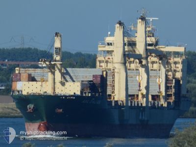
AAL DALIAN
General Cargo
Current Trip
| Time Travelled | 3 days |
|---|---|
| Remaining Time | --- |
| Distance Travelled | 953.59 nm |
| Remaining Distance | --- |
| AVG Speed | 10.7 Knop |
| MAX Speed | 16.4 Knop |
| AVG Wind | 8 knots |
| MAX Wind | 16 knots |
| MIN Temp | 25.4°C / 77.72°F |
| MAX Temp | 29.8°C / 85.64°F |
| Djupgående | 9.1 m |
| Position mottagen | 7 h, 50 m sen |
Current Position
| Longitud | 103.49985° |
|---|---|
| Latitude | 1.21998° |
| Status | Under way using engine |
| Fart | 15.5 Knop |
| Kurs | 282.7° |
| Område | Singapore Strait |
| Station | T-AIS |
| Position mottagen | 7 h, 50 m sen |
Info
Information
The current position of AAL DALIAN is in Singapore Strait with coordinates 1.21998° / 103.49985° as reported on 2024-04-15 20:49 by AIS to our vessel tracker app. The vessel's current speed is 15.5 Knop and is heading at the port of BEAUMONT. The estimated time of arrival as calculated by MyShipTracking vessel tracking app is 2024-05-24 06:00 LT
The vessel AAL DALIAN (IMO: 9498470, MMSI: 636018145) is a General Cargo that was built in 2013 ( 11 År gammal ). It's sailing under the flag of [LR] Liberia.
In this page you can find informations about the vessels current position, last detected port calls, and current voyage information. If the vessels is not in coverage by AIS you will find the latest position.
The current position of AAL DALIAN is detected by our AIS receivers and we are not responsible for the reliability of the data. The last position was recorded while the vessel was in Coverage by the Ais receivers of our vessel tracking app.
The current draught of AAL DALIAN as reported by AIS is 9.1 meters
Weather
| Temperature | 29.2°C / 84.56°F |
|---|---|
| Wind Speed | 6 knots |
| Direction | 93° E |
| Pressure | 1010.1 hPa |
| Humidity | 72.9 % |
| Cloud Coverage | 100 % |
Featured Company
Last Port Calls
| Port | Arrival | Departure | Time In Port |
|---|---|---|---|
| 2024-04-11 06:16 | 2024-04-12 16:38 | 1 d | |
| 2024-04-06 08:05 | 2024-04-08 21:53 | 2 d | |
| 2024-03-24 11:19 | 2024-03-28 00:39 | 3 d | |
| 2024-03-02 18:42 | 2024-03-03 03:34 | 8 h | |
| 2024-03-01 11:27 | 2024-03-02 18:34 | 1 d | |
| 2024-02-14 06:41 | 2024-02-17 13:22 | 3 d | |
| 2024-02-10 15:13 | 2024-02-12 08:33 | 1 d | |
| 2024-02-04 12:13 | 2024-02-07 09:10 | 2 d | |
| 2024-02-02 19:57 |
Most Visited Ports (Last year)
| Port | Arrivals | |
|---|---|---|
| 6 | ||
| 2 | ||
| 2 | ||
| 2 | ||
| 1 | ||
| 1 |
Last Trips
| Origin | Departure | Destination | Arrival | Distance | |
|---|---|---|---|---|---|
| 2024-04-09 04:53 | 2024-04-11 13:16 | 14.91 nm | |||
| 2024-03-28 08:39 | 2024-04-06 15:05 | 1717.96 nm | |||
| 2024-03-03 11:34 | 2024-03-24 19:19 | 1658.48 nm | |||
| 2024-03-03 02:34 | 2024-03-03 02:42 | 0.44 nm | |||
| 2024-02-17 23:22 | 2024-03-01 19:27 | 4174.93 nm | |||
| 2024-02-12 19:33 | 2024-02-14 16:41 | 584.56 nm | |||
| 2024-02-07 19:40 | 2024-02-11 02:13 | 976.09 nm | |||
| 2024-02-03 06:57 | 2024-02-04 22:43 | 556.69 nm |
Events
| Tid | Event | Detaljer | Position / Dest | Information |
|---|---|---|---|---|
| 2024-04-15 20:55 | Status ändrad | Default Under way using engine |
1.22758 / 103.47144
US BPT
|
Fart: 15.5 kn Kurs: 282.7° |
| 2024-04-15 20:49 | UTANFÖR täckningsområde |
1.21998 / 103.49985
Singapore Strait
|
Fart: 15.5 kn Kurs: 282.7° |
|
| 2024-04-15 20:28 | Byter havsområde | Malaysian part of the Singapore Strait Indonesian part of the Singapore Strait |
1.20258 / 103.58276
Singapore Strait
|
Fart: 15.2 kn Kurs: 283.4° |
| 2024-04-15 20:11 | Byter havsområde | Indonesian part of the Singapore Strait Singaporean part of the Singapore Strait |
1.18969 / 103.65572
Singapore Strait
|
Fart: 14.7 kn Kurs: 291.8° |
| 2024-04-15 20:08 | Byter havsområde | Singaporean part of the Singapore Strait Indonesian part of the Singapore Strait |
1.18349 / 103.66616
Singapore Strait
|
Fart: 14.9 kn Kurs: 309.4° |
| 2024-04-15 19:50 | Byter havsområde | Indonesian part of the Singapore Strait Singaporean part of the Singapore Strait |
1.13981 / 103.72425
Singapore Strait
|
Fart: 14.3 kn Kurs: 286.7° |
| 2024-04-15 18:38 | STARTAR förflyttning | 0.56 nm, East of SINGAPORE |
1.25836 / 103.86387
US BPT
|
Fart: 3.1 kn Kurs: 230° |
| 2024-04-15 18:22 | Status ändrad | Under way using engine At anchor |
1.26113 / 103.86912
US BPT
|
Fart: 1.8 kn Kurs: 57° |
| 2024-04-15 17:54 | Status ändrad | At anchor Default |
1.26084 / 103.86985
US BPT
|
Fart: 0.1 kn Kurs: 46° |
| 2024-04-15 17:51 | Status ändrad | Default At anchor |
1.26081 / 103.86987
US BPT
|
Fart: Kurs: 44° |