
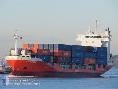
A2B FUTURE
Container Ship
Current Trip
| Time Travelled | 8 h, 33 mins |
|---|---|
| Remaining Time | 5 h, 26 mins |
| Distance Travelled | 102.35 nm |
| Remaining Distance | 64.01 nm |
| AVG Speed | 12.6 Knop |
| MAX Speed | 15.5 Knop |
| AVG Wind | 15.9 knots |
| MAX Wind | 18.5 knots |
| MIN Temp | 7.5°C / 45.5°F |
| MAX Temp | 8.6°C / 47.48°F |
| Djupgående | 5.2 m |
| Position mottagen | 1 m sen |
Current Position
| Longitud | 3.28371° |
|---|---|
| Latitude | 51.90854° |
| Status | Under way using engine |
| Fart | 11.3 Knop |
| Kurs | 74.4° |
| Område | North Sea |
| Station | T-AIS |
| Position mottagen | 1 m sen |
Info
Information
The current position of A2B FUTURE is in North Sea with coordinates 51.90854° / 3.28371° as reported on 2024-04-25 00:04 by AIS to our vessel tracker app. The vessel's current speed is 11.3 Knop and is heading at the port of MOERDIJK. The estimated time of arrival as calculated by MyShipTracking vessel tracking app is 2024-04-25 05:31 LT
The vessel A2B FUTURE (IMO: 9122241, MMSI: 244870287) is a Container Ship that was built in 1995 ( 29 År gammal ). It's sailing under the flag of [NL] Netherlands.
In this page you can find informations about the vessels current position, last detected port calls, and current voyage information. If the vessels is not in coverage by AIS you will find the latest position.
The current position of A2B FUTURE is detected by our AIS receivers and we are not responsible for the reliability of the data. The last position was recorded while the vessel was in Coverage by the Ais receivers of our vessel tracking app.
The current draught of A2B FUTURE as reported by AIS is 5.2 meters
Weather
| Temperature | 7.5°C / 45.5°F |
|---|---|
| Wind Speed | 13 knots |
| Direction | 330° NNW |
| Pressure | 1009.7 hPa |
| Humidity | 64.1 % |
| Cloud Coverage | 85 % |
Featured Company
Last Port Calls
| Port | Arrival | Departure | Time In Port |
|---|---|---|---|
| 2024-04-24 08:01 | 2024-04-24 15:32 | 7 h | |
| 2024-04-24 07:50 | 2024-04-24 07:52 | 2 m | |
| 2024-04-23 05:27 | 2024-04-23 17:22 | 11 h | |
| 2024-04-22 06:29 | 2024-04-22 13:36 | 7 h | |
| 2024-04-22 06:18 | 2024-04-22 06:21 | 2 m | |
| 2024-04-21 04:19 | 2024-04-21 16:04 | 11 h | |
| 2024-04-20 09:10 | 2024-04-20 13:53 | 4 h | |
| 2024-04-19 04:29 | 2024-04-19 19:29 | 14 h | |
| 2024-04-18 07:28 | 2024-04-18 14:58 | 7 h | |
| 2024-04-17 08:36 | 2024-04-17 17:05 | 8 h |
Most Visited Ports (Last year)
| Port | Arrivals | |
|---|---|---|
| 184 | ||
| 145 | ||
| 4 | ||
| 2 | ||
| 1 | ||
| 1 |
Last Trips
| Origin | Departure | Destination | Arrival | Distance | |
|---|---|---|---|---|---|
| 2024-04-24 08:52 | 2024-04-24 09:01 | 0.45 nm | |||
| 2024-04-23 19:22 | 2024-04-24 08:50 | 168.26 nm | |||
| 2024-04-22 14:36 | 2024-04-23 07:27 | 165.71 nm | |||
| 2024-04-22 07:21 | 2024-04-22 07:29 | 0.78 nm | |||
| 2024-04-21 18:04 | 2024-04-22 07:18 | 167.79 nm | |||
| 2024-04-20 14:53 | 2024-04-21 06:19 | 165.78 nm | |||
| 2024-04-19 21:29 | 2024-04-20 10:10 | 169.03 nm | |||
| 2024-04-18 15:58 | 2024-04-19 06:29 | 165.93 nm | |||
| 2024-04-17 19:05 | 2024-04-18 08:28 | 166.83 nm | |||
| 2024-04-16 21:36 | 2024-04-17 10:36 | 165.75 nm |
Events
| Tid | Event | Detaljer | Position / Dest | Information |
|---|---|---|---|---|
| 2024-04-24 21:50 | Byter havsområde | Dutch part of the North Sea Belgian part of the North Sea |
51.83014 / 2.61307
North Sea
NLMOE
|
Fart: 11.1 kn Kurs: 89.7° |
| 2024-04-24 21:29 | Byter havsområde | Belgian part of the North Sea United Kingdom part of the North Sea |
51.83188 / 2.50574
North Sea
NLMOE
|
Fart: 12 kn Kurs: 90.7° |
| 2024-04-24 19:32 | STARTAR förflyttning |
51.65458 / 1.98204
NLMOE
|
Fart: 12.1 kn Kurs: 55° |
|
| 2024-04-24 19:31 | STOPPAR förflyttning |
51.65332 / 1.97904
NLMOE
|
Fart: Kurs: 0° |
|
| 2024-04-24 17:40 | STARTAR förflyttning | 10.03 nm, North of RAMSGATE |
51.48939 / 1.47411
NLMOE
|
Fart: 12.5 kn Kurs: 83.7° |
| 2024-04-24 17:39 | STOPPAR förflyttning | 9.99 nm, North of RAMSGATE |
51.48914 / 1.47042
NLMOE
|
Fart: Kurs: 0° |
| 2024-04-24 16:11 | STARTAR förflyttning | 7.35 nm, North of WHITSTABLE |
51.47754 / .95164
NLMOE
|
Fart: 14.1 kn Kurs: 81.4° |
| 2024-04-24 16:11 | STOPPAR förflyttning | 7.39 nm, North West of WHITSTABLE |
51.47711 / .94740
NLMOE
|
Fart: Kurs: 0° |
| 2024-04-24 15:32 | STARTAR förflyttning | 0.96 nm, South West of SHEERNESS |
51.43165 / .71944
NLMOE
|
Fart: 12.4 kn Kurs: 65° |
| 2024-04-24 15:32 | AVGÅTT HAMN |
|
51.43165 / .71944
NLMOE
|
Fart: 12.3 kn Kurs: 65° |