
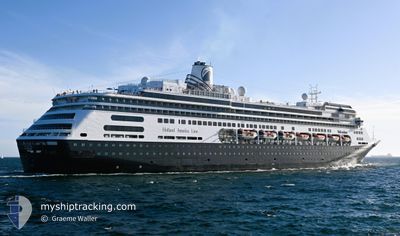
VOLENDAM
Passengers Ship
Current Trip
| Time Travelled | 16 h, 24 mins |
|---|---|
| Remaining Time | --- |
| Distance Travelled | 257.17 морская миля |
| Remaining Distance | --- |
| AVG Speed | 14 Узлы |
| MAX Speed | 18.5 Узлы |
| AVG Wind | 14.8 knots |
| MAX Wind | 18.3 knots |
| MIN Temp | 27°C / 80.6°F |
| MAX Temp | 28.6°C / 83.48°F |
| Осадка | 8.1 м |
| Позиция Получена | 12 h, 18 m тому назад |
Current Position
| Долгота | -75.65194° |
|---|---|
| Широта | 11.02910° |
| Статус | Under way using engine |
| Скорость | 13.7 Узлы |
| Курс | 7.2° |
| Район | Caribbean Sea |
| Станция | T-AIS |
| Позиция Получена | 12 h, 18 m тому назад |
Info
Information
The current position of VOLENDAM is in Caribbean Sea with coordinates 11.02910° / -75.65194° as reported on 2024-04-18 03:23 by AIS to our vessel tracker app. The vessel's current speed is 13.7 Узлы and is heading at the port of HALF MOON CAY. The estimated time of arrival as calculated by MyShipTracking vessel tracking app is 2024-04-20 10:00 LT
The vessel VOLENDAM (IMO: 9156515, MMSI: 245968000) is a Passengers Ship that was built in 1999 ( 25 лет ). It's sailing under the flag of [NL] Netherlands.
In this page you can find informations about the vessels current position, last detected port calls, and current voyage information. If the vessels is not in coverage by AIS you will find the latest position.
The current position of VOLENDAM is detected by our AIS receivers and we are not responsible for the reliability of the data. The last position was recorded while the vessel was in Coverage by the Ais receivers of our vessel tracking app.
The current draught of VOLENDAM as reported by AIS is 8.1 meters
Weather
| Temperature | 27.5°C / 81.5°F |
|---|---|
| Wind Speed | 13 knots |
| Direction | 88° E |
| Pressure | 1013 hPa |
| Humidity | 79.7 % |
| Cloud Coverage | 17 % |
Featured Company
Last Port Calls
| Port | Arrival | Departure | Time In Port |
|---|---|---|---|
| 2024-04-17 14:09 | 2024-04-17 23:17 | 9 h | |
| 2024-04-14 13:10 | 2024-04-15 00:57 | 11 h | |
| 2024-04-12 15:21 | 2024-04-13 00:27 | 9 h | |
| 2024-04-11 13:04 | 2024-04-11 20:08 | 7 h | |
| 2024-04-09 13:12 | 2024-04-09 21:20 | 8 h | |
| 2024-04-06 13:19 | 2024-04-07 00:39 | 11 h | |
| 2024-03-18 00:52 | 2024-03-18 03:59 | 3 h | |
| 2024-03-12 16:26 | 2024-03-14 05:55 | 1 d | |
| 2024-03-11 20:27 | 2024-03-12 04:40 | 8 h | |
| 2024-03-10 18:22 | 2024-03-11 03:53 | 9 h |
Last Trips
| Origin | Departure | Destination | Arrival | Distance | |
|---|---|---|---|---|---|
| 2024-04-14 18:57 | 2024-04-17 09:09 | 825.35 морская миля | |||
| 2024-04-12 18:27 | 2024-04-14 07:10 | 470.27 морская миля | |||
| 2024-04-11 15:08 | 2024-04-12 09:21 | 342.00 морская миля | |||
| 2024-04-09 16:20 | 2024-04-11 08:04 | 717.22 морская миля | |||
| 2024-04-06 17:39 | 2024-04-09 08:12 | 1050.82 морская миля | |||
| 2024-03-18 16:59 | 2024-04-06 06:19 | 5411.97 морская миля | |||
| 2024-03-14 18:55 | 2024-03-18 13:52 | 1172.09 морская миля | |||
| 2024-03-12 17:40 | 2024-03-13 05:26 | 156.67 морская миля | |||
| 2024-03-11 16:53 | 2024-03-12 09:27 | 295.48 морская миля | |||
| 2024-03-10 17:10 | 2024-03-11 07:22 | 218.50 морская миля |
Events
| Время | Событие | Детали | Позиция / Направление | Информация |
|---|---|---|---|---|
| 2024-04-18 03:26 | Статус изменился | Default Under way using engine |
11.04110 / -75.65026
CO CTG > BS HMC
|
Скорость: 13.7 kn Курс: 7.2° |
| 2024-04-18 03:23 | Статус изменился | Under way using engine Default |
11.02910 / -75.65194
CO CTG > BS HMC
|
Скорость: 13 kn Курс: 7° |
| 2024-04-18 03:23 | Вне покрытия |
11.02910 / -75.65194
Caribbean Sea
CO CTG > BS HMC
|
Скорость: 13.7 kn Курс: 7.2° |
|
| 2024-04-18 03:03 | Статус изменился | Default Under way using engine |
10.95333 / -75.66167
CO CTG > BS HMC
|
Скорость: 13.8 kn Курс: 7.7° |
| 2024-04-18 03:00 | Статус изменился | Under way using engine Default |
10.94304 / -75.66353
CO CTG > BS HMC
|
Скорость: 13 kn Курс: 6° |
| 2024-04-18 02:48 | Статус изменился | Default Under way using engine |
10.89500 / -75.66833
CO CTG > BS HMC
|
Скорость: 13.8 kn Курс: 7° |
| 2024-04-18 02:46 | Статус изменился | Under way using engine Default |
10.88946 / -75.67008
CO CTG > BS HMC
|
Скорость: 13 kn Курс: 6° |
| 2024-04-18 02:26 | Статус изменился | Default Under way using engine |
10.81044 / -75.67969
CO CTG > BS HMC
|
Скорость: 14.1 kn Курс: 8.4° |
| 2024-04-18 02:08 | Статус изменился | Under way using engine Default |
10.74233 / -75.68961
CO CTG > BS HMC
|
Скорость: 13.9 kn Курс: 9° |
| 2024-04-18 02:03 | Статус изменился | Default Under way using engine |
10.72030 / -75.69295
CO CTG > BS HMC
|
Скорость: 14 kn Курс: 9.3° |