
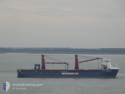
UHL FLAIR
Cargo
Current Trip
| Trip Time | 1 day |
|---|---|
| Trip Distance | 290.98 морская миля |
| AVG Speed | 11.7 Узлы |
| MAX Speed | 14.6 Узлы |
| Осадка | 6.7 м |
| AVG Wind | 12.5 knots |
| MAX Wind | 18 knots |
| MIN Temp | -4.7°C / 23.54°F |
| MAX Temp | 0.9°C / 33.62°F |
| Позиция Получена | 2 d тому назад |
Current Position
| Долгота | 20.73569° |
|---|---|
| Широта | 63.53255° |
| Статус | Under way using engine |
| Скорость | 13.9 Узлы |
| Курс | 40.5° |
| Район | Gulf of Bothnia |
| Станция | T-AIS |
| Позиция Получена | 2 d тому назад |
Info
Information
The current position of UHL FLAIR is in Gulf of Bothnia with coordinates 63.53255° / 20.73569° as reported on 2024-04-17 01:22 by AIS to our vessel tracker app. The vessel's current speed is 13.9 Узлы and is currently inside the port of AJOS.
The vessel UHL FLAIR (IMO: 9897133, MMSI: 255806359) is a Cargo It's sailing under the flag of [PT] Portugal.
In this page you can find informations about the vessels current position, last detected port calls, and current voyage information. If the vessels is not in coverage by AIS you will find the latest position.
The current position of UHL FLAIR is detected by our AIS receivers and we are not responsible for the reliability of the data. The last position was recorded while the vessel was in Coverage by the Ais receivers of our vessel tracking app.
The current draught of UHL FLAIR as reported by AIS is 6.7 meters
Weather
| Temperature | -11°C / 12.2°F |
|---|---|
| Wind Speed | 5 knots |
| Direction | 91° E |
| Pressure | 1018.3 hPa |
| Humidity | 92.8 % |
| Cloud Coverage | 76 % |
Featured Company
Last Port Calls
| Port | Arrival | Departure | Time In Port |
|---|---|---|---|
| 2024-04-17 21:41 | |||
| 2024-04-15 14:07 | 2024-04-16 18:32 | 1 d | |
| 2024-03-31 18:08 | 2024-04-01 02:33 | 8 h | |
| 2024-02-19 05:49 | 2024-02-27 01:50 | 7 d | |
| 2024-02-14 17:41 | 2024-02-17 02:11 | 2 d | |
| 2024-02-04 14:45 |
Most Visited Ports (Last year)
| Port | Arrivals | |
|---|---|---|
| 2 | ||
| 2 | ||
| 1 | ||
| 1 | ||
| 1 | ||
| 1 |
Last Trips
| Origin | Departure | Destination | Arrival | Distance | |
|---|---|---|---|---|---|
| 2024-04-16 21:32 | 2024-04-18 00:41 | 290.98 морская миля | |||
| 2024-04-01 03:33 | 2024-04-15 17:07 | 2839.60 морская миля | |||
| 2024-02-27 07:20 | 2024-03-31 19:08 | 9064.42 морская миля | |||
| 2024-02-17 07:41 | 2024-02-19 11:19 | 6.34 морская миля | |||
| 2024-02-04 16:45 | 2024-02-14 23:11 | 3603.81 морская миля |
Events
| Время | Событие | Детали | Позиция / Направление | Информация |
|---|---|---|---|---|
| 2024-04-17 22:05 | Окончание движения |
65.66609 / 24.51456
[FI] AJOS
|
Скорость: 0.2 kn Курс: 64° |
|
| 2024-04-17 21:41 | Порт |
|
65.65494 / 24.50837
[FI] AJOS
|
Скорость: 3.6 kn Курс: 13° |
| 2024-04-17 16:25 | Начало движения |
65.16363 / 24.61622
FI KEM
|
Скорость: 4.6 kn Курс: 143° |
|
| 2024-04-17 15:53 | Окончание движения |
65.16869 / 24.60709
FI KEM
|
Скорость: Курс: 143° |
|
| 2024-04-17 15:11 | Начало движения |
65.16696 / 24.42197
FI KEM
|
Скорость: 6 kn Курс: 58° |
|
| 2024-04-17 14:49 | Окончание движения |
65.16387 / 24.40966
FI KEM
|
Скорость: Курс: 57° |
|
| 2024-04-17 01:28 | Статус изменился | Default Under way using engine |
63.54184 / 20.77698
FI KEM
|
Скорость: 13.9 kn Курс: 40.5° |
| 2024-04-17 01:22 | Вне покрытия |
63.53255 / 20.73569
Gulf of Bothnia
FI KEM
|
Скорость: 13.9 kn Курс: 40.5° |
|
| 2024-04-17 01:22 | Статус изменился | Under way using engine Default |
63.53220 / 20.73502
FI KEM
|
Скорость: 14.2 kn Курс: 27° |
| 2024-04-17 01:16 | Статус изменился | Default Under way using engine |
63.50984 / 20.70776
FI KEM
|
Скорость: 14.1 kn Курс: 28.1° |