
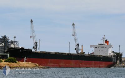
TWINKLE ISLAND
Bulk Carrier
Current Trip
| Time Travelled | 36 days |
|---|---|
| Remaining Time | 2 h, 52 mins |
| Distance Travelled | 9672.16 морская миля |
| Remaining Distance | 20.25 морская миля |
| AVG Speed | 10.9 Узлы |
| MAX Speed | 14.2 Узлы |
| AVG Wind | 13.6 knots |
| MAX Wind | 31.7 knots |
| MIN Temp | 14.9°C / 58.82°F |
| MAX Temp | 30.4°C / 86.72°F |
| Осадка | 13.5 м |
| Позиция Получена | 2 m тому назад |
Current Position
| Долгота | 103.49315° |
|---|---|
| Широта | 1.13703° |
| Статус | Under way using engine |
| Скорость | 6.4 Узлы |
| Курс | 126.9° |
| Район | Singapore Strait |
| Станция | T-AIS |
| Позиция Получена | 2 m тому назад |
Info
Information
The current position of TWINKLE ISLAND is in Singapore Strait with coordinates 1.13703° / 103.49315° as reported on 2024-04-24 20:54 by AIS to our vessel tracker app. The vessel's current speed is 6.4 Узлы and is heading at the port of SINGAPORE. The estimated time of arrival as calculated by MyShipTracking vessel tracking app is 2024-04-24 23:48 LT
The vessel TWINKLE ISLAND (IMO: 9512367, MMSI: 538004652) is a Bulk Carrier that was built in 2012 ( 12 лет ). It's sailing under the flag of [MH] Marshall Is.
In this page you can find informations about the vessels current position, last detected port calls, and current voyage information. If the vessels is not in coverage by AIS you will find the latest position.
The current position of TWINKLE ISLAND is detected by our AIS receivers and we are not responsible for the reliability of the data. The last position was recorded while the vessel was in Coverage by the Ais receivers of our vessel tracking app.
The current draught of TWINKLE ISLAND as reported by AIS is 13.5 meters
Weather
| Temperature | 29°C / 84.2°F |
|---|---|
| Wind Speed | 7 knots |
| Direction | 73° ENE |
| Pressure | 1005.8 hPa |
| Humidity | 80.8 % |
| Cloud Coverage | 27 % |
Featured Company
Last Port Calls
| Port | Arrival | Departure | Time In Port |
|---|---|---|---|
| 2024-03-19 15:53 | |||
| 2024-02-20 16:37 | 2024-02-29 11:34 | 8 d |
Last Trips
| Origin | Departure | Destination | Arrival | Distance | |
|---|---|---|---|---|---|
| 2024-01-14 13:37 | 2024-02-20 13:37 | 8215.59 морская миля |
Events
| Время | Событие | Детали | Позиция / Направление | Информация |
|---|---|---|---|---|
| 2024-04-24 20:33 | Осадка изменилась | 13.5 10.5 |
1.15831 / 103.46144
SGSIN
|
Скорость: 6.6 kn Курс: 118.3° |
| 2024-04-24 20:33 | Пункт назначения изменился | SGSIN ARBHI |
1.15831 / 103.46144
SGSIN
|
Скорость: 6.6 kn Курс: 118.3° |
| 2024-04-24 20:33 | ETA изменился | 2024/04/25 02:30 2024/03/15 02:00 |
1.15831 / 103.46144
SGSIN
|
Скорость: 6.6 kn Курс: 118.3° |
| 2024-04-24 20:26 | Статус изменился | Under way using engine Default |
1.16459 / 103.44996
ARBHI
|
Скорость: 6.6 kn Курс: 119° |
| 2024-04-24 20:24 | Статус изменился | Default Under way using engine |
1.16580 / 103.44781
ARBHI
|
Скорость: 6.6 kn Курс: 118.8° |
| 2024-04-24 20:16 | Изменение морского района | Indonesian part of the Singapore Strait Indonesian part of the Malacca Strait |
1.17368 / 103.43391
Singapore Strait
|
Скорость: 6.6 kn Курс: 119.2° |
| 2024-04-24 20:16 | В покрытии |
1.17368 / 103.43391
Singapore Strait
|
Скорость: 6.6 kn Курс: 119.2° |
|
| 2024-04-24 20:14 | Статус изменился | Under way using engine Default |
1.17531 / 103.43094
ARBHI
|
Скорость: 6.6 kn Курс: 119° |
| 2024-04-23 22:55 | Статус изменился | Default Under way using engine |
3.28339 / 100.46415
ARBHI
|
Скорость: 11.2 kn Курс: 135.9° |
| 2024-04-23 22:50 | Вне покрытия |
3.29561 / 100.45546
Malacca Strait
|
Скорость: 11.2 kn Курс: 135.9° |