
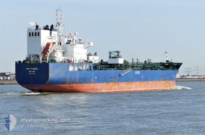
TRF MANDAL
Tanker B
Current Trip
US SW PASS
| Time Travelled | 1 day |
|---|---|
| Remaining Time | --- |
| Distance Travelled | 427.29 морская миля |
| Remaining Distance | --- |
| AVG Speed | 11.1 Узлы |
| MAX Speed | 13.3 Узлы |
| AVG Wind | 12.7 knots |
| MAX Wind | 18 knots |
| MIN Temp | 17.5°C / 63.5°F |
| MAX Temp | 24.6°C / 76.28°F |
| Осадка | 8.6 м |
| Позиция Получена | 1 d тому назад |
Current Position
| Долгота | -94.72913° |
|---|---|
| Широта | 29.34429° |
| Статус | Under way using engine |
| Скорость | 13.1 Узлы |
| Курс | 86.1° |
| Район | Gulf of Mexico |
| Станция | T-AIS |
| Позиция Получена | 1 d тому назад |
Info
Information
The current position of TRF MANDAL is in Gulf of Mexico with coordinates 29.34429° / -94.72913° as reported on 2024-04-22 05:49 by AIS to our vessel tracker app. The vessel's current speed is 13.1 Узлы
The vessel TRF MANDAL (IMO: 9732773, MMSI: 538006542) is a Tanker B It's sailing under the flag of [MH] Marshall Is.
In this page you can find informations about the vessels current position, last detected port calls, and current voyage information. If the vessels is not in coverage by AIS you will find the latest position.
The current position of TRF MANDAL is detected by our AIS receivers and we are not responsible for the reliability of the data. The last position was recorded while the vessel was in Coverage by the Ais receivers of our vessel tracking app.
The current draught of TRF MANDAL as reported by AIS is 8.6 meters
Weather
| Temperature | 24.4°C / 75.92°F |
|---|---|
| Wind Speed | 9 knots |
| Direction | 175° S |
| Pressure | 1018.6 hPa |
| Humidity | 41.8 % |
| Cloud Coverage | --- |
Featured Company
Last Port Calls
| Port | Arrival | Departure | Time In Port |
|---|---|---|---|
| 2024-04-18 00:59 | 2024-04-22 05:00 | 4 d | |
| 2024-03-05 21:19 | 2024-04-09 05:47 | ||
| 2024-02-06 22:25 | 2024-02-07 17:53 | 19 h |
Most Visited Ports (Last year)
| Port | Arrivals | |
|---|---|---|
| 2 | ||
| 2 | ||
| 2 | ||
| 1 | ||
| 1 | ||
| 1 |
Last Trips
| Origin | Departure | Destination | Arrival | Distance | |
|---|---|---|---|---|---|
| 2024-04-09 00:47 | 2024-04-17 19:59 | 937.50 морская миля | |||
| 2024-02-07 19:53 | 2024-03-05 15:19 | 8265.13 морская миля | |||
| 2023-12-31 14:47 | 2024-02-07 00:25 | 7891.32 морская миля |
Events
| Время | Событие | Детали | Позиция / Направление | Информация |
|---|---|---|---|---|
| 2024-04-22 12:38 | Начало движения | 18.24 nm, South East of GALVESTON |
29.14154 / -94.50591
US SW PASS
|
Скорость: 4.5 kn Курс: 89° |
| 2024-04-22 08:14 | Окончание движения | 17.92 nm, South East of GALVESTON |
29.14277 / -94.51228
US SW PASS
|
Скорость: 0.3 kn Курс: 78° |
| 2024-04-22 05:54 | Статус изменился | Default Under way using engine |
29.34350 / -94.70769
US SW PASS
|
Скорость: 13.1 kn Курс: 86.1° |
| 2024-04-22 05:49 | Вне покрытия |
29.34429 / -94.72913
Gulf of Mexico
|
Скорость: 13.1 kn Курс: 86.1° |
|
| 2024-04-22 05:18 | Статус изменился | Under way using engine Default |
29.36898 / -94.83152
US SW PASS
|
Скорость: 10.2 kn Курс: 105° |
| 2024-04-22 05:14 | Статус изменился | Default Under way using engine |
29.37205 / -94.84372
US SW PASS
|
Скорость: 9.1 kn Курс: 105.3° |
| 2024-04-22 05:00 | ПОРТ ОТПРАВЛЕНИЯ |
|
29.38063 / -94.88021
US SW PASS
|
Скорость: 7.3 kn Курс: 89° |
| 2024-04-22 04:59 | Статус изменился | Under way using engine Default |
29.37999 / -94.88362
[US] TEXAS CITY
|
Скорость: 7.6 kn Курс: 60° |
| 2024-04-22 04:54 | Статус изменился | Default Under way using engine |
29.37151 / -94.88767
[US] TEXAS CITY
|
Скорость: 6.6 kn Курс: 54° |
| 2024-04-22 04:49 | Статус изменился | Under way using engine Default |
29.36283 / -94.89093
[US] TEXAS CITY
|
Скорость: 5.9 kn Курс: 91° |