
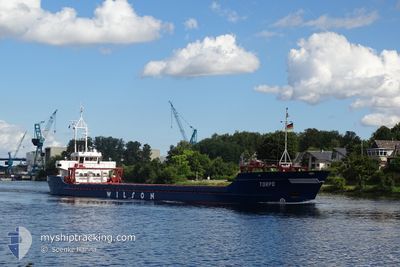
TORPO
General Cargo
Current Trip
| Time Travelled | 21 days |
|---|---|
| Remaining Time | --- |
| Distance Travelled | 3524.33 морская миля |
| Remaining Distance | --- |
| AVG Speed | 7.6 Узлы |
| MAX Speed | 12.8 Узлы |
| AVG Wind | 17.4 knots |
| MAX Wind | 43.6 knots |
| MIN Temp | 5.8°C / 42.44°F |
| MAX Temp | 19.8°C / 67.64°F |
| Осадка | 5.2 м |
| Позиция Получена | 4 m тому назад |
Current Position
| Долгота | 24.47156° |
|---|---|
| Широта | 40.92587° |
| Статус | At anchor |
| Скорость | |
| Курс | 253° |
| Район | Aegean Sea |
| Станция | T-AIS |
| Позиция Получена | 4 m тому назад |
Info
Information
The current position of TORPO is in Aegean Sea with coordinates 40.92587° / 24.47156° as reported on 2024-04-24 07:31 by AIS to our vessel tracker app. The vessel's current speed is 0 Узлы
The vessel TORPO (IMO: 8908791, MMSI: 314419000) is a General Cargo that was built in 1990 ( 34 лет ). It's sailing under the flag of [BB] Barbados.
In this page you can find informations about the vessels current position, last detected port calls, and current voyage information. If the vessels is not in coverage by AIS you will find the latest position.
The current position of TORPO is detected by our AIS receivers and we are not responsible for the reliability of the data. The last position was recorded while the vessel was in Coverage by the Ais receivers of our vessel tracking app.
The current draught of TORPO as reported by AIS is 5.2 meters
Weather
| Temperature | 17.2°C / 62.96°F |
|---|---|
| Wind Speed | 4 knots |
| Direction | 272° W |
| Pressure | 1005.4 hPa |
| Humidity | 66.4 % |
| Cloud Coverage | 22 % |
Featured Company
Last Port Calls
| Port | Arrival | Departure | Time In Port |
|---|---|---|---|
| 2024-03-30 01:52 | 2024-04-02 13:37 | 3 d | |
| 2024-03-23 05:06 | 2024-03-23 17:33 | 12 h | |
| 2024-03-07 14:42 | 2024-03-07 16:49 | 2 h | |
| 2024-03-06 06:42 | 2024-03-06 23:52 | 17 h | |
| 2024-02-20 17:29 | 2024-02-22 17:34 | 2 d | |
| 2024-02-15 19:30 | 2024-02-17 14:38 | 1 d | |
| 2024-02-09 16:13 | 2024-02-12 14:15 | 2 d | |
| 2024-02-06 04:49 | 2024-02-08 10:10 | 2 d | |
| 2024-02-01 18:32 |
Last Trips
| Origin | Departure | Destination | Arrival | Distance | |
|---|---|---|---|---|---|
| 2024-03-23 18:33 | 2024-03-30 02:52 | 1086.14 морская миля | |||
| 2024-03-07 17:49 | 2024-03-23 06:06 | 2241.32 морская миля | |||
| 2024-03-07 00:52 | 2024-03-07 15:42 | 146.79 морская миля | |||
| 2024-02-22 18:34 | 2024-03-06 07:42 | 2260.21 морская миля | |||
| 2024-02-17 15:38 | 2024-02-20 18:29 | 247.72 морская миля | |||
| 2024-02-12 15:15 | 2024-02-15 20:30 | 659.16 морская миля | |||
| 2024-02-08 11:10 | 2024-02-09 17:13 | 252.64 морская миля | |||
| 2024-02-01 19:32 | 2024-02-06 05:49 | 969.78 морская миля |
Events
| Время | Событие | Детали | Позиция / Направление | Информация |
|---|---|---|---|---|
| 2024-04-22 22:42 | Статус изменился | At anchor Under way using engine |
40.92504 / 24.47254
GR NKV
|
Скорость: 0.4 kn Курс: 316° |
| 2024-04-22 22:35 | Окончание движения | 1.37 nm, South of NEA KARVALI |
40.92498 / 24.47136
GR NKV
|
Скорость: 0.3 kn Курс: 301° |
| 2024-04-22 19:22 | Статус изменился | Under way using engine Default |
40.48604 / 24.42153
GR NKV
|
Скорость: 9.1 kn Курс: 351° |
| 2024-04-22 19:02 | В покрытии |
40.48604 / 24.42153
Aegean Sea
GR NKV
|
Скорость: 9.2 kn Курс: 351.9° |
|
| 2024-04-22 18:19 | Статус изменился | Default Under way using engine |
40.33005 / 24.45503
GR NKV
|
Скорость: 9.3 kn Курс: 351.5° |
| 2024-04-22 18:10 | Вне покрытия |
40.30743 / 24.45992
Aegean Sea
GR NKV
|
Скорость: 9.3 kn Курс: 351.5° |
|
| 2024-04-22 17:47 | Статус изменился | Under way using engine Default |
40.24753 / 24.47196
GR NKV
|
Скорость: 9.1 kn Курс: 352° |
| 2024-04-22 17:30 | Статус изменился | Default Under way using engine |
40.20427 / 24.48009
GR NKV
|
Скорость: 9 kn Курс: 351.9° |
| 2024-04-22 17:17 | Статус изменился | Under way using engine Default |
40.17188 / 24.48627
GR NKV
|
Скорость: 9.3 kn Курс: 354° |
| 2024-04-22 16:51 | Статус изменился | Default Under way using engine |
40.10643 / 24.49727
GR NKV
|
Скорость: 9.3 kn Курс: 352.3° |