
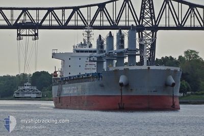
TAC SUZUKA
Cargo
Current Trip
| Time Travelled | 19 days |
|---|---|
| Remaining Time | --- |
| Distance Travelled | 4961.25 морская миля |
| Remaining Distance | --- |
| AVG Speed | 10.5 Узлы |
| MAX Speed | 13.7 Узлы |
| AVG Wind | 9.6 knots |
| MAX Wind | 27.6 knots |
| MIN Temp | 15.4°C / 59.72°F |
| MAX Temp | 30.6°C / 87.08°F |
| Осадка | 9.8 м |
| Позиция Получена | 10 h, 23 m тому назад |
Current Position
| Долгота | 0.14540° |
|---|---|
| Широта | 36.60566° |
| Статус | Under way using engine |
| Скорость | 10 Узлы |
| Курс | 75.9° |
| Район | Mediterranean Sea - Western Basin |
| Станция | T-AIS |
| Позиция Получена | 10 h, 23 m тому назад |
Info
Information
The current position of TAC SUZUKA is in Mediterranean Sea - Western Basin with coordinates 36.60566° / 0.14540° as reported on 2024-04-20 02:29 by AIS to our vessel tracker app. The vessel's current speed is 10 Узлы and is heading at the port of BATUMI. The estimated time of arrival as calculated by MyShipTracking vessel tracking app is 2024-04-30 06:00 LT
The vessel TAC SUZUKA (IMO: 9880128, MMSI: 352986134) is a Cargo It's sailing under the flag of [PA] Panama.
In this page you can find informations about the vessels current position, last detected port calls, and current voyage information. If the vessels is not in coverage by AIS you will find the latest position.
The current position of TAC SUZUKA is detected by our AIS receivers and we are not responsible for the reliability of the data. The last position was recorded while the vessel was in Coverage by the Ais receivers of our vessel tracking app.
The current draught of TAC SUZUKA as reported by AIS is 9.8 meters
Weather
| Temperature | 15.9°C / 60.62°F |
|---|---|
| Wind Speed | 17 knots |
| Direction | 69° ENE |
| Pressure | 1015 hPa |
| Humidity | 67.5 % |
| Cloud Coverage | 100 % |
Featured Company
Last Port Calls
| Port | Arrival | Departure | Time In Port |
|---|---|---|---|
| 2024-03-29 21:00 | 2024-03-31 14:06 | 1 d | |
| 2024-02-04 18:19 | 2024-02-11 11:37 | 6 d | |
| 2024-02-02 19:31 |
Most Visited Ports (Last year)
| Port | Arrivals | |
|---|---|---|
| 2 | ||
| 2 | ||
| 2 | ||
| 1 | ||
| 1 | ||
| 1 |
Last Trips
| Origin | Departure | Destination | Arrival | Distance | |
|---|---|---|---|---|---|
| 2024-02-11 06:37 | 2024-03-29 18:00 | 4716.76 морская миля | |||
| 2024-02-02 15:31 | 2024-02-04 13:19 | 538.10 морская миля |
Events
| Время | Событие | Детали | Позиция / Направление | Информация |
|---|---|---|---|---|
| 2024-04-20 02:44 | Статус изменился | Default Under way using engine |
36.62689 / .24304
GE BUS
|
Скорость: 10 kn Курс: 75.9° |
| 2024-04-20 02:29 | Вне покрытия |
36.60566 / .14540
Mediterranean Sea - Western Basin
GE BUS
|
Скорость: 10 kn Курс: 75.9° |
|
| 2024-04-19 22:00 | Статус изменился | Under way using engine Default |
36.41172 / -.67052
GE BUS
|
Скорость: 9.3 kn Курс: 73° |
| 2024-04-19 21:47 | Статус изменился | Default Under way using engine |
36.40451 / -.70226
GE BUS
|
Скорость: 9.6 kn Курс: 76.3° |
| 2024-04-19 20:46 | Статус изменился | Under way using engine Default |
36.36156 / -.90140
GE BUS
|
Скорость: 9.7 kn Курс: 76° |
| 2024-04-19 20:37 | Статус изменился | Default Under way using engine |
36.35653 / -.92639
GE BUS
|
Скорость: 9.8 kn Курс: 76.3° |
| 2024-04-19 20:28 | Статус изменился | Under way using engine Default |
36.35022 / -.95848
GE BUS
|
Скорость: 9.8 kn Курс: 76° |
| 2024-04-19 20:26 | Статус изменился | Default Under way using engine |
36.34938 / -.96285
GE BUS
|
Скорость: 9.8 kn Курс: 76.9° |
| 2024-04-19 17:41 | Обнаружено в море | Algerian part of the Mediterranean Sea - Western Basin |
36.27085 / -1.56795
Mediterranean Sea - Western Basin
GE BUS
|
Скорость: 10.7 kn Курс: 83.8° |
| 2024-04-19 16:40 | Обнаружено в море | Spanish part of the Mediterranean Sea - Western Basin |
36.24673 / -1.78538
Mediterranean Sea - Western Basin
GE BUS
|
Скорость: 10.1 kn Курс: 83.6° |