
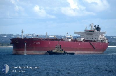
STI LAUREN
Tanker
Current Trip
MINA ABDULA
| Time Travelled | 26 days |
|---|---|
| Remaining Time | --- |
| Distance Travelled | 6709.87 морская миля |
| Remaining Distance | --- |
| AVG Speed | 12.2 Узлы |
| MAX Speed | 16.5 Узлы |
| AVG Wind | 9.1 knots |
| MAX Wind | 27.3 knots |
| MIN Temp | 7.4°C / 45.32°F |
| MAX Temp | 32.5°C / 90.5°F |
| Осадка | 9 м |
| Позиция Получена | 2 d тому назад |
Current Position
| Долгота | 54.08309° |
|---|---|
| Широта | 25.90963° |
| Статус | Under way using engine |
| Скорость | 13.4 Узлы |
| Курс | 300° |
| Район | Persian Gulf |
| Станция | T-AIS |
| Позиция Получена | 2 d тому назад |
Info
Information
The current position of STI LAUREN is in Persian Gulf with coordinates 25.90963° / 54.08309° as reported on 2024-04-22 11:35 by AIS to our vessel tracker app. The vessel's current speed is 13.4 Узлы
The vessel STI LAUREN (IMO: 9696711, MMSI: 538005512) is a Tanker It's sailing under the flag of [MH] Marshall Is.
In this page you can find informations about the vessels current position, last detected port calls, and current voyage information. If the vessels is not in coverage by AIS you will find the latest position.
The current position of STI LAUREN is detected by our AIS receivers and we are not responsible for the reliability of the data. The last position was recorded while the vessel was in Coverage by the Ais receivers of our vessel tracking app.
The current draught of STI LAUREN as reported by AIS is 9 meters
Weather
| Temperature | 29°C / 84.2°F |
|---|---|
| Wind Speed | 9 knots |
| Direction | 360° N |
| Pressure | 1002.5 hPa |
| Humidity | 38.1 % |
| Cloud Coverage | --- |
Featured Company
Events
| Время | Событие | Детали | Позиция / Направление | Информация |
|---|---|---|---|---|
| 2024-04-23 21:51 | Окончание движения | 2.08 nm, South East of SHUAIBA |
29.02667 / 48.20667
MINA ABDULA
|
Скорость: Курс: -1° |
| 2024-04-22 11:40 | Статус изменился | Default Under way using engine |
25.91987 / 54.06348
MINA ABDULA
|
Скорость: 13.4 kn Курс: 300° |
| 2024-04-22 11:35 | Вне покрытия |
25.90963 / 54.08309
Persian Gulf
MINA ABDULA
|
Скорость: 13.4 kn Курс: 300° |
|
| 2024-04-22 09:23 | Обнаружено в море | Iranian part of the Persian Gulf |
25.69162 / 54.55632
Persian Gulf
MINA ABDULA
|
Скорость: 13.1 kn Курс: 278.5° |
| 2024-04-22 02:59 | Изменение морского района | United Arab Emirates part of the Persian Gulf Omani part of the Persian Gulf |
26.19129 / 55.85803
Persian Gulf
MINA ABDULA
|
Скорость: 12.2 kn Курс: 209.6° |
| 2024-04-22 02:37 | Изменение морского района | Omani part of the Persian Gulf Omani part of the Gulf of Oman |
26.25366 / 55.89648
Persian Gulf
MINA ABDULA
|
Скорость: 12.2 kn Курс: 218.2° |
| 2024-04-22 02:37 | Статус изменился | Under way using engine Default |
26.25411 / 55.89688
MINA ABDULA
|
Скорость: 12.2 kn Курс: 218° |
| 2024-04-22 02:28 | В покрытии |
26.25366 / 55.89648
Persian Gulf
MINA ABDULA
|
Скорость: 12.2 kn Курс: 218.2° |
|
| 2024-04-21 19:26 | Статус изменился | Default Under way using engine |
25.91412 / 56.82770
MINA ABDULA
|
Скорость: 12.6 kn Курс: 350.2° |
| 2024-04-21 19:21 | Вне покрытия |
25.89861 / 56.83059
Gulf of Oman
MINA ABDULA
|
Скорость: 12.6 kn Курс: 350.2° |