
SORLANDET
Sailing Vessel
Current Trip
| Trip Time | 54 days |
|---|---|
| Trip Distance | 1639.35 морская миля |
| AVG Speed | 5.8 Узлы |
| MAX Speed | 5.8 Узлы |
| Осадка | 4.5 м |
| AVG Wind | 12 knots |
| MAX Wind | 27.3 knots |
| MIN Temp | 10.1°C / 50.18°F |
| MAX Temp | 17.8°C / 64.04°F |
| Позиция Получена | 7 m тому назад |
Current Position
| Долгота | -6.23324° |
|---|---|
| Широта | 53.34582° |
| Статус | Moored |
| Скорость | |
| Курс | 276° |
| Район | Irish Sea and St. George's Channel |
| Станция | T-AIS |
| Позиция Получена | 7 m тому назад |
Info
Information
The current position of SORLANDET is in Irish Sea and St. George's Channel with coordinates 53.34582° / -6.23324° as reported on 2024-04-18 09:40 by AIS to our vessel tracker app. The vessel's current speed is 0 Узлы and is currently inside the port of DUBLIN.
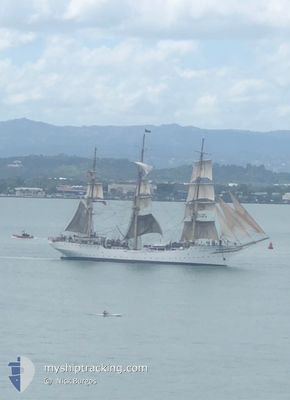
The vessel SORLANDET (IMO: 5334561, MMSI: 257165000) is a Sailing Vessel that was built in 1927 ( 97 лет ). It's sailing under the flag of [NO] Norway.
In this page you can find informations about the vessels current position, last detected port calls, and current voyage information. If the vessels is not in coverage by AIS you will find the latest position.
The current position of SORLANDET is detected by our AIS receivers and we are not responsible for the reliability of the data. The last position was recorded while the vessel was in Coverage by the Ais receivers of our vessel tracking app.
The current draught of SORLANDET as reported by AIS is 4.5 meters
Weather
| Temperature | 7.8°C / 46.04°F |
|---|---|
| Wind Speed | 6 knots |
| Direction | 258° WSW |
| Pressure | 1024.2 hPa |
| Humidity | 82.5 % |
| Cloud Coverage | 80 % |
Featured Company
Most Visited Ports (Last year)
| Port | Arrivals | |
|---|---|---|
| 11 | ||
| 4 | ||
| 3 | ||
| 2 | ||
| 1 | ||
| 1 |
Last Trips
| Origin | Departure | Destination | Arrival | Distance | |
|---|---|---|---|---|---|
| 2024-02-18 15:05 | 2024-04-12 22:02 | 1639.35 морская миля | |||
| 2024-01-26 14:17 | 2024-02-05 04:42 | 363.18 морская миля |
Events
| Время | Событие | Детали | Позиция / Направление | Информация |
|---|---|---|---|---|
| 2024-04-12 21:34 | Статус изменился | Moored Under way using engine |
53.34578 / -6.23324
[IE] DUBLIN
|
Скорость: Курс: 278° |
| 2024-04-12 21:03 | Окончание движения |
53.34603 / -6.23351
[IE] DUBLIN
|
Скорость: 0.3 kn Курс: 295° |
|
| 2024-04-12 21:02 | Порт |
|
53.34597 / -6.23330
[IE] DUBLIN
|
Скорость: 0.6 kn Курс: 289° |
| 2024-04-12 19:37 | Начало движения | 0.8 nm, East of DUN LAOGHAIRE |
53.29728 / -6.11026
NL SCE
|
Скорость: 3.3 kn Курс: 90° |
| 2024-04-12 19:14 | Статус изменился | Under way using engine At anchor |
53.29458 / -6.12038
NL SCE
|
Скорость: 1 kn Курс: 169° |
| 2024-04-11 10:08 | Статус изменился | At anchor Under way sailing |
53.29364 / -6.12151
NL SCE
|
Скорость: Курс: 219° |
| 2024-04-11 10:04 | Окончание движения | 0.55 nm, South East of DUN LAOGHAIRE |
53.29351 / -6.12137
NL SCE
|
Скорость: 0.1 kn Курс: 244° |
| 2024-04-11 01:47 | В покрытии |
52.67921 / -5.77552
Irish Sea and St. George's Channel
NL SCE
|
Скорость: 5.7 kn Курс: 4.1° |
|
| 2024-04-11 00:37 | Вне покрытия |
52.54948 / -5.82692
Irish Sea and St. George's Channel
NL SCE
|
Скорость: 8 kn Курс: 19.8° |
|
| 2024-04-10 21:52 | Изменение морского района | Irish part of the Irish Sea and St. George's Channel Irish part of the Celtic Sea |
52.09941 / -6.00017
Irish Sea and St. George's Channel
NL SCE
|
Скорость: 11.2 kn Курс: 23.5° |