
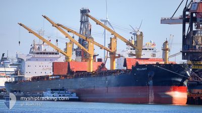
BELLIGHT
Cargo
Current Trip
BROWNSVELLE
| Time Travelled | 32 days |
|---|---|
| Remaining Time | --- |
| Distance Travelled | 8246.88 морская миля |
| Remaining Distance | --- |
| AVG Speed | 10.2 Узлы |
| MAX Speed | 14.5 Узлы |
| AVG Wind | 12.3 knots |
| MAX Wind | 28 knots |
| MIN Temp | 17.7°C / 63.86°F |
| MAX Temp | 31.8°C / 89.24°F |
| Осадка | 11.8 м |
| Позиция Получена | 8 d тому назад |
Current Position
| Долгота | 17.85413° |
|---|---|
| Широта | -34.57529° |
| Статус | Under way using engine |
| Скорость | 11.5 Узлы |
| Курс | 307.8° |
| Район | South Atlantic Ocean |
| Станция | T-AIS |
| Позиция Получена | 8 d тому назад |
Info
Information
The current position of BELLIGHT is in South Atlantic Ocean with coordinates -34.57529° / 17.85413° as reported on 2024-04-16 02:34 by AIS to our vessel tracker app. The vessel's current speed is 11.5 Узлы
The vessel BELLIGHT (IMO: 9724776, MMSI: 258491000) is a Cargo It's sailing under the flag of [NO] Norway.
In this page you can find informations about the vessels current position, last detected port calls, and current voyage information. If the vessels is not in coverage by AIS you will find the latest position.
The current position of BELLIGHT is detected by our AIS receivers and we are not responsible for the reliability of the data. The last position was recorded while the vessel was in Coverage by the Ais receivers of our vessel tracking app.
The current draught of BELLIGHT as reported by AIS is 11.8 meters
Weather
| Temperature | 26.6°C / 79.88°F |
|---|---|
| Wind Speed | 16 knots |
| Direction | 109° ESE |
| Pressure | 1015.7 hPa |
| Humidity | 75.7 % |
| Cloud Coverage | 100 % |
Featured Company
Events
| Время | Событие | Детали | Позиция / Направление | Информация |
|---|---|---|---|---|
| 2024-04-16 02:40 | Статус изменился | Default Under way using engine |
-34.56428 / 17.83557
BROWNSVELLE
|
Скорость: 11.5 kn Курс: 307.8° |
| 2024-04-16 02:34 | Вне покрытия |
-34.57529 / 17.85413
South Atlantic Ocean
BROWNSVELLE
|
Скорость: 11.5 kn Курс: 307.8° |
|
| 2024-04-16 02:08 | Статус изменился | Under way using engine Default |
-34.62123 / 17.93606
BROWNSVELLE
|
Скорость: 11 kn Курс: 304° |
| 2024-04-16 02:06 | Статус изменился | Default Under way using engine |
-34.62500 / 17.94500
BROWNSVELLE
|
Скорость: 11.5 kn Курс: 305.3° |
| 2024-04-16 01:04 | Статус изменился | Under way using engine Default |
-34.71339 / 18.15588
BROWNSVELLE
|
Скорость: 11.5 kn Курс: 289° |
| 2024-04-16 01:01 | Статус изменился | Default Under way using engine |
-34.71605 / 18.16632
BROWNSVELLE
|
Скорость: 11.5 kn Курс: 289.4° |
| 2024-04-16 00:55 | Статус изменился | Under way using engine Default |
-34.72236 / 18.19042
BROWNSVELLE
|
Скорость: 11 kn Курс: 284° |
| 2024-04-16 00:54 | Статус изменился | Default Under way using engine |
-34.72333 / 18.19500
BROWNSVELLE
|
Скорость: 11.5 kn Курс: 285° |
| 2024-04-15 23:55 | ETA изменился | 2024/05/13 17:00 2024/05/07 17:00 |
-34.77781 / 18.41229
BROWNSVELLE
|
Скорость: 11.1 kn Курс: 287.7° |
| 2024-04-15 23:36 | Статус изменился | Under way using engine Default |
-34.79405 / 18.47992
BROWNSVELLE
|
Скорость: 11 kn Курс: 288° |