
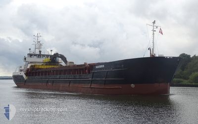
HAVBRIS
General Cargo
Current Trip
| Time Travelled | 1 day |
|---|---|
| Remaining Time | --- |
| Distance Travelled | 223.51 морская миля |
| Remaining Distance | 103.53 морская миля |
| AVG Speed | 7.9 Узлы |
| MAX Speed | 13.5 Узлы |
| AVG Wind | 8.4 knots |
| MAX Wind | 16 knots |
| MIN Temp | 0.9°C / 33.62°F |
| MAX Temp | 7.8°C / 46.04°F |
| Осадка | 3.5 м |
| Позиция Получена | 5 h, 45 m тому назад |
Current Position
| Долгота | 8.33232° |
|---|---|
| Широта | 54.00407° |
| Статус | Under way using engine |
| Скорость | 13.1 Узлы |
| Курс | 284.1° |
| Район | North Sea |
| Станция | T-AIS |
| Позиция Получена | 5 h, 45 m тому назад |
Info
Information
The current position of HAVBRIS is in North Sea with coordinates 54.00407° / 8.33232° as reported on 2024-04-25 03:26 by AIS to our vessel tracker app. The vessel's current speed is 13.1 Узлы and is heading at the port of HARLINGEN. The estimated time of arrival as calculated by MyShipTracking vessel tracking app is 2024-04-25 21:00 LT
The vessel HAVBRIS (IMO: 8800157, MMSI: 259029000) is a General Cargo that was built in 1988 ( 36 лет ). It's sailing under the flag of [NO] Norway.
In this page you can find informations about the vessels current position, last detected port calls, and current voyage information. If the vessels is not in coverage by AIS you will find the latest position.
The current position of HAVBRIS is detected by our AIS receivers and we are not responsible for the reliability of the data. The last position was recorded while the vessel was in Coverage by the Ais receivers of our vessel tracking app.
The current draught of HAVBRIS as reported by AIS is 3.5 meters
Weather
| Temperature | 7°C / 44.6°F |
|---|---|
| Wind Speed | 8 knots |
| Direction | 293° WNW |
| Pressure | 1003.5 hPa |
| Humidity | 62.4 % |
| Cloud Coverage | 100 % |
Featured Company
Last Port Calls
| Port | Arrival | Departure | Time In Port |
|---|---|---|---|
| 2024-04-23 22:08 | 2024-04-24 05:09 | 7 h | |
| 2024-04-19 07:24 | 2024-04-19 13:26 | 6 h | |
| 2024-04-18 22:31 | 2024-04-18 23:59 | 1 h | |
| 2024-04-16 09:26 | 2024-04-16 16:18 | 6 h | |
| 2024-04-15 04:26 | 2024-04-15 11:36 | 7 h | |
| 2024-04-13 13:07 | 2024-04-13 20:02 | 6 h | |
| 2024-04-12 03:49 | 2024-04-12 11:55 | 8 h | |
| 2024-04-11 04:19 | 2024-04-11 09:47 | 5 h | |
| 2024-04-09 17:19 | 2024-04-10 14:15 | 20 h | |
| 2024-04-09 00:11 | 2024-04-09 16:59 | 16 h |
Last Trips
| Origin | Departure | Destination | Arrival | Distance | |
|---|---|---|---|---|---|
| 2024-04-19 15:26 | 2024-04-24 00:08 | 848.60 морская миля | |||
| 2024-04-19 01:59 | 2024-04-19 09:24 | 71.28 морская миля | |||
| 2024-04-16 18:18 | 2024-04-19 00:31 | 444.71 морская миля | |||
| 2024-04-15 13:36 | 2024-04-16 11:26 | 193.23 морская миля | |||
| 2024-04-13 22:02 | 2024-04-15 06:26 | 225.17 морская миля | |||
| 2024-04-12 13:55 | 2024-04-13 15:07 | 210.88 морская миля | |||
| 2024-04-11 11:47 | 2024-04-12 05:49 | 140.03 морская миля | |||
| 2024-04-10 16:15 | 2024-04-11 06:19 | 108.62 морская миля | |||
| 2024-04-09 18:59 | 2024-04-09 19:19 | 1.34 морская миля | |||
| 2024-04-07 18:11 | 2024-04-09 02:11 | 143.72 морская миля |
Events
| Время | Событие | Детали | Позиция / Направление | Информация |
|---|---|---|---|---|
| 2024-04-25 03:30 | Статус изменился | Default Under way using engine |
54.00716 / 8.30820
HARLINGEN
|
Скорость: 13.1 kn Курс: 284.1° |
| 2024-04-25 03:26 | Статус изменился | Under way using engine Default |
54.00407 / 8.33232
HARLINGEN
|
Скорость: 13.5 kn Курс: 285° |
| 2024-04-25 03:26 | Вне покрытия |
54.00407 / 8.33232
North Sea
HARLINGEN
|
Скорость: 13.1 kn Курс: 284.1° |
|
| 2024-04-25 03:02 | Статус изменился | Default Under way using engine |
53.97984 / 8.48085
HARLINGEN
|
Скорость: 13 kn Курс: 276.7° |
| 2024-04-25 00:15 | Начало движения | 0.9 nm, South West of BRUNSBUETTEL |
53.89207 / 9.14243
HARLINGEN
|
Скорость: 4.7 kn Курс: 229° |
| 2024-04-24 23:06 | Окончание движения | 0.8 nm, South West of BRUNSBUETTEL |
53.89321 / 9.14479
HARLINGEN
|
Скорость: 0.2 kn Курс: 223° |
| 2024-04-24 23:05 | Изменение морского района | German part of the North Sea German part of the Baltic Sea |
53.89334 / 9.14513
North Sea
HARLINGEN
|
Скорость: 0.8 kn Курс: 226.4° |
| 2024-04-24 21:29 | Статус изменился | Under way using engine Default |
54.03361 / 9.30156
HARLINGEN
|
Скорость: 6.5 kn Курс: 188° |
| 2024-04-24 21:16 | Статус изменился | Default Under way using engine |
54.05732 / 9.30836
HARLINGEN
|
Скорость: 6.8 kn Курс: 196.6° |
| 2024-04-24 21:08 | Статус изменился | Under way using engine Default |
54.07116 / 9.31427
HARLINGEN
|
Скорость: 6.8 kn Курс: 198° |