
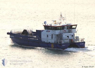
SEAZIP 6
Other Type
Current Trip
| Trip Time | 7 h, 6 mins |
|---|---|
| Trip Distance | 71.76 морская миля |
| AVG Speed | 9.6 Узлы |
| MAX Speed | 9.6 Узлы |
| Осадка | 2.2 м |
| AVG Wind | 14.1 knots |
| MAX Wind | 15.2 knots |
| MIN Temp | 5.1°C / 41.18°F |
| MAX Temp | 5.7°C / 42.26°F |
| Позиция Получена | 9 m тому назад |
Current Position
| Долгота | --- |
|---|---|
| Широта | --- |
| Статус | Moored |
| Скорость | |
| Курс | 102° |
| Район | North Sea |
| Станция | T-AIS |
| Позиция Получена | 9 m тому назад |
Info
Information
The current position of SEAZIP 6 is in North Sea with coordinates 53.44477° / 6.82531° as reported on 2025-12-09 12:57 by AIS to our vessel tracker app. The vessel's current speed is 0 Узлы and is currently inside the port of EEMSHAVEN.
The vessel SEAZIP 6 (IMO: 9776119, MMSI: 244650652) is a Other Type It's sailing under the flag of [NL] Netherlands.
In this page you can find informations about the vessels current position, last detected port calls, and current voyage information. If the vessels is not in coverage by AIS you will find the latest position.
The current position of SEAZIP 6 is detected by our AIS receivers and we are not responsible for the reliability of the data. The last position was recorded while the vessel was in Coverage by the Ais receivers of our vessel tracking app.
The current draught of SEAZIP 6 as reported by AIS is 2.2 meters
Weather
| Temperature | 10°C / 50°F |
|---|---|
| Wind Speed | 13 knots |
| Direction | 175° S |
| Pressure | 1008.8 hPa |
| Humidity | 93.4 % |
| Cloud Coverage | 100 % |
Featured Company
Last Port Calls
| Port | Arrival | Departure | Time In Port |
|---|---|---|---|
| 2025-11-20 14:40 | |||
| 2025-11-19 12:48 | 2025-11-20 07:34 | 18 h | |
| 2025-11-14 13:06 | 2025-11-19 07:51 | 4 d | |
| 2025-11-13 14:06 | 2025-11-14 07:47 | 17 h | |
| 2025-11-12 23:24 | 2025-11-13 07:49 | 8 h | |
| 2025-11-11 17:40 | 2025-11-12 16:24 | 22 h | |
| 2025-11-10 16:12 | 2025-11-11 11:13 | 19 h | |
| 2025-11-10 09:33 | 2025-11-10 10:47 | 1 h | |
| 2025-11-07 12:44 | 2025-11-08 09:01 | 20 h | |
| 2025-11-06 13:53 | 2025-11-06 15:48 | 1 h |
Most Visited Ports (Last year)
| Port | Arrivals | |
|---|---|---|
| 27 | ||
| 14 | ||
| 10 | ||
| 7 | ||
| 4 | ||
| 3 |
Last Trips
| Origin | Departure | Destination | Arrival | Distance | |
|---|---|---|---|---|---|
| 2025-11-20 07:34 | 2025-11-20 14:40 | 71.76 морская миля | |||
| 2025-11-19 07:51 | 2025-11-19 12:48 | 62.53 морская миля | |||
| 2025-11-14 07:47 | 2025-11-14 13:06 | 74.07 морская миля | |||
| 2025-11-13 07:49 | 2025-11-13 14:06 | 78.36 морская миля | |||
| 2025-11-12 16:24 | 2025-11-12 23:24 | 82.49 морская миля | |||
| 2025-11-11 11:13 | 2025-11-11 17:40 | 66.80 морская миля | |||
| 2025-11-10 10:47 | 2025-11-10 16:12 | 73.65 морская миля | |||
| 2025-11-08 09:01 | 2025-11-10 09:33 | 206.42 морская миля | |||
| 2025-11-06 15:48 | 2025-11-07 12:44 | 96.59 морская миля | |||
| 2025-11-06 07:38 | 2025-11-06 13:53 | 85.19 морская миля |
Events
| Время | Событие | Детали | Позиция / Направление | Информация |
|---|---|---|---|---|
| 2025-12-09 10:57 | Пункт назначения изменился | EEMSHAVEN<>NORDERNEX EEMSHAVEN<>NORDERNEY |
53.44476 / 6.82531
[NL] EEMSHAVEN
|
Скорость: Курс: 105° |
| 2025-12-09 03:33 | Пункт назначения изменился | EEMSHAVEN<>NORDERNEY EEMSHAVEN<>NORDERNEX |
53.44479 / 6.82531
[NL] EEMSHAVEN
|
Скорость: Курс: 105° |
| 2025-12-09 01:33 | Пункт назначения изменился | EEMSHAVEN<>NORDERNEX EEMSHAVEN<>NORDERNEY |
53.44477 / 6.82532
[NL] EEMSHAVEN
|
Скорость: Курс: 103° |
| 2025-12-08 04:45 | Пункт назначения изменился | EEMSHAVEN<>NORDERNEY EEMSHAVEN<>NORDERNEX |
53.44476 / 6.82532
[NL] EEMSHAVEN
|
Скорость: Курс: 103° |
| 2025-12-07 17:39 | Пункт назначения изменился | EEMSHAVEN<>NORDERNEX EEMSHAVEN<>NORDERNEY |
53.44476 / 6.82533
[NL] EEMSHAVEN
|
Скорость: Курс: 103° |
| 2025-12-07 13:12 | В покрытии |
53.44474 / 6.82533
North Sea
[NL] EEMSHAVEN
|
Скорость: Курс: 23.8° |
|
| 2025-12-07 11:19 | Вне покрытия |
53.44477 / 6.82532
North Sea
[NL] EEMSHAVEN
|
Скорость: Курс: 23.8° |
|
| 2025-12-07 05:44 | Пункт назначения изменился | EEMSHAVEN<>NORDERNEY EEMSHAVEN<>NORDERNEX |
53.44476 / 6.82531
[NL] EEMSHAVEN
|
Скорость: Курс: 106° |
| 2025-12-06 05:55 | Пункт назначения изменился | EEMSHAVEN<>NORDERNEX EEMSHAVEN<>NORDERNEY |
53.44477 / 6.82531
[NL] EEMSHAVEN
|
Скорость: Курс: 103° |
| 2025-12-05 08:07 | Пункт назначения изменился | EEMSHAVEN<>NORDERNEY EEMSHAVEN<>NORDERNEX |
53.44477 / 6.82531
[NL] EEMSHAVEN
|
Скорость: Курс: 104° |