
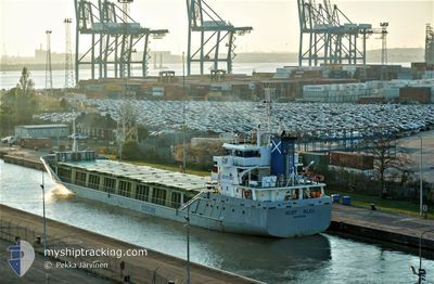
SCOT BAY
General Cargo
Current Trip
| Trip Time | 1 day |
|---|---|
| Trip Distance | 483.37 морская миля |
| AVG Speed | 11 Узлы |
| MAX Speed | 14.7 Узлы |
| Осадка | 4 м |
| AVG Wind | 8.3 knots |
| MAX Wind | 18 knots |
| MIN Temp | 6.7°C / 44.06°F |
| MAX Temp | 11.8°C / 53.24°F |
| Позиция Получена | 3 m тому назад |
Current Position
| Долгота | -9.04949° |
|---|---|
| Широта | 53.26962° |
| Статус | Moored |
| Скорость | |
| Курс | 129° |
| Район | North Atlantic Ocean |
| Станция | T-AIS |
| Позиция Получена | 3 m тому назад |
Info
Information
The current position of SCOT BAY is in North Atlantic Ocean with coordinates 53.26962° / -9.04949° as reported on 2024-04-25 09:33 by AIS to our vessel tracker app. The vessel's current speed is 0 Узлы and is currently inside the port of GALWAY.
The vessel SCOT BAY (IMO: 9243930, MMSI: 232974000) is a General Cargo that was built in 2001 ( 23 лет ). It's sailing under the flag of [GB] United Kingdom.
In this page you can find informations about the vessels current position, last detected port calls, and current voyage information. If the vessels is not in coverage by AIS you will find the latest position.
The current position of SCOT BAY is detected by our AIS receivers and we are not responsible for the reliability of the data. The last position was recorded while the vessel was in Coverage by the Ais receivers of our vessel tracking app.
The current draught of SCOT BAY as reported by AIS is 4 meters
Weather
| Temperature | 9.5°C / 49.1°F |
|---|---|
| Wind Speed | 2 knots |
| Direction | 319° NW |
| Pressure | 1006.5 hPa |
| Humidity | 77.3 % |
| Cloud Coverage | 100 % |
Featured Company
Last Port Calls
| Port | Arrival | Departure | Time In Port |
|---|---|---|---|
| 2024-04-25 05:50 | |||
| 2024-04-21 21:06 | 2024-04-23 12:10 | 1 d | |
| 2024-04-17 22:27 | 2024-04-18 21:26 | 22 h | |
| 2024-04-13 14:50 | 2024-04-14 14:32 | 23 h | |
| 2024-04-10 01:35 | 2024-04-10 16:02 | 14 h | |
| 2024-04-02 18:13 | 2024-04-03 15:45 | 21 h | |
| 2024-03-25 11:31 | 2024-03-25 23:22 | 11 h | |
| 2024-03-20 07:52 | 2024-03-20 16:14 | 8 h | |
| 2024-03-16 23:33 | 2024-03-18 21:56 | 1 d | |
| 2024-03-09 10:33 | 2024-03-13 14:55 | 4 d |
Last Trips
| Origin | Departure | Destination | Arrival | Distance | |
|---|---|---|---|---|---|
| 2024-04-23 13:10 | 2024-04-25 06:50 | 483.37 морская миля | |||
| 2024-04-18 23:26 | 2024-04-21 22:06 | 701.82 морская миля | |||
| 2024-04-14 15:32 | 2024-04-18 00:27 | 691.22 морская миля | |||
| 2024-04-10 18:02 | 2024-04-13 15:50 | 588.09 морская миля | |||
| 2024-04-03 17:45 | 2024-04-10 03:35 | 1279.08 морская миля | |||
| 2024-03-25 23:22 | 2024-04-02 20:13 | 1689.68 морская миля | |||
| 2024-03-20 16:14 | 2024-03-25 11:31 | 437.84 морская миля | |||
| 2024-03-18 21:56 | 2024-03-20 07:52 | 323.35 морская миля | |||
| 2024-03-13 14:55 | 2024-03-16 23:33 | 733.48 морская миля | |||
| 2024-03-07 15:57 | 2024-03-09 10:33 | 426.51 морская миля |
Events
| Время | Событие | Детали | Позиция / Направление | Информация |
|---|---|---|---|---|
| 2024-04-25 06:26 | Статус изменился | Moored Under way using engine |
53.26962 / -9.04941
[IE] GALWAY
|
Скорость: Курс: 131° |
| 2024-04-25 06:08 | Окончание движения |
53.26980 / -9.05093
[IE] GALWAY
|
Скорость: 0.3 kn Курс: 71° |
|
| 2024-04-25 05:50 | Порт |
|
53.26725 / -9.04507
[IE] GALWAY
|
Скорость: 1.8 kn Курс: 316° |
| 2024-04-25 04:38 | В покрытии |
53.19318 / -9.24312
North Atlantic Ocean
IEGWY
|
Скорость: 11.9 kn Курс: 64° |
|
| 2024-04-24 20:56 | Вне покрытия |
52.07250 / -10.78804
North Atlantic Ocean
IEGWY
|
Скорость: 10.9 kn Курс: 1.6° |
|
| 2024-04-24 18:16 | Статус изменился | Under way using engine Default |
51.62153 / -10.52817
IEGWY
|
Скорость: 11 kn Курс: 322° |
| 2024-04-24 18:13 | Статус изменился | Default Under way using engine |
51.61278 / -10.51675
IEGWY
|
Скорость: 11 kn Курс: 320.4° |
| 2024-04-24 15:52 | Изменение морского района | Irish part of the North Atlantic Ocean Irish part of the Celtic Sea |
51.41430 / -9.94162
North Atlantic Ocean
IEGWY
|
Скорость: 10.6 kn Курс: 290.3° |
| 2024-04-24 03:17 | Изменение морского района | Irish part of the Celtic Sea Irish part of the Irish Sea and St. George's Channel |
52.13970 / -6.21561
Celtic Sea
IEGWY
|
Скорость: 13.9 kn Курс: 233.6° |
| 2024-04-24 01:52 | Статус изменился | Under way using engine Default |
52.43410 / -5.99113
IEGWY
|
Скорость: 14.7 kn Курс: 202° |